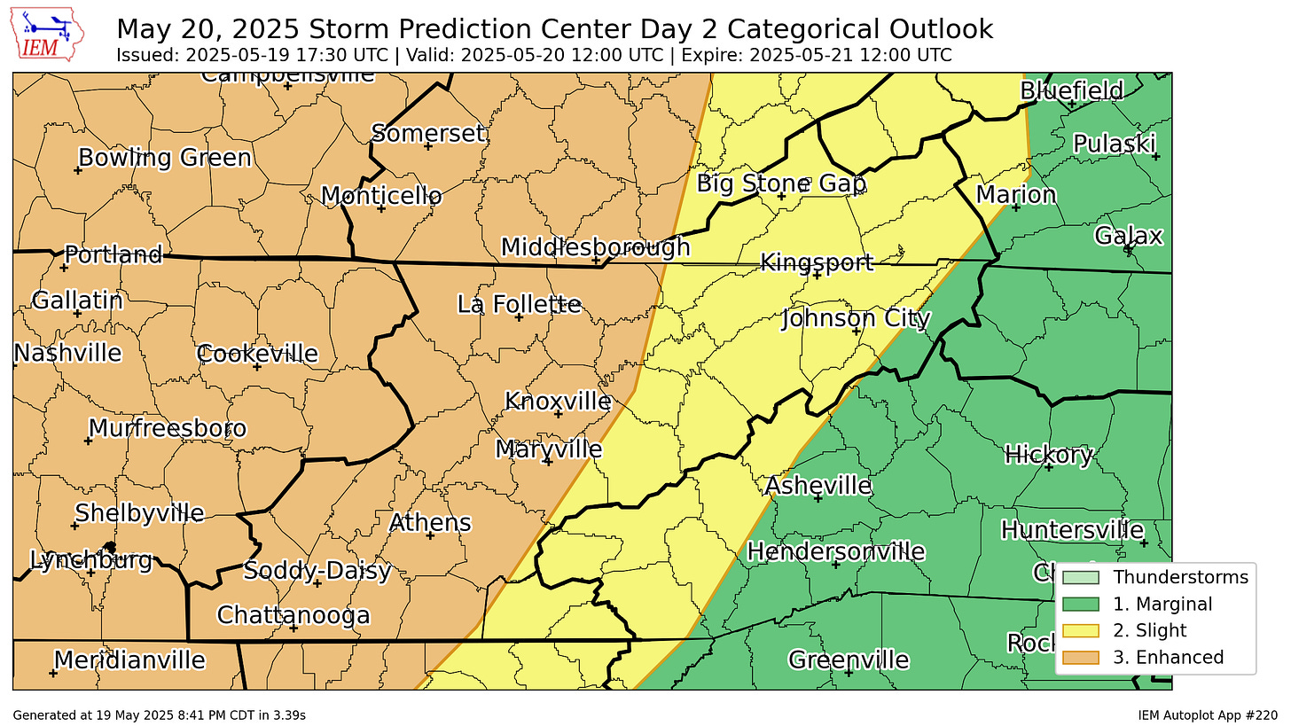
An 'enhanced risk' of severe weather on Tuesday
Damaging wind risk appears quite high, relatively speaking, on Tuesday
Much of Tennessee, including the northern Cumberland Plateau region, has been included in an “enhanced risk” outlook for severe weather on Tuesday by the Storm Prediction Center in Norman, Okla.
An “enhanced risk” is the third level on the SPC’s five-step scale for measuring the threat of severe weather. Enhanced risk outlooks are relatively rare for the northern plateau region, but this will be the second “enhanced risk” day in the past five days. The region was also under an “enhanced risk” for severe weather on Friday, the evening a fatal tornado ripped through the Kentucky towns of Somerset and London.
Statistically speaking, an “enhanced risk” means there’s a 30% chance that severe weather will occur. Specifically, the SPC has highlighted a 45% risk for damaging wind gusts in the northern plateau region, along with a 15% risk of tornadoes and large hail.
A 45% risk of damaging winds is quite high, relatively speaking, for the northern plateau region; a threat level rarely seen in this part of the country.
Models have indicated two rounds of thunderstorms on Tuesday — the first during the early afternoon hours, around 2 p.m. (give or take an hour either direction) and the second during the evening hours, around 8 p.m. (again, give or take an hour either way).
In a Monday afternoon forecast discussion, the National Weather Service’s Morristown office, which covers Scott County, said that confidence is increasing that severe weather will occur.
“Damaging winds, large hail, and a few tornadoes are all possible,” the NWS said. “Make sure to have multiple ways to receive watch and warning information and stay weather aware.”
In the same discussion, the NWS said that there could be “scattered to widespread severe weather … associated with the cold front in the evening,” around 8 p.m.
Specifically, the NWS said, damaging wind gusts to 70 mph, large hail to 1.25 inches, and a few tornadoes could occur.


