


If you subscribe to weather folklore, the cold snap we’re in for later this week would have to be “cotton britches winter.”
The old-timers referred to spring-time cold snaps by whatever was blooming at the time: commonly, redbud winter, dogwood winter, locus winter and blackberry winter. Since all of those plants have already bloomed, the upcoming cold snap would be the name that usually came next on the old-timers’ list: cotton britches winter, which was so-called because it referred to the need to have not packed away your long underwear for the season.
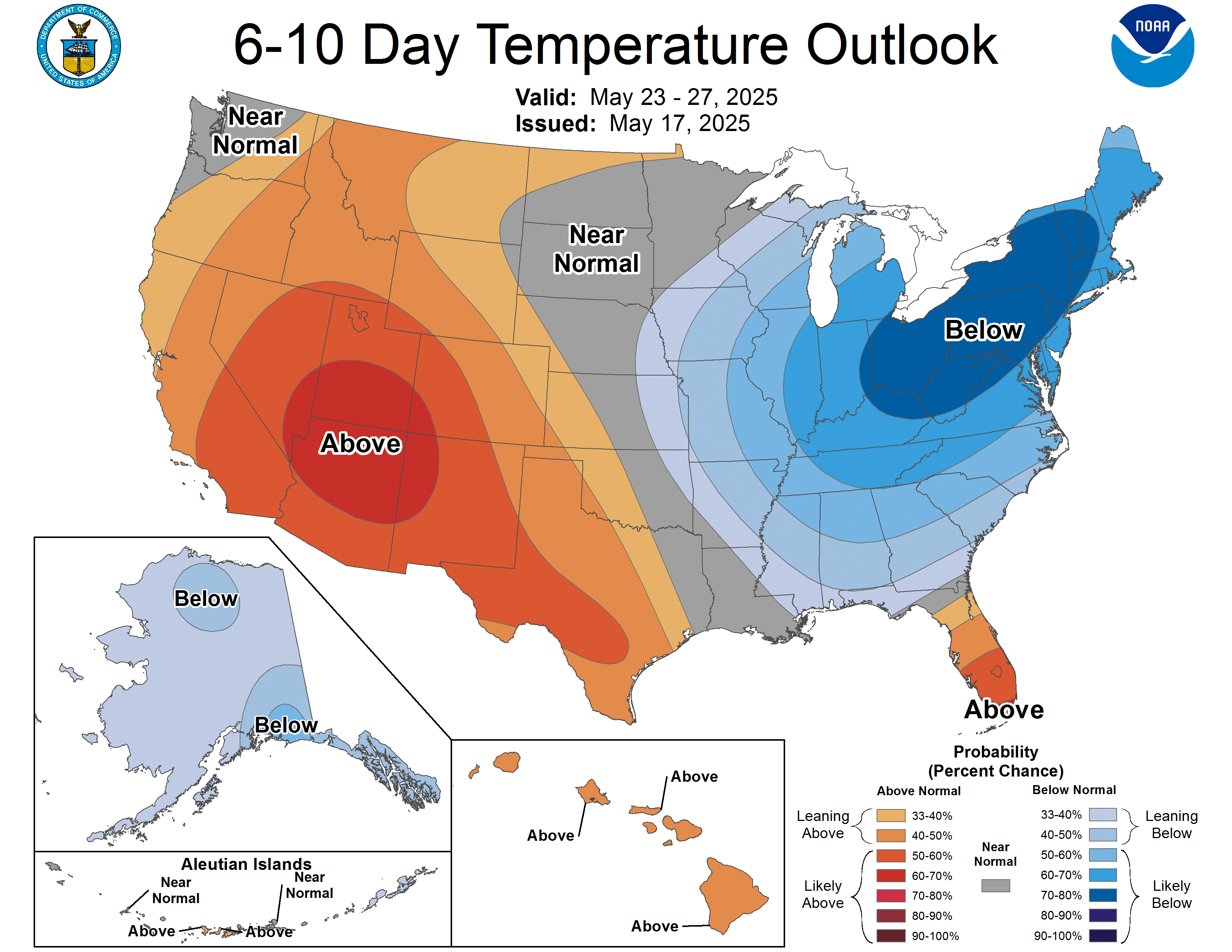
In any event, a late-season cold snap appears to be headed our way next week, as an unusually mild month of May nears its end with, apparently, one last hurrah.
After a warmer-than-usual month of April, this month has featured a dearth of warm daytime temperatures. Even when it was supposed to be warm, it hasn’t been. On Thursday, for example, the forecasted high was 86° in Oneida. The actual recorded high, according to the National Weather Service, was only 80°.
Believe it or not, May has actually been warmer than normal overall, but that’s due to very mild nighttime temperatures, which have been running about five degrees warmer than normal this month — thanks mostly to excessive cloud cover that hasn’t allowed a lot of radiational cooling at nights. It’s been a rather wet month, featuring about 33% more rainfall than normal to this point, and that has meant more cloudy nights.
After several rainy days to start the week, including a threat of severe thunderstorms on Tuesday, colder air will settle across Tennessee for a few days to end the week. The National Weather Service’s forecasted high for Oneida on Thursday is just 64°. If some models are to be believed, that prediction may be optimistic; some models show us struggling to get out of the 50s on Thursday, with cloudy skies and a chance of lingering rain showers.
Memorial Day weekend is considered the unofficial kickoff to the summer season. The Big South Fork National River & Recreation Area’s swimming pool at Bandy Creek will open on Friday. But it won’t feel much like summer, at least to start the weekend. Temperatures will climb back into the low 70s by Saturday. Even still, cooler-than-normal temperatures are expected to hang around through much of the following week. And the relatively wet weather pattern that we’re in may linger all the way into the middle of June, at least.
Not everyone will be bummed about the upcoming cold snap. The NWS office in Nashville described the week ahead like this in a Saturday afternoon forecast discussion: “Once that front pushes through, some absolutely fantastic weather is in store with temperatures falling enough to give us that one last reminder of what we likely won’t see until October again.”
Last-season cool snaps aren’t unusual, of course. Our record coolest high temperature for Thursday’s date in Oneida is 57°, set in 2002.
Incidentally, frost is not a concern with this cold snap; nighttime temperatures aren’t currently expected to drop below the mid 40s.