


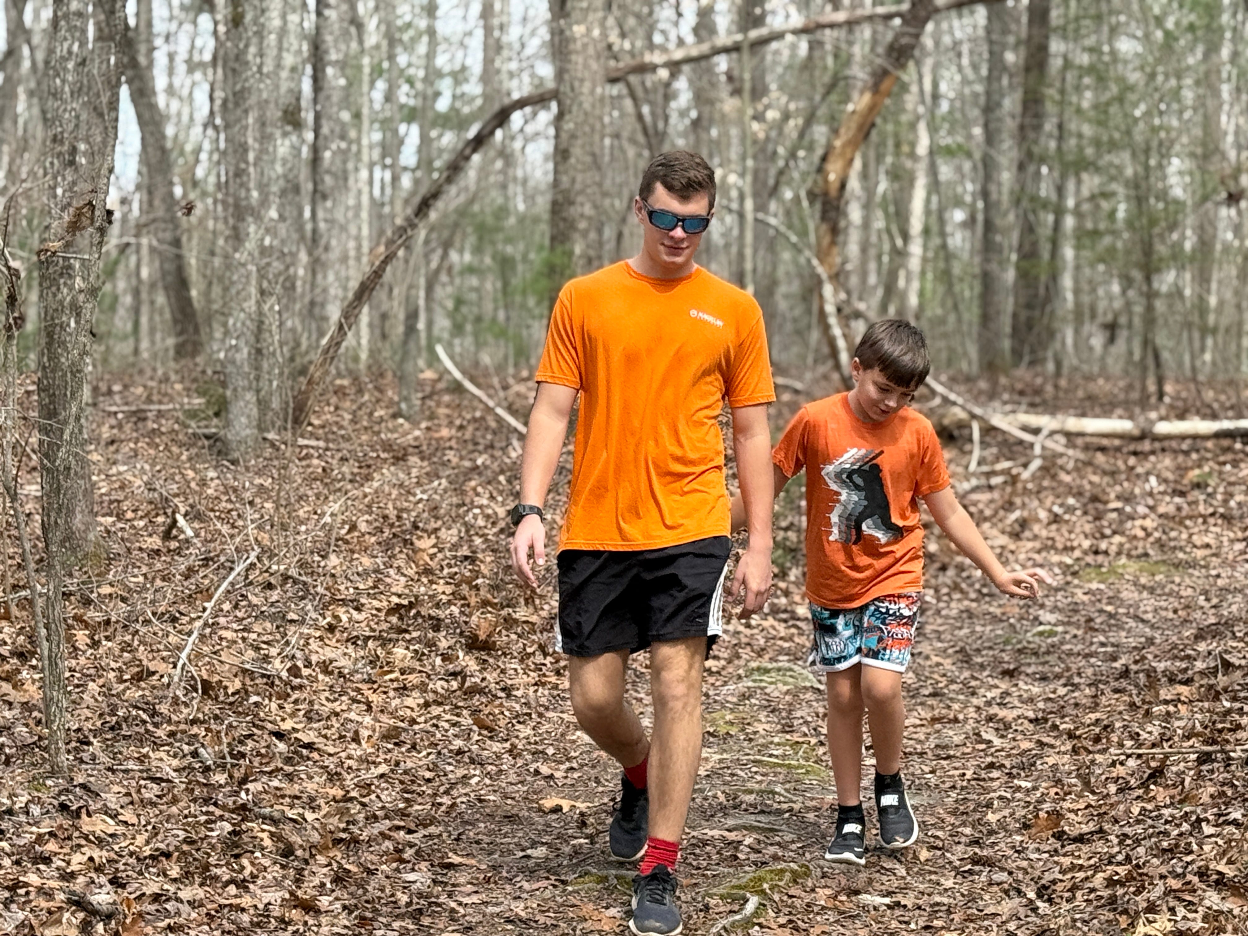
The 2026 Spring Hiking Challenge begins this week — the first official week of spring — with a short, easy stroll to Sunset Overlook.
In making this hike, we’re returning to the site of the inaugural Twenty Week Hiking Challenge back in March 2015, when more than 700 hikers joined us on Week 1 for the hike to Sunset.
We chose the hike to Sunset Overlook because we want to start slow and easy for novice hikers who aren’t experienced in the woods. Sunset Overlook is one of the easiest trails the Big South Fork has to offer — subjectively, it’s second only to the Bandy Creek Loop. Angel Falls Trail is an easier walk, but further distance (about four miles).
The purpose of the Spring Hiking Challenge is to encourage local residents to explore the Big South Fork and discover the beautiful places that exist in our back yard — places that some people who have lived in this area their entire lives have never seen before. In the process, we hope participants will discover that hiking is an excellent health tool, not just for physical fitness but maybe even more so for mental fitness.
Over the next 14 weeks (ending the final week before summer officially begins in June), we’ll hike 14 trails throughout the Big South Fork. We’ll avoid horse trails, which are generally more difficult to walk, and stick solely to hiking trails. Each trail will feature at least one of overlooks, rock formations, or waterfalls, along with other points of interest. Each trail will include a “Make It Better” option for hikers that want to add some mileage to their effort. Each will also include a virtual scavenger hunt — requiring hikers to pay close attention to their surroundings to find a point of interest along the trail — with a prize randomly awarded to someone who finds and documents the site we’re looking for.
Hikers will document their participation by sharing photos of their hike on social media with the hashtag #SpringHikingChallenge — or, if they do not have social media, photos can be emailed to newsroom@ihoneida.com. At the end of the challenge, we’ll award a grand prize to two people — one adult, one youth, randomly chosen — who complete all 14 hikes. We’ll also award a prize for the best photograph that’s taken throughout the challenge. Those prizes, as well as the weekly prizes, will be announced in our hike stories and on our Facebook page.
Each week, the hike will be announced, along with full details about it, on our website — www.indherald.com— by Thursday.
So, with all that said, let’s get started!
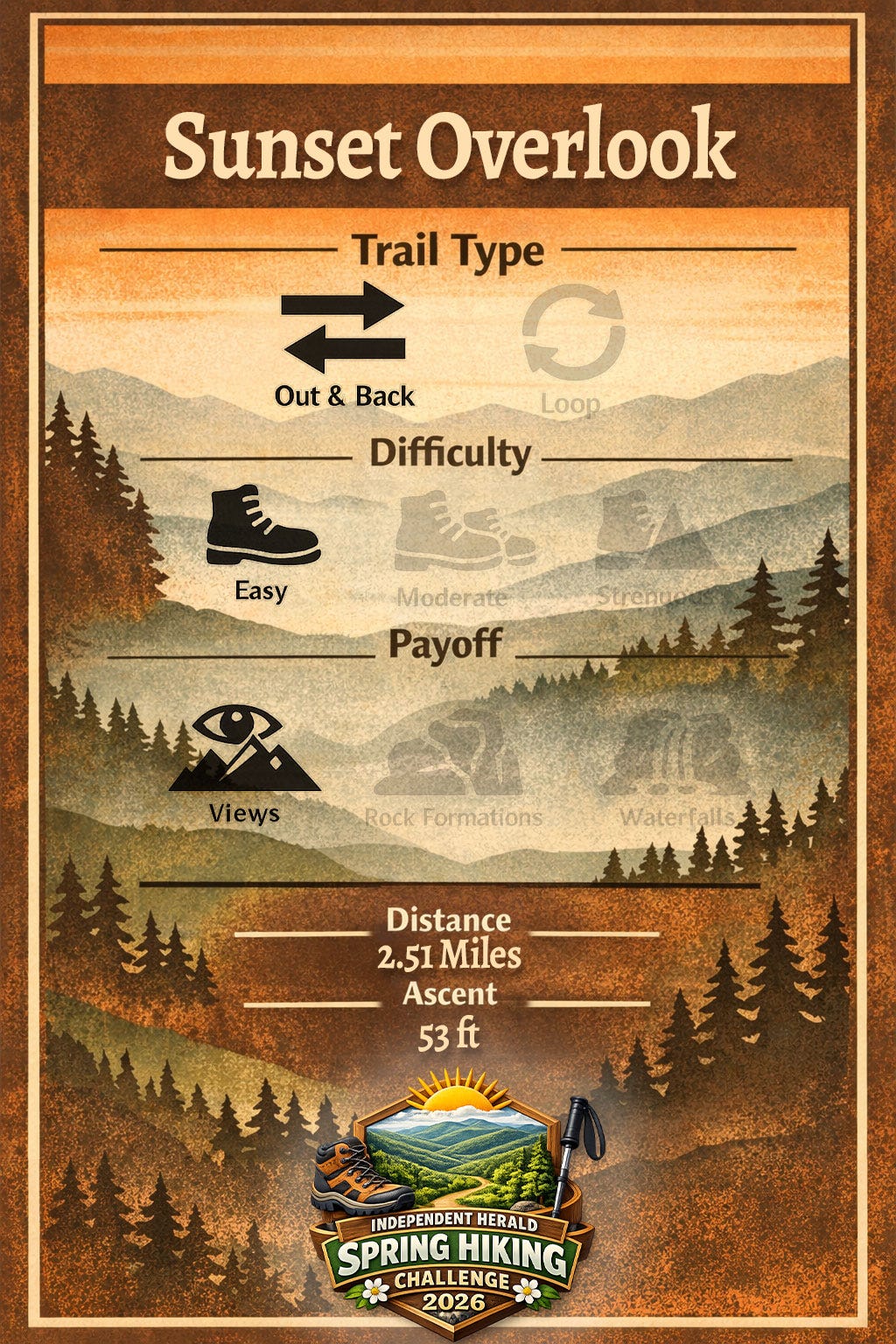
Sunset Overlook
Trailhead: East Rim
Trail Type: Out-and-back
Difficulty: Easy
Payoff: Overlook
Distance: 2.51 miles
Ascent: 53 feet
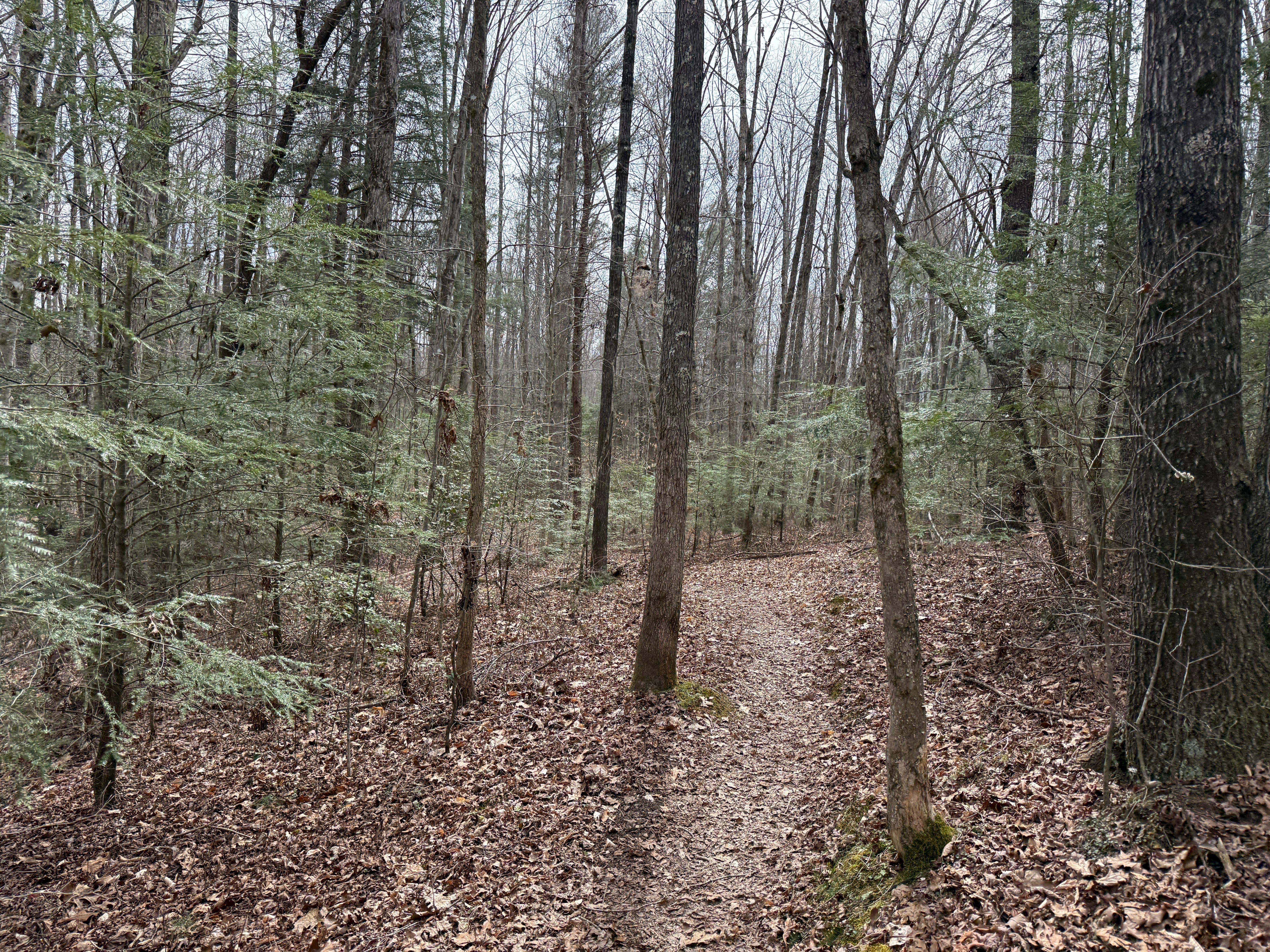
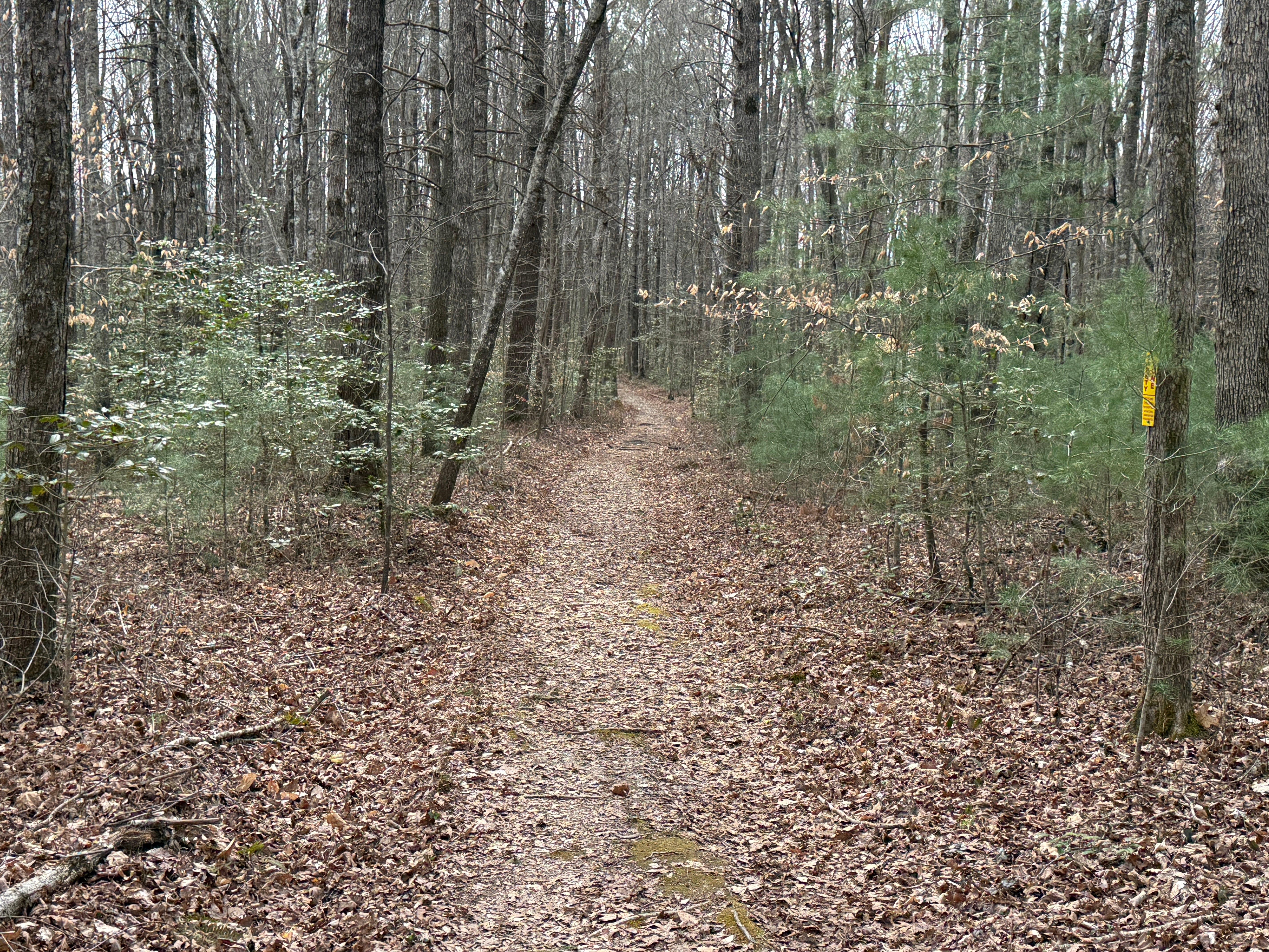
Sunset Overlook is one of the most popular hiking trails in the Big South Fork National River & Recreation Area, and also one of the easiest. It is a 2.51-mile, out-and-back hike that is almost completely level, except for a slight bit of elevation change near the overlook.
The hike begins and ends at East Rim Trailhead, which is located on East Rim Overlook Road near the Big South Fork headquarters west of Oneida. The destination is a rock outcropping that overlooks the Big South Fork River approximately one mile upstream from Leatherwood Ford. The East Rim Trailhead is a paved parking area on the right side of East Rim Overlook Road, just a few hundred feet from the turn off S.R. 297. The trail begins on the left side of East Rim Overlook Road (across the road from the parking area).
Mile 0.14: The hiking trail crosses a single-lane, gravel administrative access road. The road accesses a shooting range for law enforcement training purposes. Note the sign where the hiking trail crosses the road indicating that only authorized personnel are permitted on the road beyond the hiking trail.
0.15: Almost as soon as the hiking trail re-enters the forest on the north side of the administrative access road, there’s a small pond on the left. This area was farmland before the Big South Fork NRRA was established, and this is the smallest of four farm ponds that are located in the area. It has been mostly filled with sediment over the years, but hosts a healthy stand of cattails and other aquatic plant life, along with amphibians like frogs and salamanders.
0.25: A building can be spotted through the trees to the left. This is part of the National Park Service’s Resource Management division. Specifically, it houses the NPS’s firefighting cache. Also notice the small hemlocks that are growing in abundance here. Although the Sunset Overlook Trail stays entirely on top of the plateau, it features several of the forest types that can be found within the boundaries of the Big South Fork NRRA. This is the head of a small, unnamed stream that eventually empties into the Big South Fork River, and hemlocks can be found in abundance around most streams in the BSF, both inside and outside the gorge. The hemlock is a threatened tree species, due to the hemlock woolly adelgid infestation. NPS botanists are using chemicals to mitigate the damage.
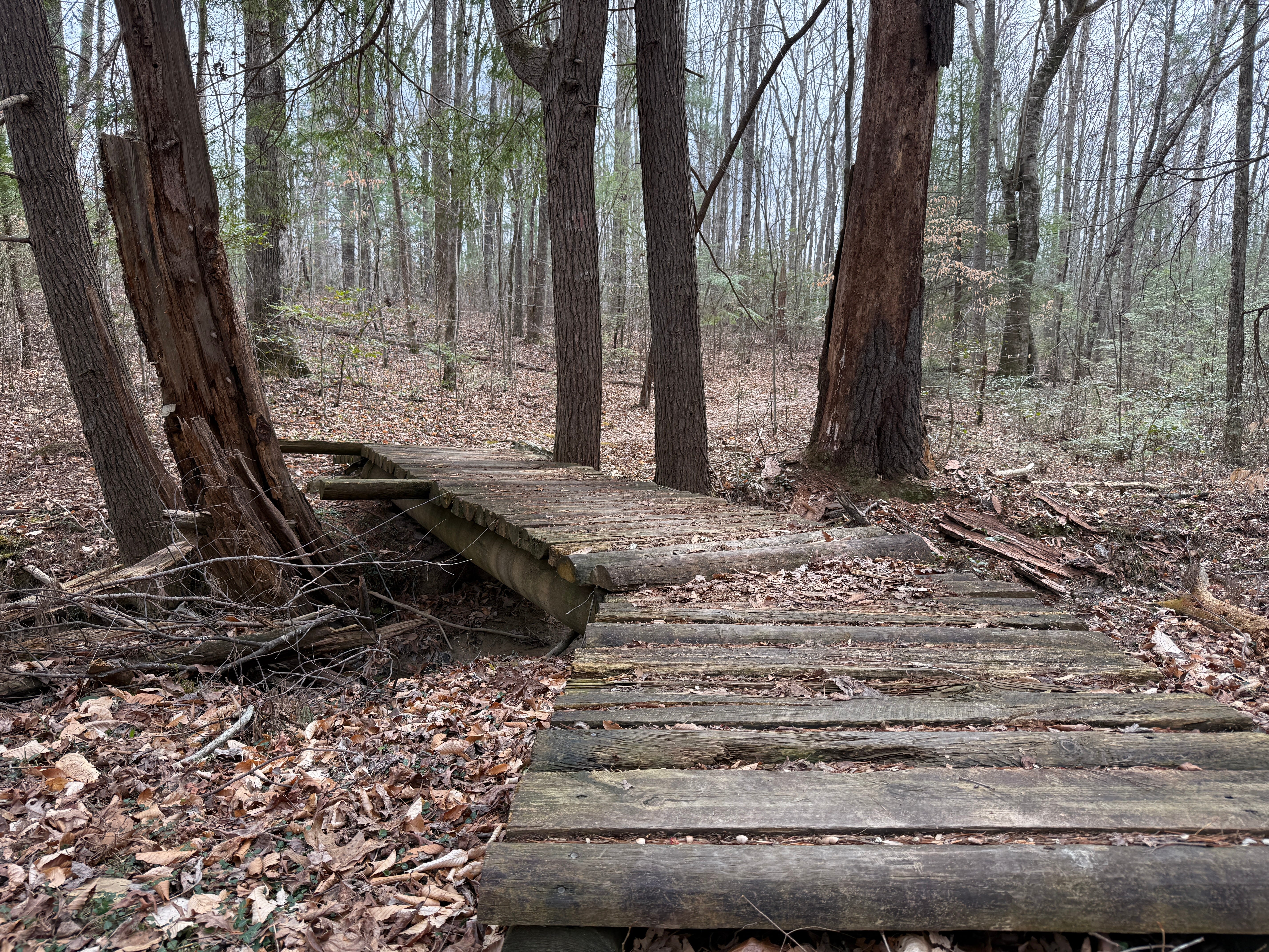
0.27: The trail crosses the first of two wooden footbridges, and mature hemlocks stand sentry over the bridge.
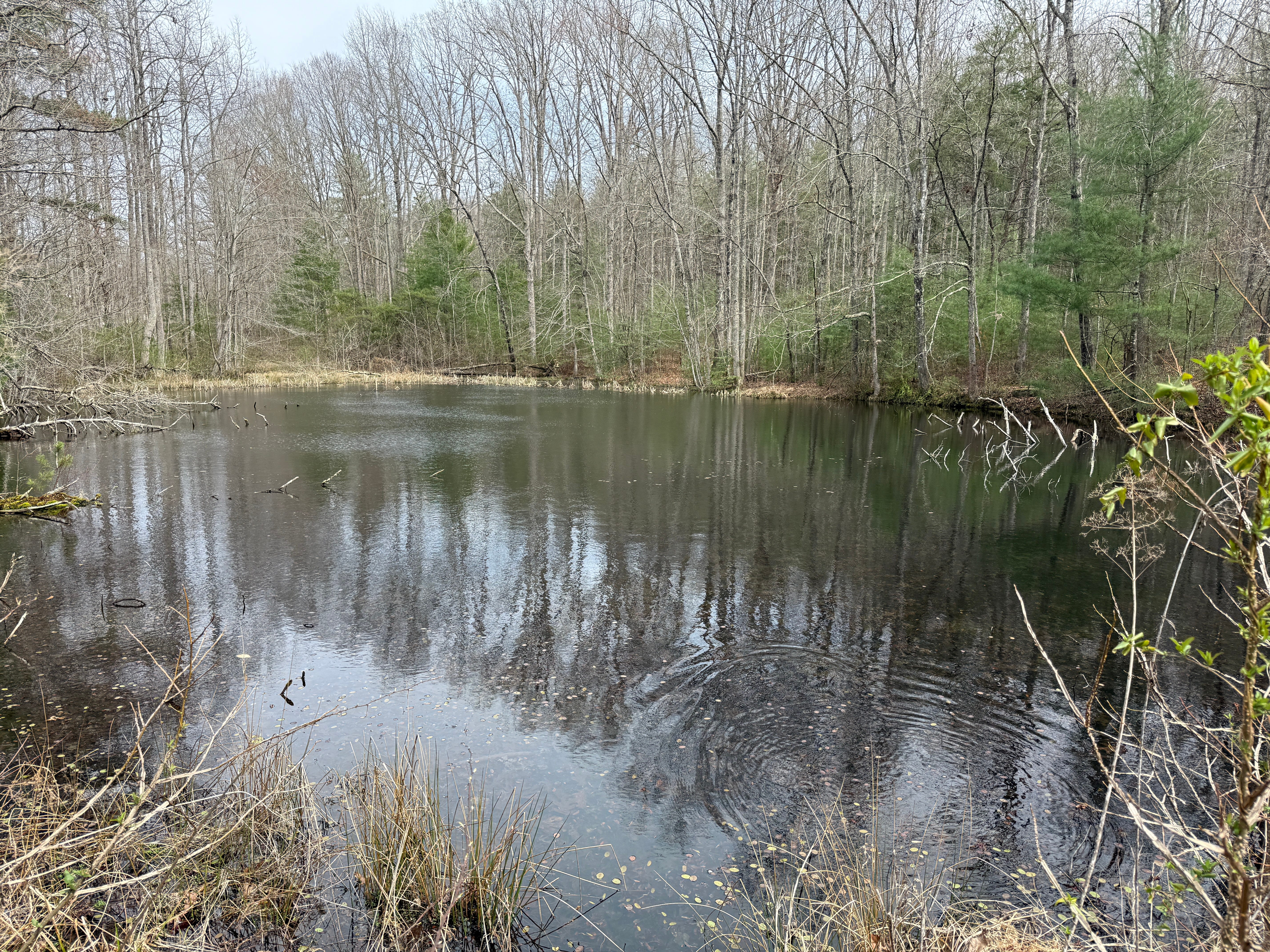
0.40: The trail crosses the earthen dam of the second of the aforementioned farm ponds that remain from the days of settlement in this area. This is the largest of the four ponds found in the vicinity of the park headquarters and is also a source of an abundance of aquatic plant and animal life.
0.47: As the trail re-enters the forest on the east side of the pond, the forest type has changed. Holly trees are now found in abundance along the trail. There are several species of evergreens that provide color along this trail before the deciduous trees have gained their leaves for the warm season. First were the hemlocks along the small stream; now are the holly trees.
0.55: Another evergreen begins to pop up in abundance along the trail: white pines. These young white pines grow in significant numbers along the ridge on the left side of the trail, spilling down the hillside to the trail itself. If you look to the ridgetop on your left, you’ll see the mature, parent white pines growing tall over the surrounding forest.
0.70: The Sunset Overlook Trail joins an old road trace, which it will follow most of the rest of the way to the overlook. This road once joined the main road, which is today S.R. 297. This road — and others like it that you’ll see joining this old road trace further along the route — were made during mid 20th century logging operations.
0.90: This is the easiest part of the hike — a great opportunity to slow down and observe the forest that surrounds you. This forest is typical of the mixed hardwood forests found throughout the Big South Fork’s plateau areas: few old-growth oak or hickory trees due to the 20th century logging operations, but lots of red maple, sugar maple, black gum, sourwood, black cherry, tulip poplar, American beech, and sassafras trees in various stages of growth.
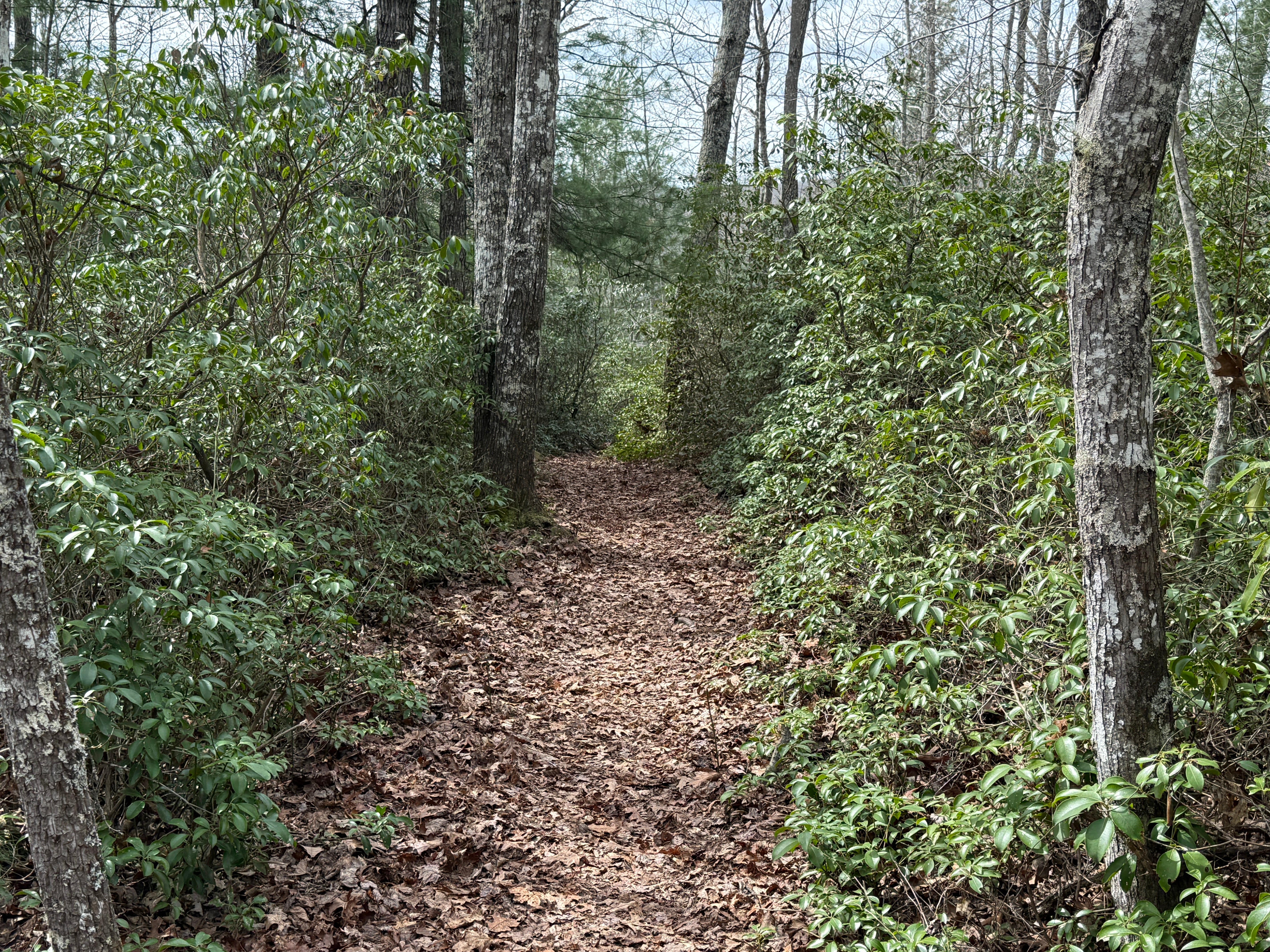
0.99: Yet another type of evergreen comes into view. Mountain laurel is found in abundance along the trail for the first time. This is a sign that you’re getting close to the rim of the gorge. Laurel is typically found outside the gorge, in the shallow, well-drained soil near the edge of the plateau. Its cousin, rhododendron, is found in the more shaded and moist areas inside the gorge. We won’t see rhododendron on this hike, since we’re staying on top of the plateau.
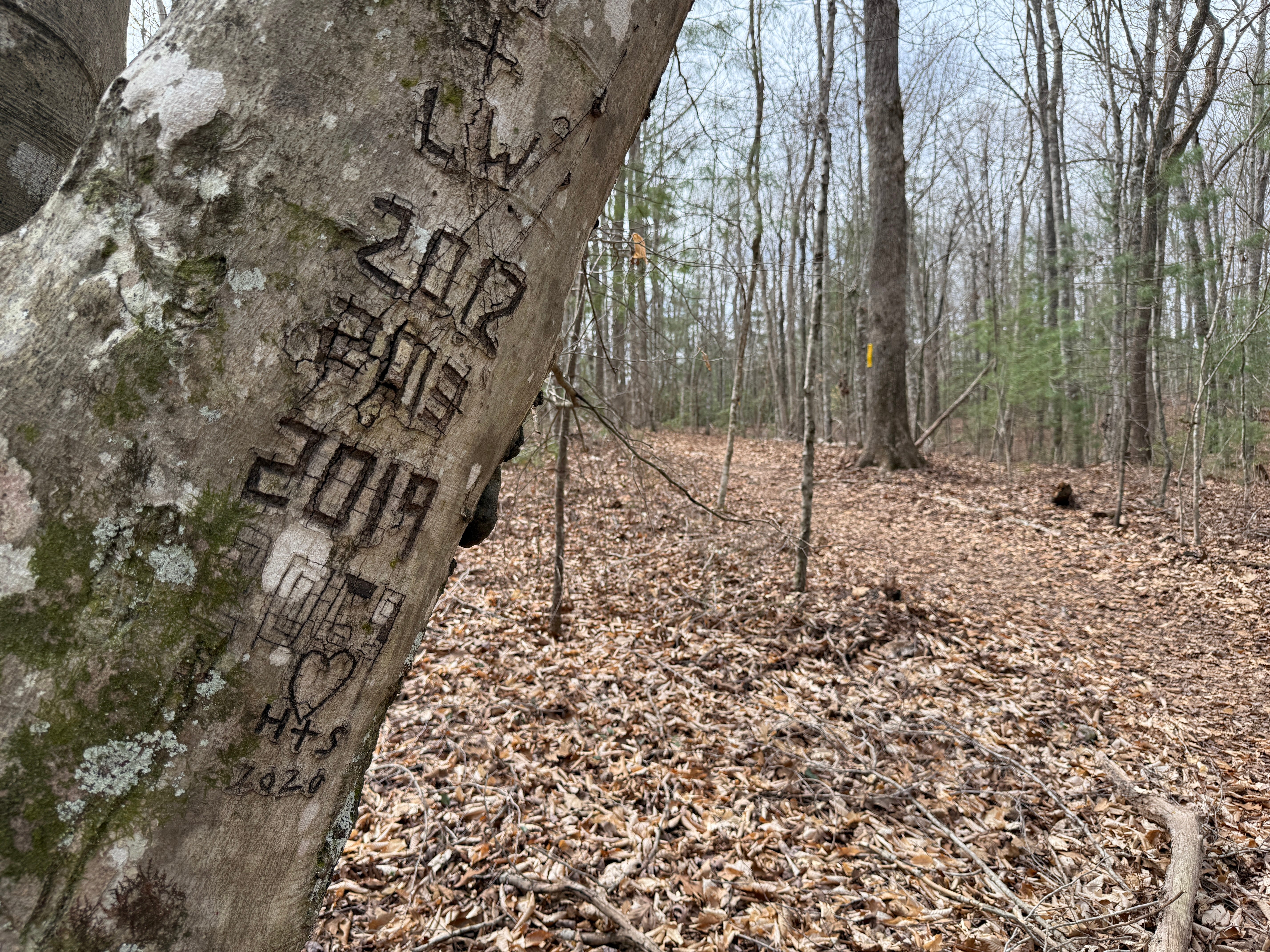
1.08: Note the carved beech tree on the left side of the trail. Beech trees often attract people with a pocketknife or other chiseling instrument because their smooth bark makes it easy to carve messages into their trunks. In some parts of the BSF, carvings from the settlement days can be found in beech trees, though they’re usually illegible because the tree’s growth has distorted the carvings. The carvings on this particular beech tree are more recent, made by hikers. (Please note: carving initials into a beech tree is a violation of the Leave No Trace ethic and should not be attempted.)
1.21: The trail begins a slight descent to the overlook.


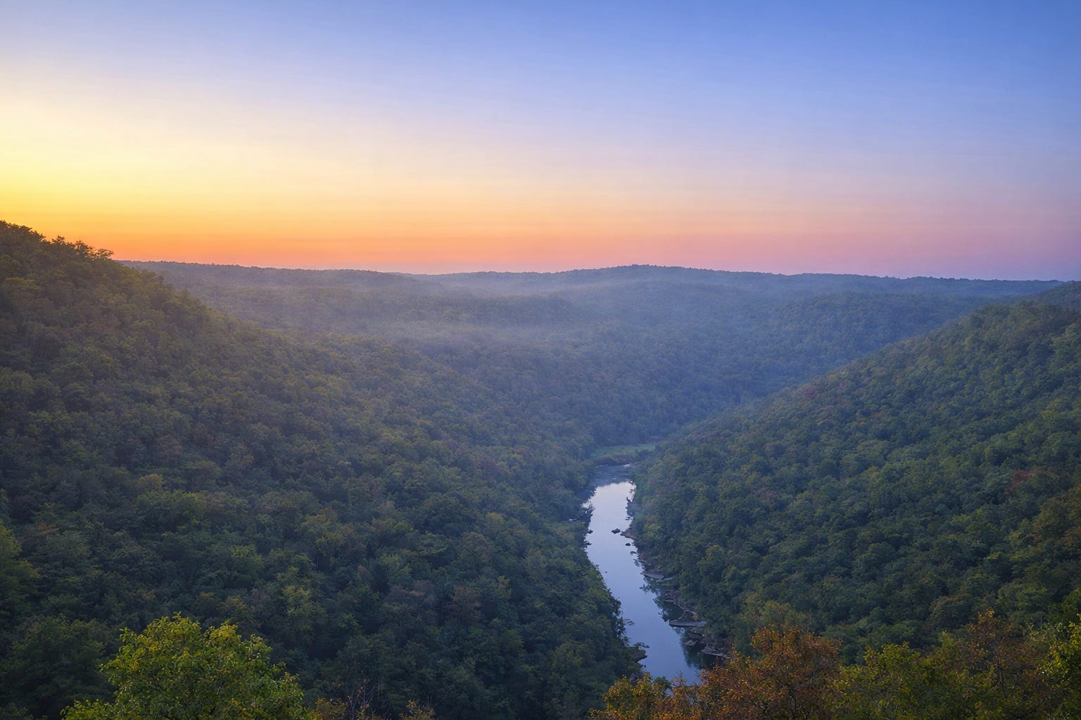
1.27: The trail emerges on the unprotected rock outcropping that provides scenic views of the river gorge. Just upstream, almost invisible through the trees, is a drainage on the west side of the river. This is the mouth of North White Oak Creek, the stream that was followed into Fentress County by the old O&W Railroad once it crossed the Big South Fork River. Downstream, the S.R. 297 bridge at Leatherwood Ford is visible. You will also see the observation platform at East Rim Overlook if you look hard enough. One item of interest that you’ll find at the overlook is the mysterious Chi Rho symbol that someone chiseled into the sandstone rock face long ago. The Chi Rho is one of the earliest Christian symbols, formed by superimposing the Greek letters Chi (X) and Rho (P) to represent Christ. This one is mysterious because no one is sure who chiseled it here, or why. However, it probably isn’t as old as you might think. Sandstone erodes quickly, and Big South Fork trail literature from the 1980s does not mention the symbol. Once you’ve enjoyed the views from the overlook, you’ll retrace your steps back to the trailhead.
Scavenger Hunt: In accordance with the “Leave No Trace” ethic, our scavenger hunt will be virtual. Each week, we’ll ask participants to find a sight along the trail and snap a picture of it. This week, we’re looking for a tree along the trail that is bent into an unnatural stair step shape (growing vertical, then horizontal, then vertical again). During the era of Native Americans, the Indians would bend trees to mark trails, causing them to grow in shapes similar to this. However, most of the trees found in this shape in the Big South Fork today are far too young to have been caused by Native Americans. Instead, they’re usually caused because a tree was damaged by a storm or some other occurrence, and then continued to grow. This week, we’ll be giving away an Embrava 32-oz. sports water bottle — perfect for hiking — to one person who finds this tree. Take a photo and tag it #SpringHikingChallenge on social media.
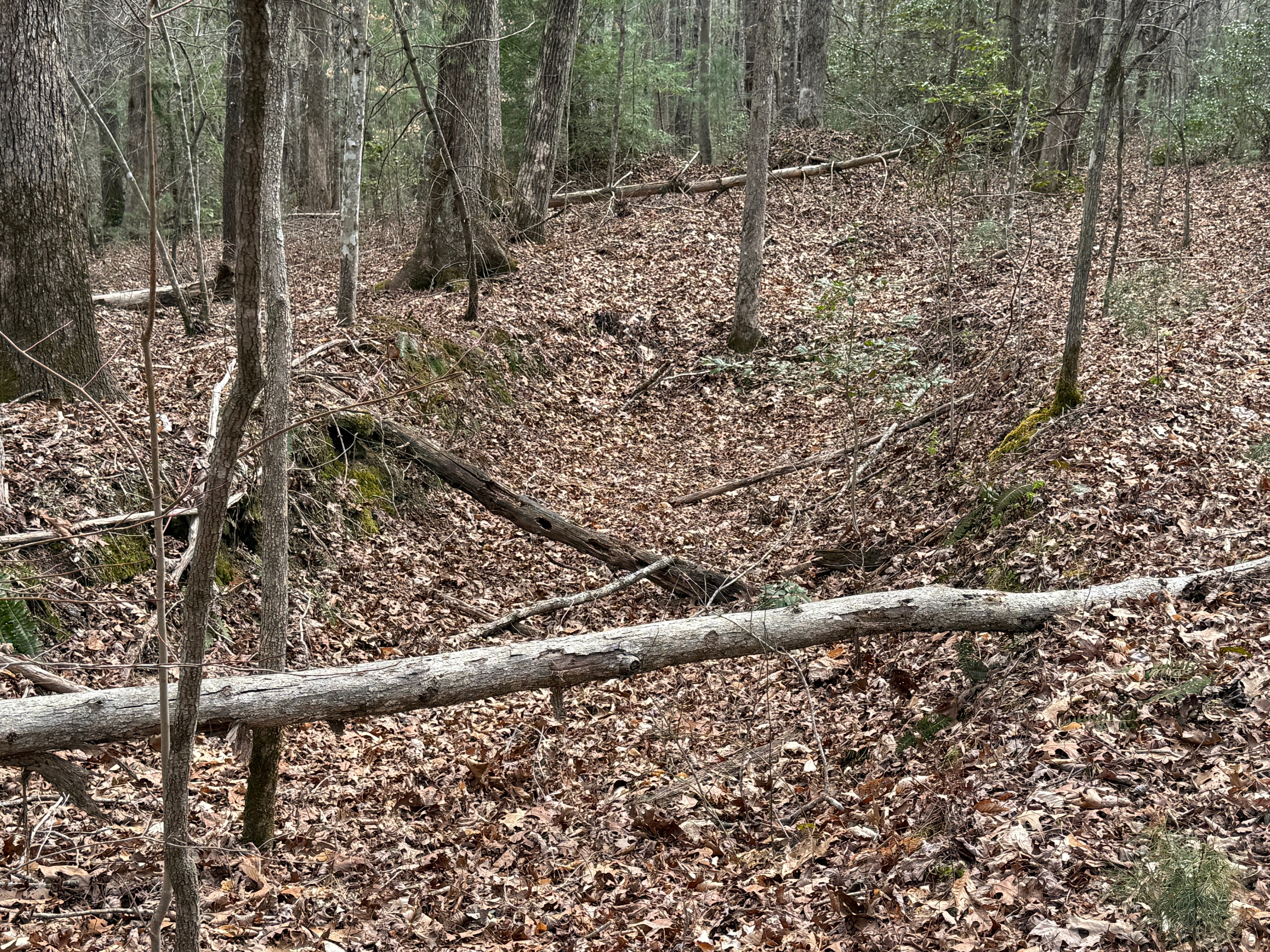
Historical Context: Like much of the Big South Fork region, the ridge leading to Sunset Overlook was heavily logged during the early and mid 20th century. The road trace that the trail follows is one of the remnants of the logging era here. Another is the deep depression that can be found on the left side of the trail at Mile 0.95. These were called “jack pits” or “loading pits.” Before hydraulic loaders and knuckleboom cranes became common in the 1960s and 1970s, loading heavy logs onto trucks was assisted by digging a pit that the truck would be backed into, lowering the bed of the truck to ground level. Workers would use hooks, chains, jacks or winches to roll the logs onto the truck.
Make It Better: There are several overlooks along this stretch of the Big South Fork River, and two of them are accessible from East Rim Trailhead. Once you’ve arrived back at your vehicle, it’s a short stroll to the second of these overlooks: Leatherwood Overlook. It is located along the Leatherwood Loop Trail. To reach it, follow the trail that departs the trailhead on the west side of the road, following it through the clearing and into the forest. When the trail reaches the Leatherwood Loop junction, take the left option and follow it to a spur trail at the rim of the gorge that leads a tenth of a mile from the main trail to the protected rock outcropping.
Be Careful For: Sunset Overlook is not protected. Use caution with pets and small children.
Please Remember: Hikers are encouraged to obey the “Leave No Trace” ethic. “Leave only footprints, take only memories.” Please do not litter! Also remember that while all trails in the Big South Fork are dog-friendly, all dogs must be always leashed on a leash that does not exceed six feet in length.
Document Your Hike: Record your participation on this week’s hike by taking a photo of you and your group and tagging it with the #SpringHikingChallenge hashtag on social media (make sure the post privacy is set to public!) or emailing newsroom@ihoneida.com.