


Traditionally, the Angel Falls Rapid trail is where hiking in the Big South Fork River & Recreation Area begins. It isn’t considered the most awe-inspiring trail in the national park — that distinction usually goes to Honey Creek Loop. But its close proximity to park headquarters and Oneida, and its ease of difficulty, make it a logical first option for visitors to the national park to put boots on the ground.
However, don’t let “easy” fool you into thinking Angel Falls isn’t worth trekking. This is a beautiful trail, with lots of redeeming qualities. We chose it for Week #2 in part because of its accessibility, in part because of its ease of difficulty, and in part because this trail doesn’t deserve to be left out simply because we started the Spring Hiking Challenge with the nearby Sunset Overlook Trail. And there are many nuances to this trail that are overlooked by those who simply park and set out to hike. So, are you ready? Let’s hike!
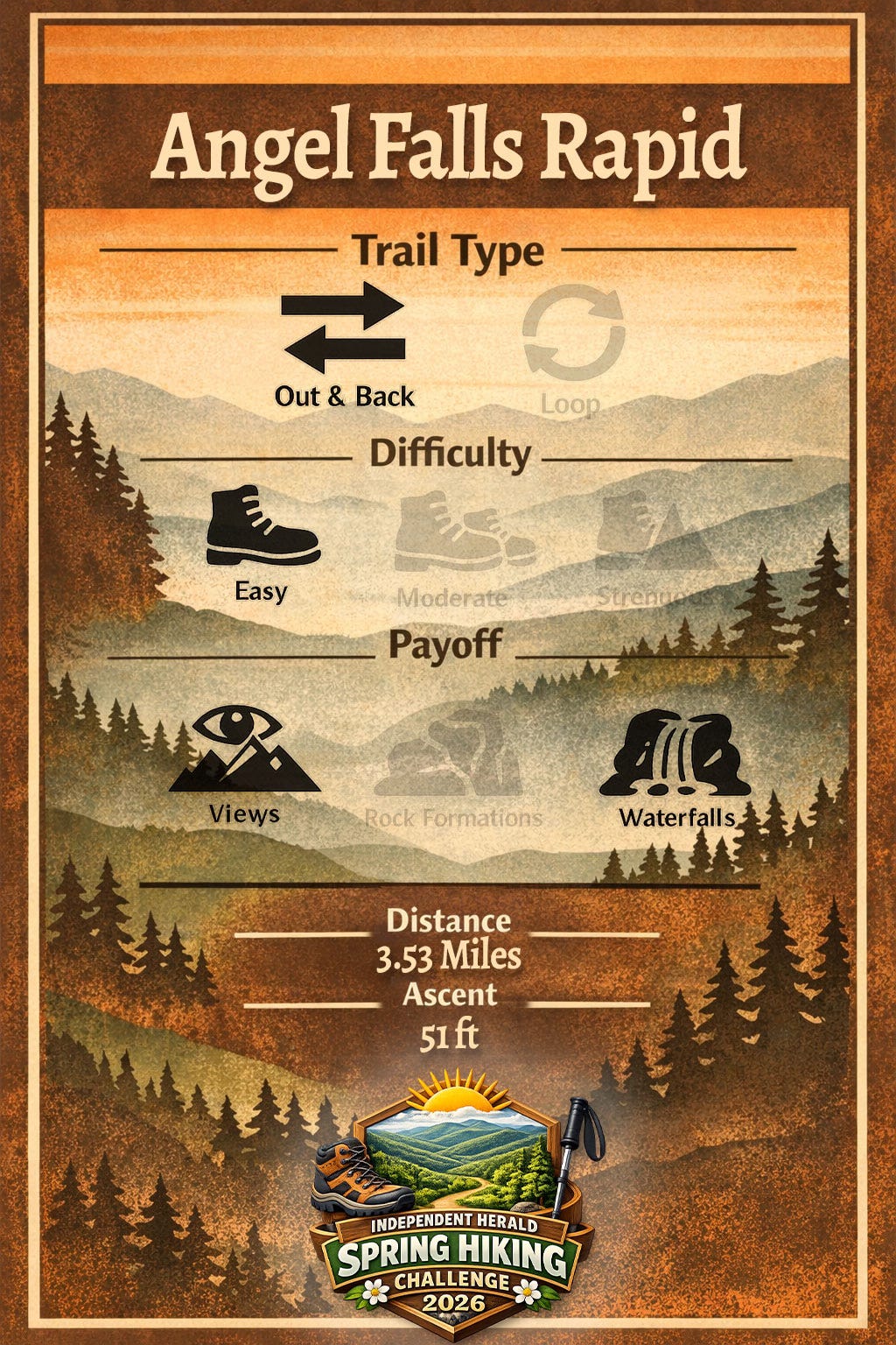
Angel Falls Rapid
Trailhead: Leatherwood Ford
Trail Type: Out-and-back
Difficulty: Easy
Payoff: Views, Waterfalls
Distance: 3.53 miles
Ascent: 51 feet
As you notice in the trail stats, Angel Falls is approximately one mile longer than the Sunset Overlook Trail. But also notice that there is slightly less elevation gain spread out over that distance. What does that mean? In some regards, Angel Falls is an even easier hike than Sunset Overlook, despite the longer distance. Hiking from the observation platform to the river’s edge adds some elevation gain that isn’t included in these stats, but it’s certainly worth the effort to see the house-sized boulders around the rapid.
To get there, take S.R. 297 (Coopertown Road) west from Oneida. Turn left onto Leatherwood Road (continuing on S.R. 297) at Terry & Terry Store, and drive into the river gorge. At the bottom of the gorge, turn into the Leatherwood Ford parking lot. Immediately turn left again and drive to the north end of the parking lot (the end opposite the gazebo and restroom facilities). The trail begins at the north end of the lot.
As you hike, note the signposts along the route. At one time, this was an interpretive trail, with an accompanying booklet available from the visitor center at Bandy Creek. Each of the numbered signposts corresponded with a site of interest along the route that was described in the booklet. There are 30 signposts between Leatherwood Ford and Angel Falls.


50 ft.: Almost immediately after you step off the asphalt and onto dirt, you’ll notice a camping spot along the river. This sandy beach-like area is both a popular swimming hole for day users and also a “backcountry” camping spot. You’ll also notice two other things almost immediately: rhododendron and trillium. We talked in last week’s hike about the difference between mountain laurel and rhododendron, the two flowering evergreen shrubs that are found in abundance in the BSF. Mountain laurel is found on top of the gorge (along Sunset Overlook Trail and many others), while rhododendron is found inside the gorge — on this trail and many others. As for trillium, it is one of the most celebrated spring wildflowers found in the Big South Fork, and all of the trails that depart from the Leatherwood Ford trailhead are great options to find them. Hundreds — if not thousands — of individual trillium can be found around the start of the Angel Falls Trail.
0.16 mile: A waterfall threads its way through jumbled rocks on the right side of the trail, the first of several side streams that feed into the Big South Fork River along this route. There was once a footbridge across this stream, but it’s no longer in place. No worries, though; you won’t get your feet wet.
0.25: You’ll pass the first whitewater rapid along this stretch of the river. This is a gentle Class I/II rapid that poses little trouble for whitewater paddlers. In fact, whitewater enthusiasts don’t usually venture this far downriver. The roaring river becomes much calmer downstream from O&W Bridge, and much calmer still downstream from Angel Falls. But there are several small rapids between Leatherwood Ford and Angel Falls.
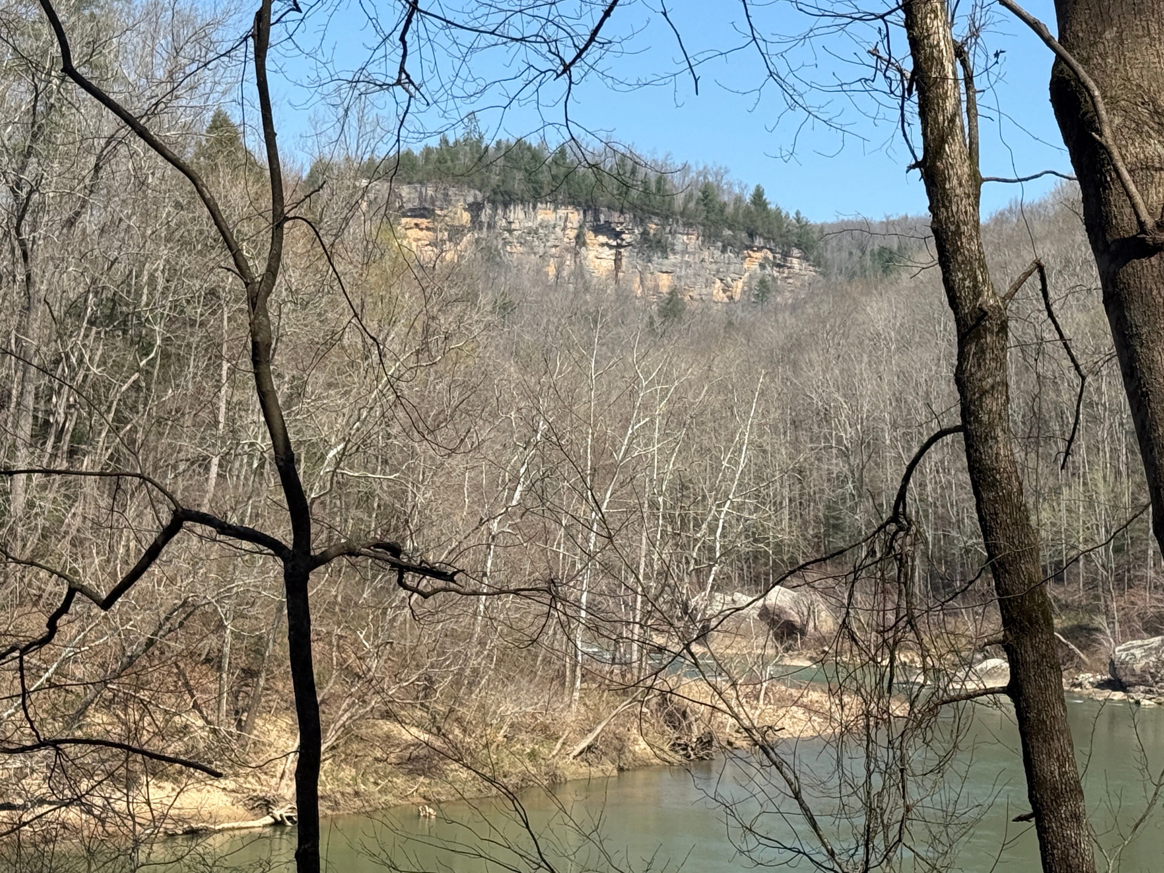
0.4: Early spring, before the green-up, is one of the best times to hike Angel Falls because you are afforded spectacular views of the cliff lines that tower over the river — views that disappear once the trees have leafed out. Here, you’ll get your first look at one of those cliff lines, and it is an excellent photo opportunity if you want to scramble down to the river’s edge.
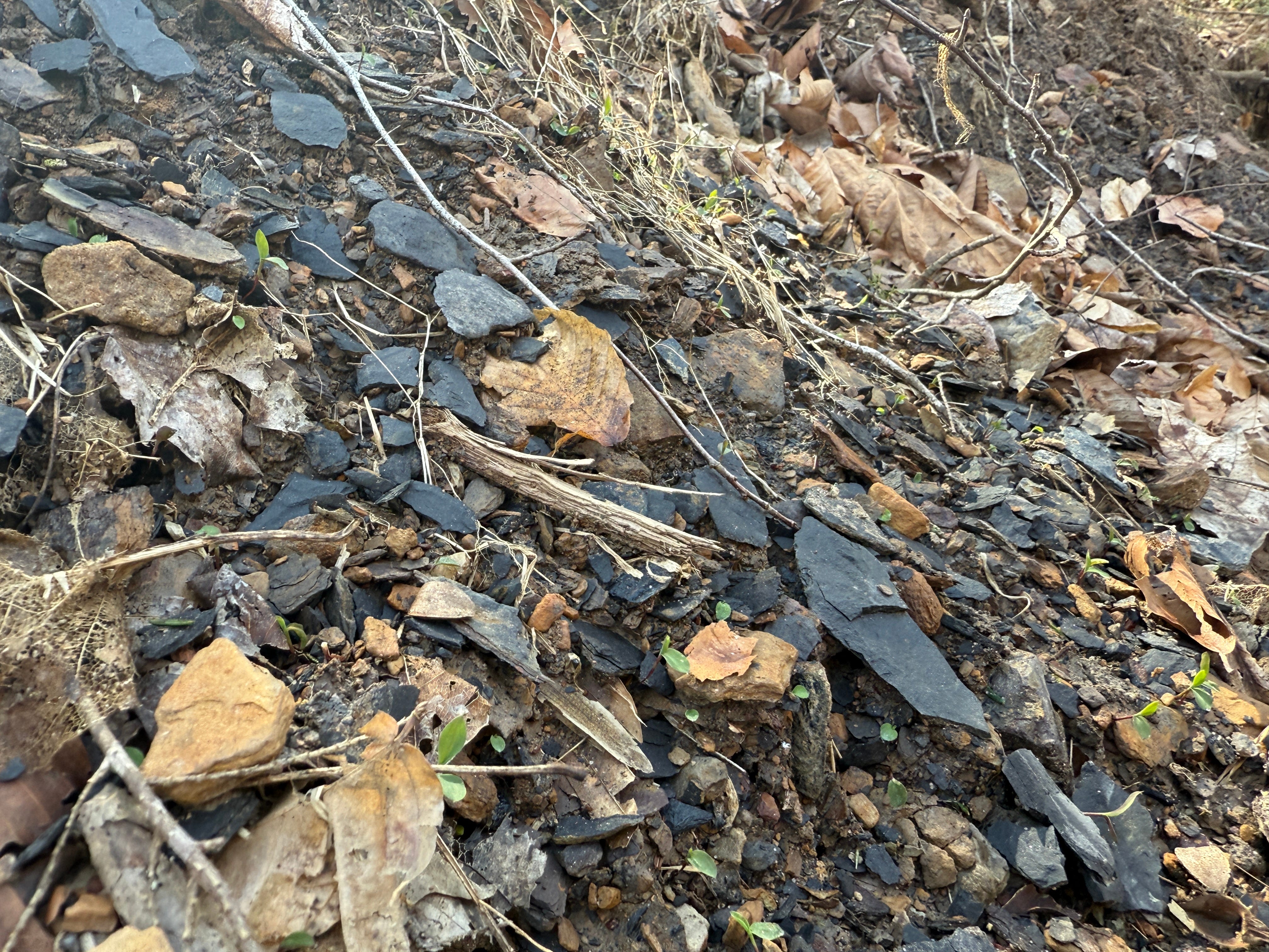
0.47: A small landslide area has exposed tiny bits of coal along the trail. You can also find coal in lesser amounts along much of the rest of the trail if you keep your eyes peeled. Coal was never mined as prolifically in the Big South Fork region as in the Cumberland Mountains to the east, but mining was a key industry here beginning around the end of the 19th century and the early 20th century. We’ll talk much more about the history of coal as we venture further into this hike.
0.5: Another backcountry campsite is found along the river’s edge.
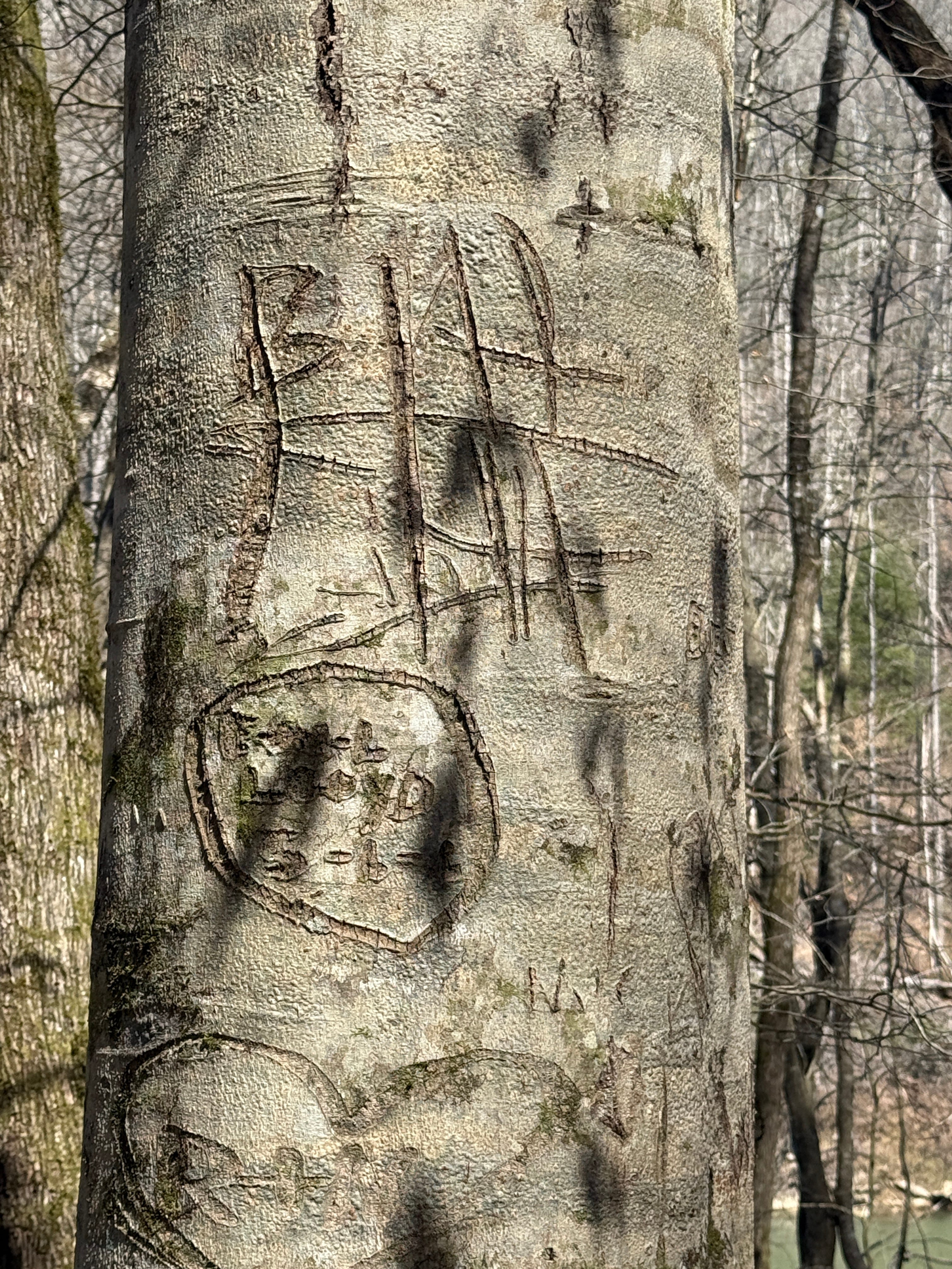
0.59: A large beech tree on the left side of the trail bears the carved initials of some hikers who have made this hike. Beech trees are hard to resist for anyone with a pocket knife and a desire to leave a record of their presence, thanks to their smooth bark. But as we said last week, please obey the Leave No Trace ethic and resist the urge!


0.73: You can find hemlock trees all along this trail, none bigger than the one you’re seeing here. The hemlocks found in this region are eastern hemlocks, which are primarily found in the New England and Great Lakes regions but also extend southward throughout the Appalachians. They’re currently threatened by the hemlock woolly adelgid, an invasive pest that weakens and eventually kills the trees. Look closely, and you’ll spot painted “dots” on the hemlocks along the trail. These are the signs of National Park Service botanists treating the trees to protect them from the pest infestation.
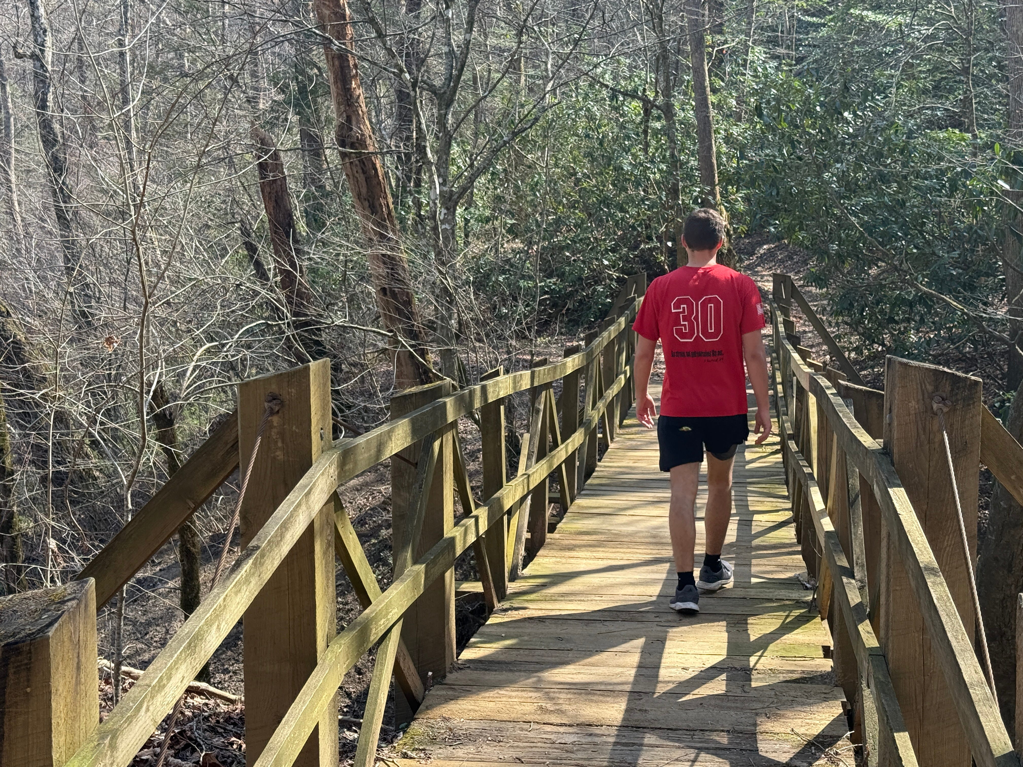
0.78: The trail crosses a wooden footbridge. This stream is Anderson Branch. You can’t really see it now, but uphill to the right is the reclaimed Anderson Branch strip mine, one of the most prolific strip mines in this part of the Big South Fork region. Coal was found in abundance around Anderson Branch … in fact, shortly after the construction of the O&W Railroad a couple of miles upstream, grade work began on a spur down the river to Leatherwood Ford and on to Anderson Branch. However, the idea was quickly abandoned.


0.89: Check out the massive boulder between the trail and the river. Sometimes, these boulders were exposed by erosion due to the moving water. Other times, they broke loose from the caprock nearly 500 feet above and tumbled down to the bottom of the gorge. Just beyond this boulder is one of several blowdowns from this past winter that you’ll find along the trail. The forces of nature constantly keep maintenance crews busy in the Big South Fork, and this past winter was particularly rough. Literally hundreds of mature hardwood trees along this two-mile stretch were toppled by winds.
1.1: You’ll get your first look at Angel Falls Overlook, the massive rock outcropping that juts out over the river at the mouth of Anderson Branch. It’s a welcome sight, because it means that the destination is getting close.
1.22: Water cascades through rocks on the right side of the trail.
1.31: Notice the cobble bar on the left side of the river. Also known as “scour praries,” cobble bars are an important part of Big South Fork ecology. There are only about 500 acres of cobble bar habitat remaining worldwide, thanks to dams and other human activity. They require free-flowing rivers where heavy rainfall drastically changes water levels. One of the best examples of a Big South Fork cobble bar is found just upstream of Leatherwood Ford, near the mouth of Bandy Creek. These rock prairies contain several native plant species that are not found anywhere else — like prairie grasses and flowering herbs. Without the floods that “scour out” the species that aren’t adapted to these conditions, these plants would not be able to thrive here. The cobble bars don’t look like much this time of year, other than a bunch of rocks, but later this summer they’ll be teeming with life.
1.4: Various wildflowers — including trillium — can be found in abundance along the trail.
1.51: The stream that you see emptying into the left side of the river is Fall Branch. It drains the area of Bandy Creek Campground and other parts of Bandy Creek on the east side of Bandy Creek Road, and is the largest tributary of the Big South Fork between Leatherwood Ford and Station Camp.
1.67: Here, we get our first look at Angel Falls. Some first-time visitors to the Big South Fork who hike this trail expecting to find a true “waterfall” are disappointed to discover that Angel Falls is only a rapid, but it’s a mighty impressive rapid, a Class IV surge of water that is a recommended portage for even experienced paddlers.


1.72: We’ve talked about the coal that was mined along this stretch of river. How about the coal that was not mined. Here, note the small seam of coal that is exposed along the right side of the trail. It is fascinating to note how firmly it is embedded between layers of rock, which illustrates why mining it was so dangerous.


1.79: We’ve reached the observation platform for Angel Falls. Below is the powerful Angel Falls Rapid. Above is the rock outcropping that is Angel Falls Overlook. They’re impressive sites all around.
It is tempting to end your hike at the observation platform, and if you’re a newcomer to hiking who’s still getting acclimated to the activity and you don’t feel up to a jaunt down to the river’s edge, that’s understandable. However, the most impressive sights of this hike, by far, are found along the edge of the river, where huge boulders — some as large as small houses — are strewn about the stream bed while jagged cliff lines tower overhead.


Scavenger Hunt: This week, we’re looking for coal! You can find it in small chunks along the trail, in small chunks smoothed by water along the river, and also in a seam still embedded in the earth near the observation platform. Take a photo of yourself with the seam of coal or, even better, find a handful of isolated chunks along the river or the trail. (But obey the Leave No Trace ethic and don’t take it with you!) This week, we’ll be giving away a wooden hiking stick affixed with a Big South Fork badge to someone who finds coal along the Angel Falls Rapid Trail. Take a photo and tag it #SpringHikingChallenge on social media.


Historical Context: Angel Falls may not be much of a waterfall today, but up until the 1950s it was very much a waterfall, a split flow that dropped about 10 feet. It was dynamited by fishermen who thought it would improve canoe travel along the river … and maybe it did, but it also created the dangerous (for canoes, at least) Angel Falls Rapid. (The left photo is what Angel Falls looked like in the 1910s.)
Make It Better: The picnic tables at the Leatherwood Ford Trailhead make an excellent, shaded spot for lunch before or after your hike. You can also continue your hike from Angel Falls to the John Hawk Smith Place, a distance of about 1.3 miles (one way). There isn’t much to see at the Hawk Smith Place today, aside from a small cemetery, and the trail is shared-use with horses much of the way. But Hawk Smith was one of the most colorful and notable people to live along the river during the Big South Fork’s settlement era.
Be Careful For: If you venture down to the river’s edge and “rock hop” on the boulders, be careful, especially with small children. A slip onto the rough boulders can result in injury. A slip into the water can result in death.
Please Remember: Hikers are encouraged to obey the “Leave No Trace” ethic. “Leave only footprints, take only memories.” Please do not litter! Also, remember that while all trails in the Big South Fork are dog-friendly, all dogs must be leashed and kept within six feet.
Document Your Hike: Record your participation on this week’s hike by taking a photo of you and your group and tagging it with the #SpringHikingChallenge hashtag on social media (make sure the post privacy is set to public!) or emailing newsroom@ihoneida.com.
For Your GPS: Here is a GPX file of the Angel Falls Rapid Trail that you can load into any GPS app or device.