


This week, we’ll make a short drive to the northern end of the Big South Fork National River & Recreation Area, visiting the beautiful Yahoo Falls near Whitley City, Ky.
This is a shorter hike than either Angel Falls or Sunset Overlook, the first two hikes of the Spring Hiking Challenge, but it’s also the first hike to earn a difficulty rating of “moderate.” It’s not a strenuous hike, by any means, but it does feature some elevation change since it starts atop the plateau and dips into the gorge to the base of the waterfall. If you’re just getting started in hiking, don’t let that deter you. This is an absolutely beautiful hike, and Yahoo Falls is one of the most-visited landforms in McCreary County — for obvious reason!


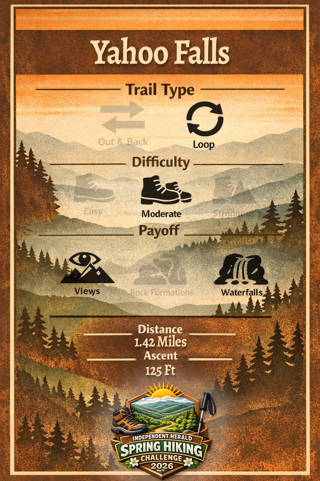
Yahoo Falls
Trailhead: Yahoo Falls
Trail Type: Loop
Difficulty: Moderate
Payoff: Views, Waterfall
Distance: 1.42 miles
Ascent: 125 feet
The Yahoo Falls Loop is a short, well-maintained loop trail near Alum Ford in the Big South Fork National River & Recreation Area, with the option to add on mileage by visiting the Yahoo Arch. To get there, take U.S. Highway 27 north to Whitley City. At the caution light on the north end of town, turn left onto Kentucky 700. After half a mile, stay straight across Kentucky 1651 to stay on Kentucky 700. Travel another 3.4 miles, then turn right onto Yahoo Falls Road. The road dead-ends at the trailhead in 1.5 miles.
The trail to Yahoo Falls is one of the most intricately built hiking trails in the entire Big South Fork NRRA.
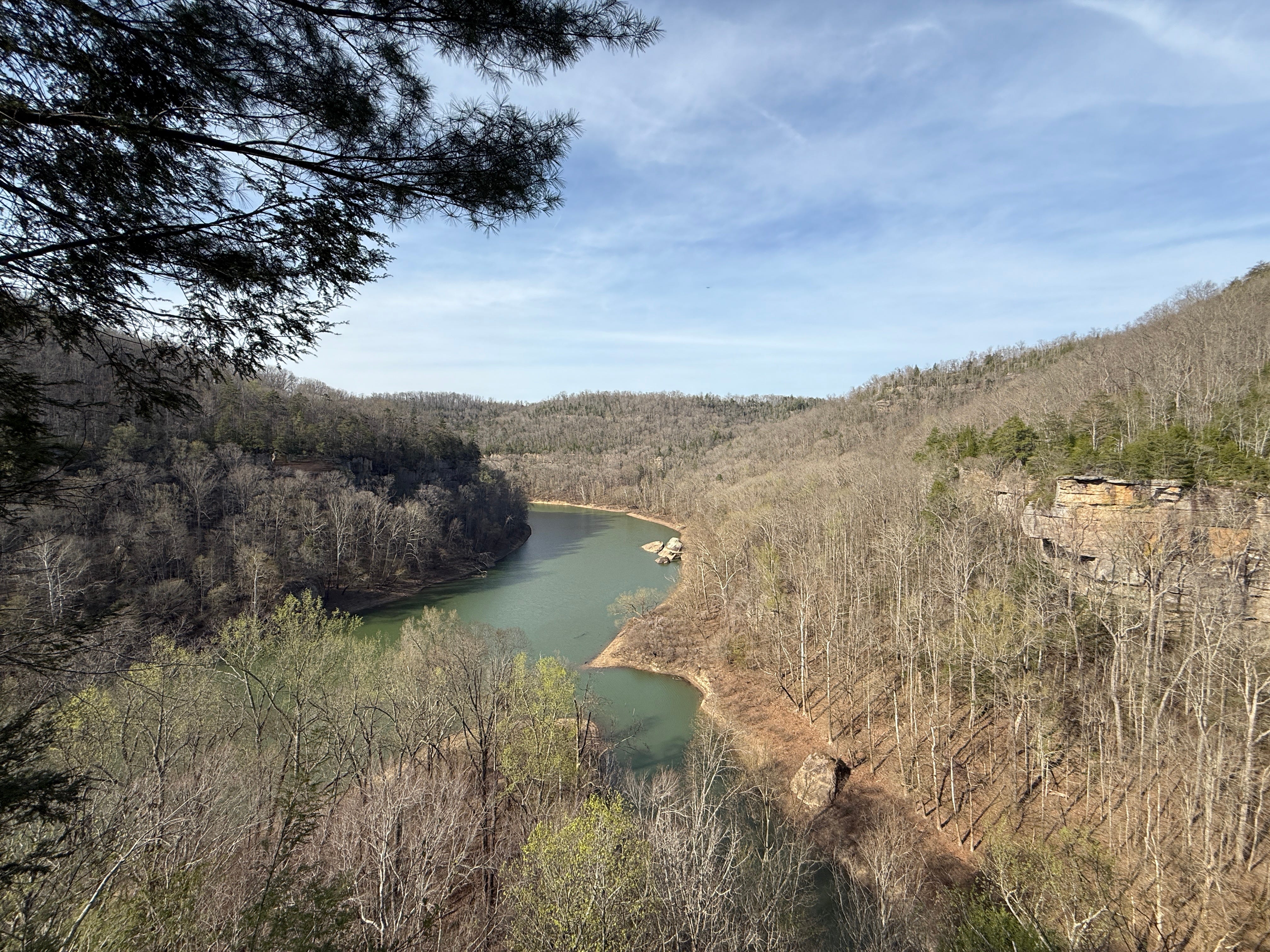
368 ft.: There is a spur trail to the left. This leads to a beautiful overlook of the Big South Fork River downstream of Yahoo Creek. Take the short side trip to the overlook either now or on your way out. Either way, it’s a beautiful site that isn’t to be missed. The trail is a mix of hemlock and beech to start, with significant stands of rhododendron mixed in.
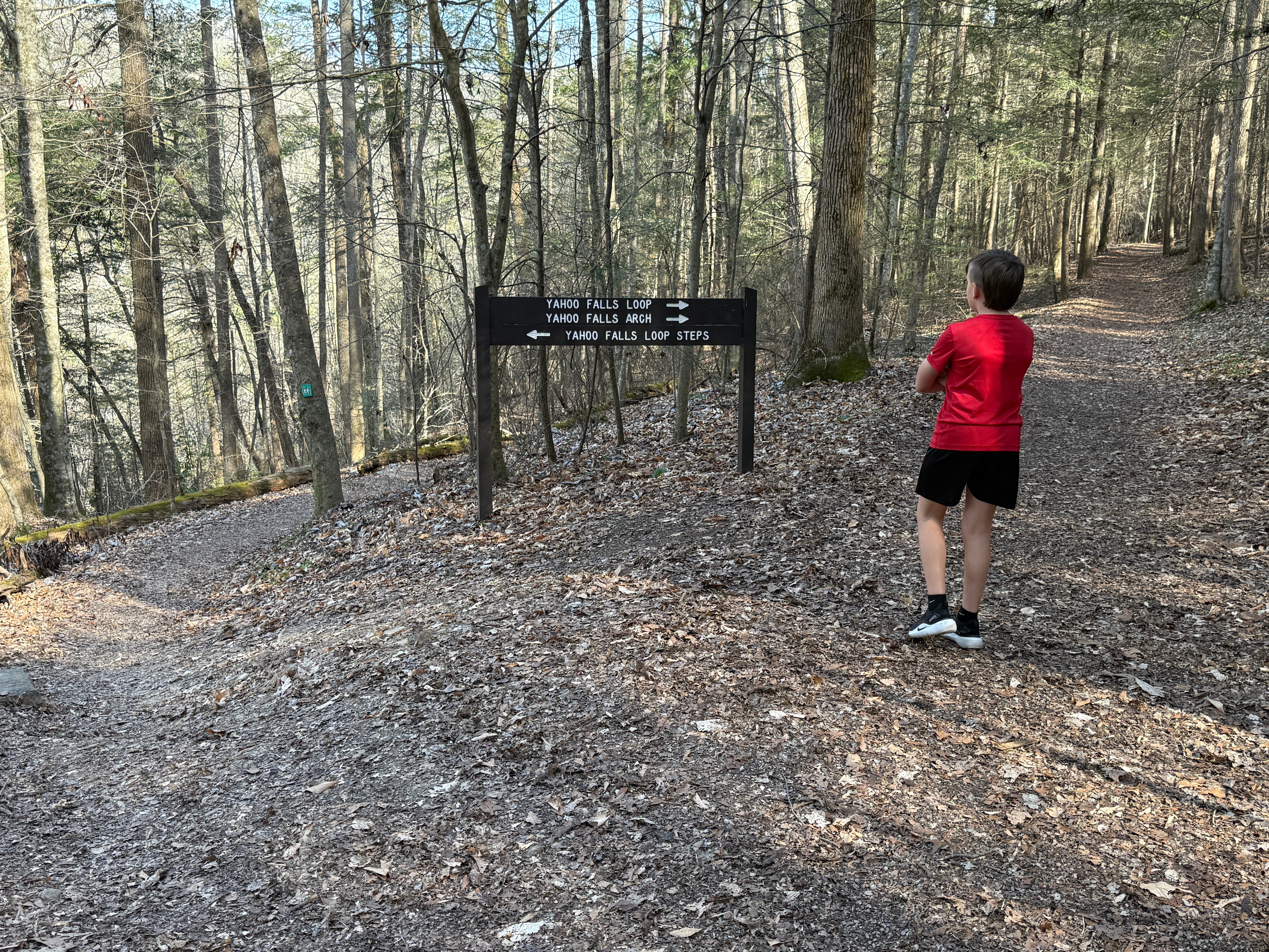
624 ft.: The trail splits, as the loop portion of the trail begins. You can hike it in either direction. For the purposes of this description, we’re going to hike it in a counter-clockwise direction. Take the right fork to hike counter-clockwise.
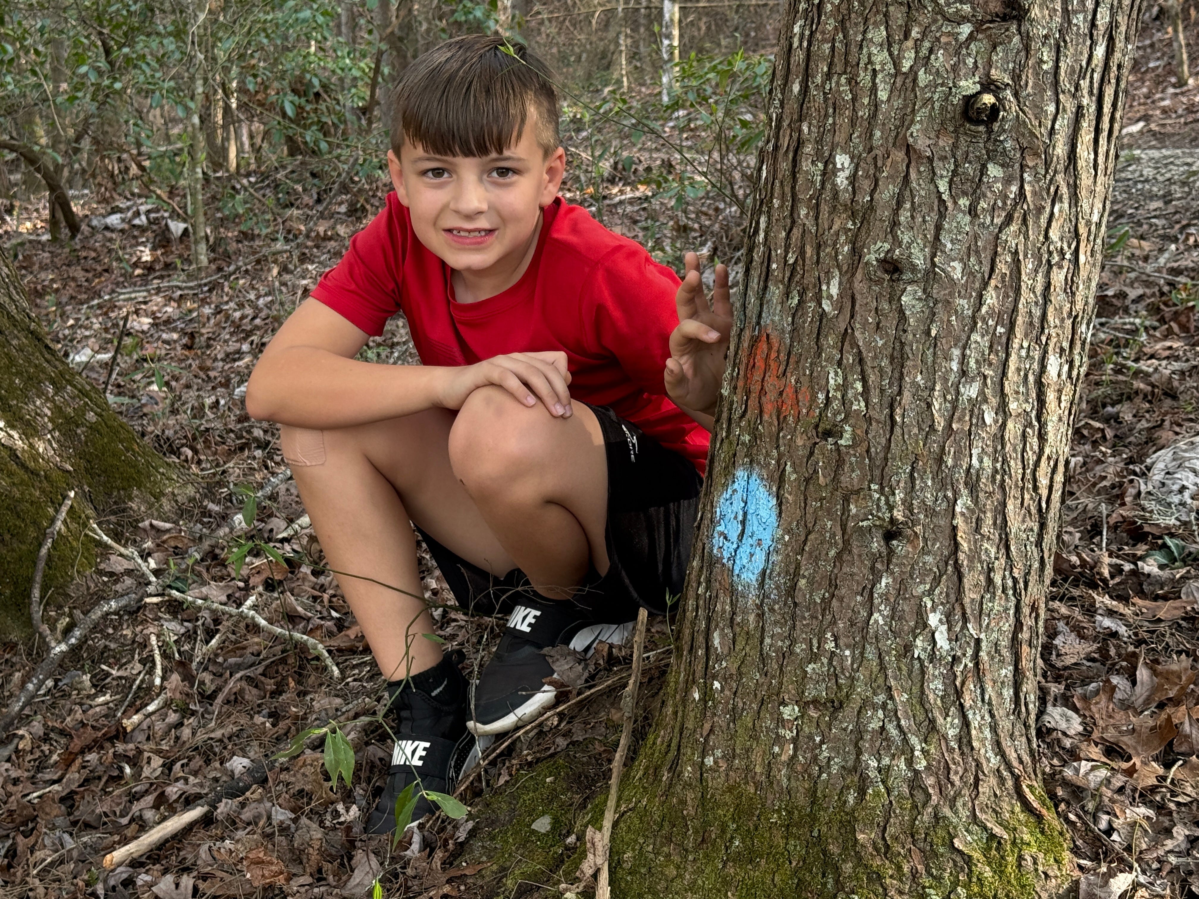
0.23 mile: The trail passes a major blowdown that was recently cleared by Big South Fork NRRA maintenance crews. The forest type continues to be a mix of hemlock and beech, with some oak and other hardwoods sprinkled in. Look closely and you’ll see painted dots at the base of the hemlock trees, indicating that they have been treated by BSF botanists for the hemlock woolly adelgid, an invasive pest that poses a serious risk to hemlock trees throughout the region.
0.28 mile: The trail splits. It isn’t signed, but take the left fork (down the hill).
0.33 mile: The trail reaches an overlook on the east side of Yahoo Creek. Just past it, there are copious stands of rhododendron.
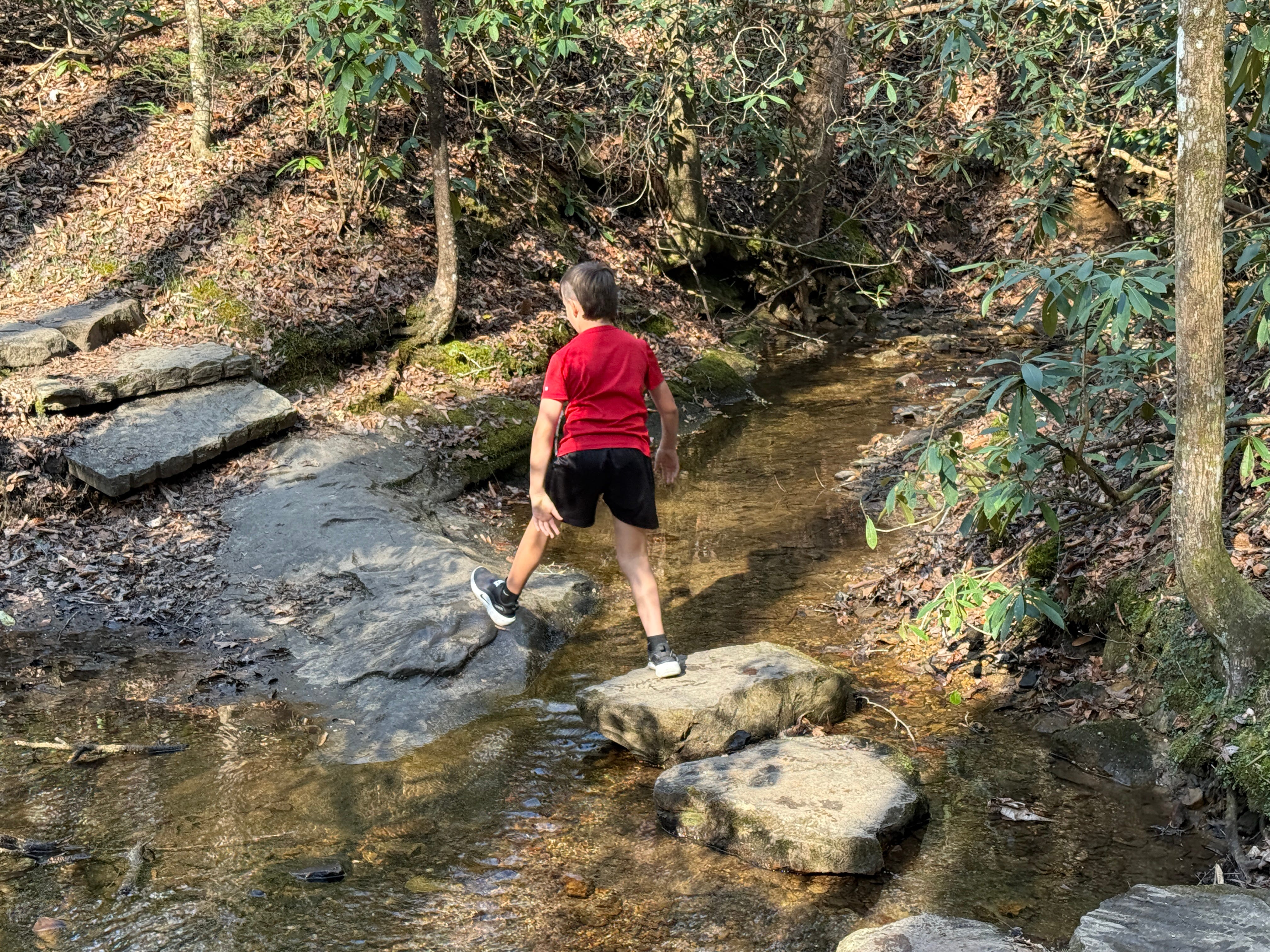
0.40 mile: The trail crosses Yahoo Creek. There is no bridge, but conveniently-placed stones make crossing the small stream easy work.
0.46 mile: Notice how rhododendron and mountain laurel grow together along this section of the trail. These plants are cousins among the evergreen flowering shrubs that are found in the Big South Fork region, but they don’t often grow together. Laurel is usually found in well-drained soils atop the ridges, usually near the rim of the gorge, while rhododendron is found in more shaded and damper areas beneath the cliff lines, inside the gorge. This section of the trail features characteristics of both the plateau top and the gorge areas, allowing both plants to grow together. They’re distinguishable by the rhododendron’s larger leaves.
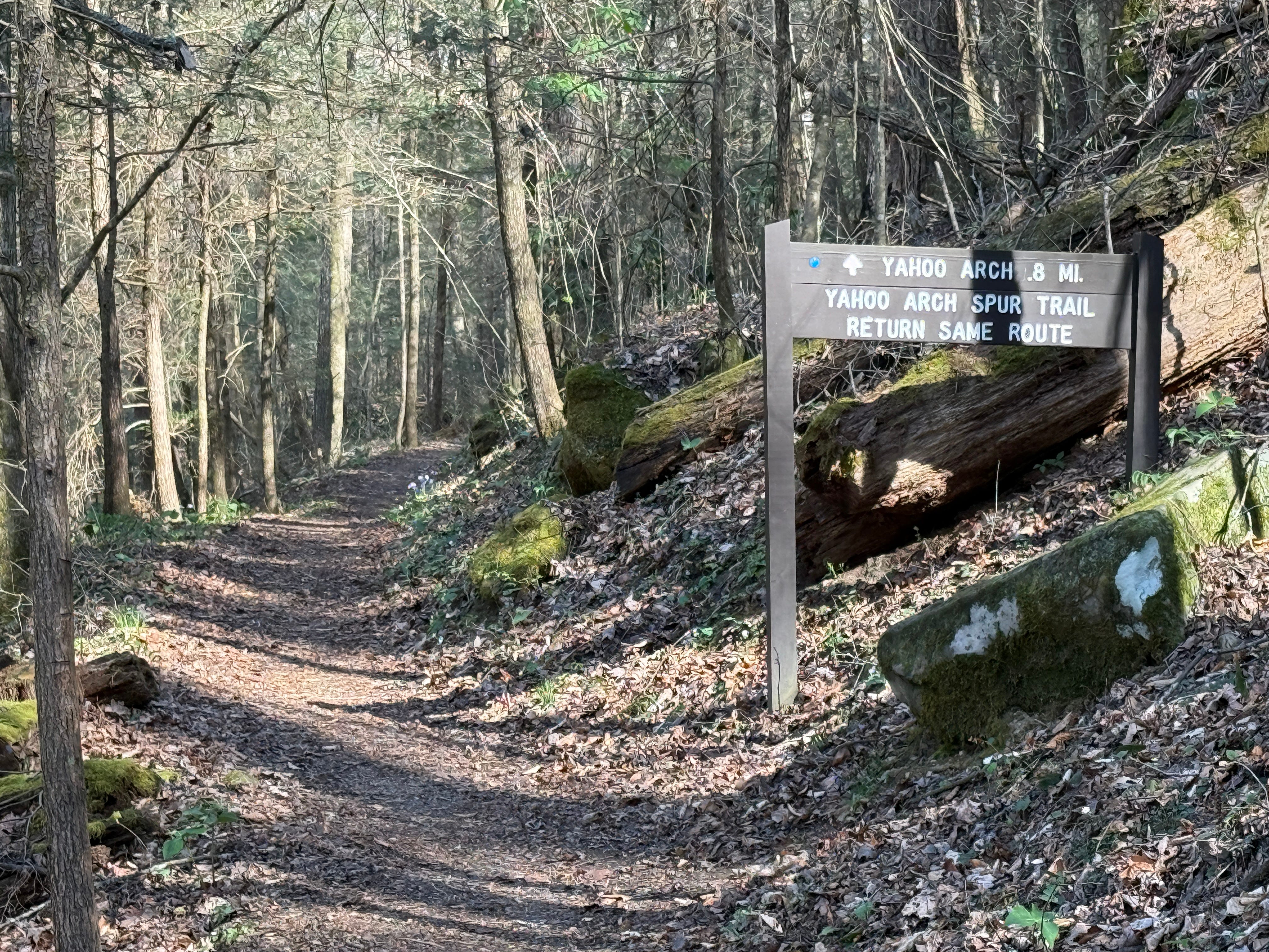
0.55 mile: The trail splits. The right fork goes to Yahoo Arch, a short trip well worth the additional effort if you choose to do so. The loop trail continues along the left fork.


0.59 mile: Check out the dirt dauber nest beneath the rock along the right side of the trail, sheltered from the weather. The dirt dauber, also called mud wasp, is a species of wasp that build nests out of mud. Nests like these are built by organ pipe mud daubers (so called because the nests resemble organ pipes). The organ pipe mud dauber is native to eastern North America, including both the eastern U.S. and southeastern Canada. Dirt daubers feed primarily on spiders. They are not aggressive and will not sting unless threatened.


0.63 mile: The trail has reached the base of the bluff line, and travels beneath the bluff line. Feel the cooler air, as the dark crevices in the rock have an air-conditioning effect on mother nature!


0.76 mile: The trail reaches Yahoo Falls. At 113 feet, Yahoo Falls it the tallest waterfall in the state of Kentucky — yes, even taller than Cumberland Falls, though the volume of water is obviously much less. Like many waterfalls in the Big South Fork NRRA, the flow of Yahoo Falls depends heavily on recent rainfall. The waterfall is not as spectacular during dry weather. However, the huge rock shelter that lies behind it is always spectacular, and certainly worth the hike in. The trail itself makes a sweeping pass through the rock shelter behind the waterfall.
0.98 mile: A side trail leads to Yahoo Creek and a wooden footbridge, offering a different perspective of the waterfall and excellent photo opportunities.
1.11 mile: The trail begins its ascent toward the top of the gorge.
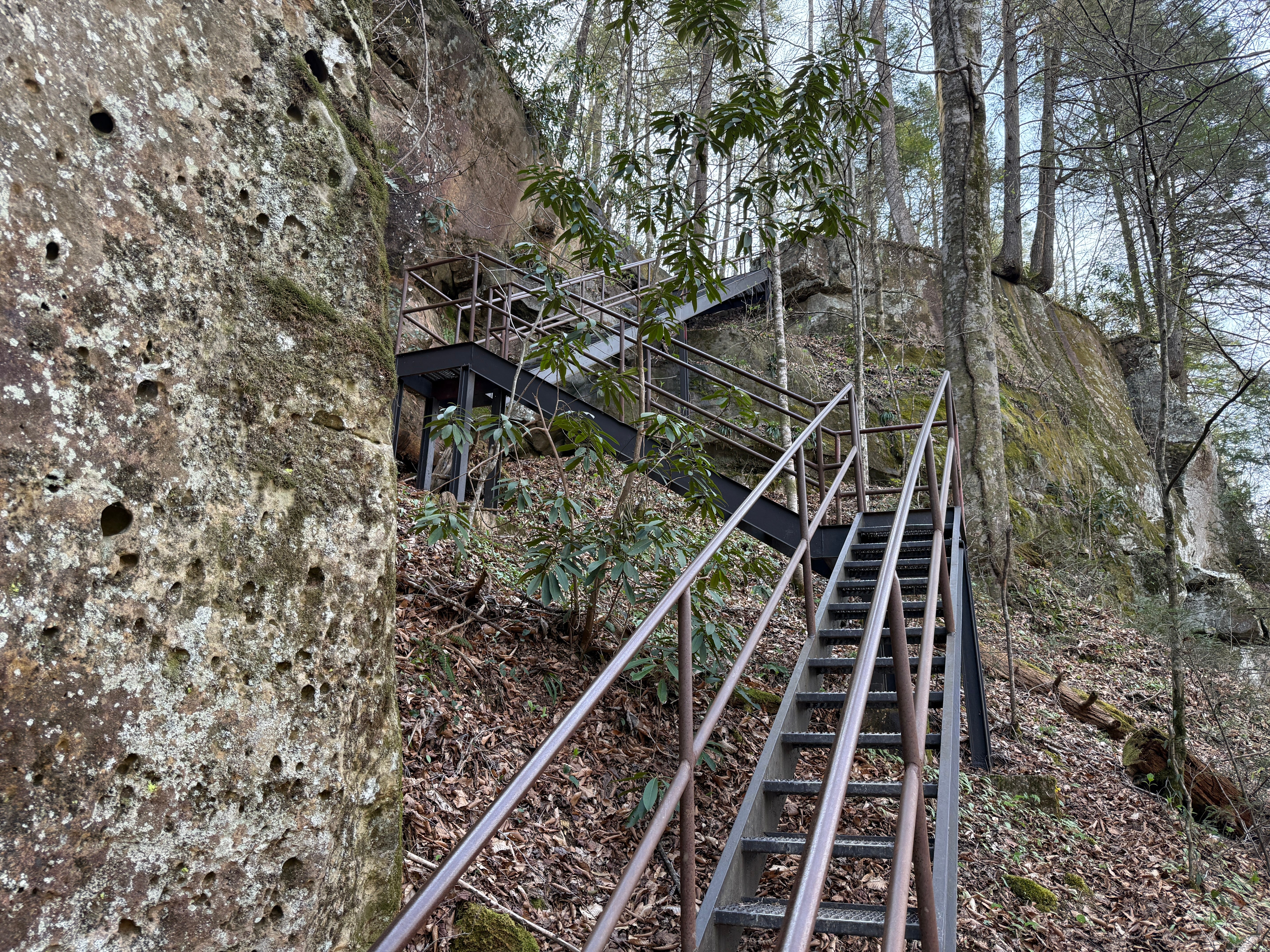
1.14 mile: The trail reaches the base of the steep staircase. This is the only part of the hike that isn’t easy, and it is what earns this trail a moderate difficulty rating. If you’re not accustomed to hiking, take your time and enjoy the views of the Big South Fork River off to the right as you climb (views that will disappear once the trees have leafed out).
1.2 mile: The trail reaches the top of the plateau. From here, simply continue back to the trailhead. If you didn’t stop by the river overlook on the way in, be sure to do so on the way out. It’s a very short side trip to an excellent vantage point.
Worth noting: There’s another overlook of the river at the trailhead, just around the bend in the road from the restroom facilities.
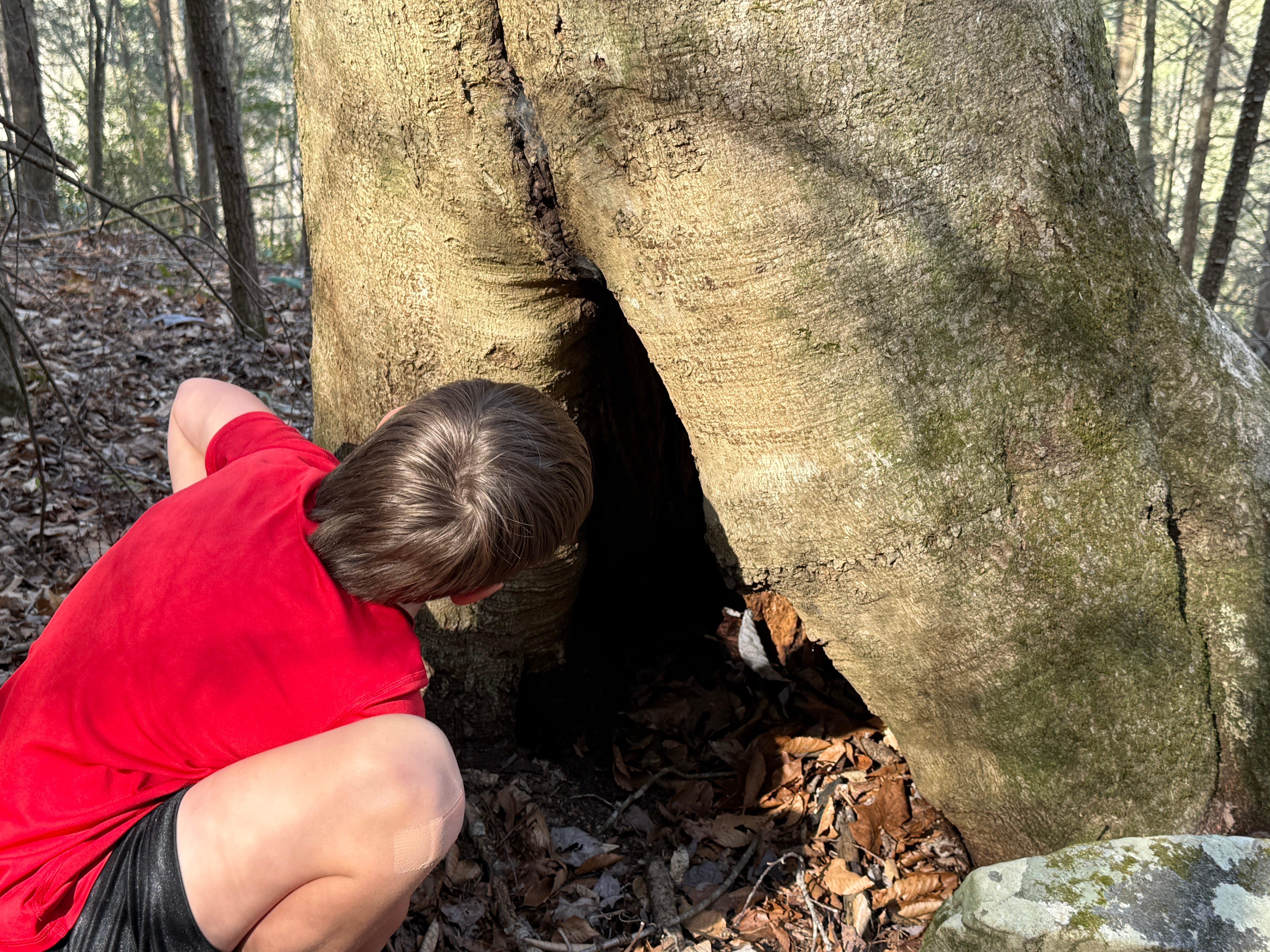
Scavenger Hunt: This week, we’re looking for a unique hollow tree. Somewhere along the trail, there is a huge beech tree with an open crevice at its base that is almost large enough for a small child to climb inside. Snap a photo of this tree and tag it with the #SpringHikingChallenge hashtag on social media. We’ll randomly select someone for a free set of Ozark Trail trekking poles.
Historical Context: The huge rock house behind Yahoo Falls is historically associated with a massacre of Cherokee Indians that allegedly occurred on Aug. 10, 1810. A number of Cherokee women and children were supposedly massacred by white settlers as they met in the rock shelter to travel to a Presbyterian school that was being opened by Rev. Gideon Blackburn near Chattanooga. They were led by Princess Corn Blossom, daughter of Cherokee war chief Doublehead and husband of Jacob “Big Jake” Troxell.
Allegedly, a group of soldiers sent by Indian hunter John Sevier of Tennessee, and under the command of Hiram “Big Tooth” Gregory, murdered the Cherokee women and children beneath Yahoo Falls.
However, historians doubt the legitimacy of the story. The account of the massacre comes from an unpublished manuscript written by Dan Troxell in the 1990s. Corn Blossom appears to have originated in a 1958 book by Thomas H. Troxel entitled Legion of the Lost Mine. In his foreword, Troxel noted that some of the characters in his book were fictitious, though he didn’t specify which. There are no contemporary records that document the Yahoo Falls Massacre or a Princess Corn Blossom.
The grave site of Big Jake Troxell (1758-1810) can be seen at the turn onto Yahoo Falls Road, 1.5 miles from the trailhead. He was a Revolutionary War soldier in the Pennsylvania militia who later lived with the Cherokee. A monument to the victims of the Yahoo Falls Massacre was placed here in the early 2000s, but was removed by the National Forest Service. (Jake Troxell is not believed to have actually been buried at this place. It is believed by many that he was actually buried at Otter Creek in an unmarked grave.)
Make It Better: Hiking to Yahoo Arch adds about 1.6 miles (0.8 mile in each direction) and it’s a fairly easy hike to a spectacular rock feature.
Be Careful For: The overlooks above Yahoo Falls are protected, but be cautious with small children, as they can easily climb over or around the short fencing.
Please Remember: Hikers are encouraged to obey the “Leave No Trace” ethic. “Leave only footprints, take only memories.” Please do not litter! Also, remember that while all trails in the Big South Fork are dog-friendly, all dogs must be leashed and kept within six feet.
Document Your Hike: Record your participation on this week’s hike by taking a photo of you and your group and tagging it with the #SpringHikingChallenge hashtag on social media (make sure the post privacy is set to public!) or emailing newsroom@ihoneida.com.