

Week #7: Buzzard Rock
We reach the halfway point of the Spring Hiking Challenge with a trip to Daniel Boone National Forest

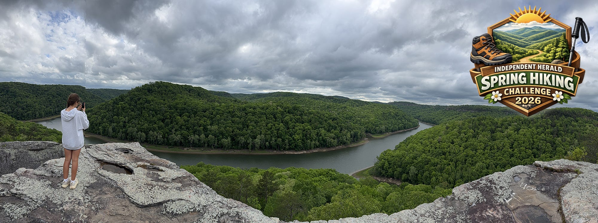
We reach the halfway point of the Spring Hiking Challenge with a visit to one of the most spectacular vantage points you’ll find anywhere in this region — and that’s saying something, because there are a lot of spectacular vantage points around here.
This one is called Buzzard Rock — a name that belies the magnificence of the views that await — and it’s located in the McCreary County section of the Daniel Boone National Forest.
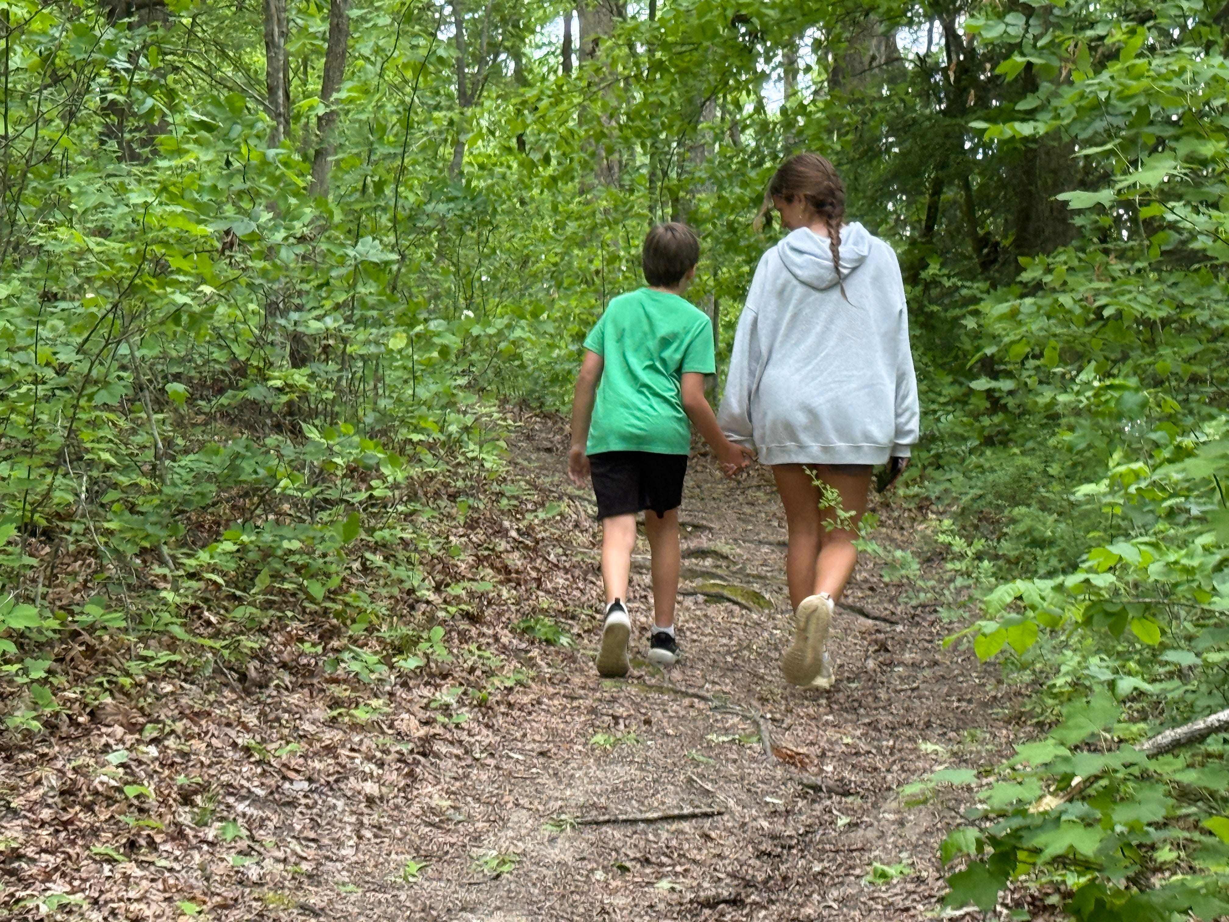
One of the nice things about Buzzard Rock is that it is truly a hike that is friendly for all ages — a short, easy stroll through the woods with a tremendous payoff waiting in the views at the end of the trail. We’re dialing back the difficulty after last week’s hike at Burnt Mill, just as we did after the earlier hike to O&W Bridge. You might be noticing a trend by this point, as we try to pace the challenge so that novice hikers who might be discovering the great outdoors for the first time can ease into it.
So, let’s head north up U.S. Highway 27 and get started…


Buzzard Rock
Trailhead: Buzzard Rock
Trail Type: Out-and-back
Payoff: Views
Difficulty: Easy
Length: 1.2 miles
Elevation Gain: 239 feet
Buzzard Rock is located inside the Daniel Boone National Forest north of Whitley City, Ky. The trailhead is located on Big Creek Road, near where the road turns over the hill to the Big Creek Boat Dock on the Big South Fork River. To get there, take U.S. Highway 27 north into Kentucky and through Whitley City. In the Beulah Heights community, 14.3 miles after crossing the TN-KY line, turn left onto Wiborg Loop Road. After six-tenths of a mile, turn left again onto Roberts Ridge Road (Tom Roberts Road). In about 1.4 miles, the road will turn into Big Creek Road. The pavement will turn to gravel. The trailhead can be a little tricky because it isn’t signed, and is simply a pull-off to the right side of the road that looks like the entrance to an ATV trail. It is located 1.1 miles past the last house on the road. If you come to a sharp left-hand switchback leading down the hill, you’ve gone too far. The easiest way to find it is to plug “Buzzard Rock” into your favorite maps app, like Waze or Apple Maps. It will lead you directly to the parking spot.
Mile 0.12: The first tenth of a mile is slightly uphill, as the trail climbs to the top of the ridge that separates Koger Creek from Big Creek. At this point, the trail levels out, and it’s an easy hike the rest of the way.
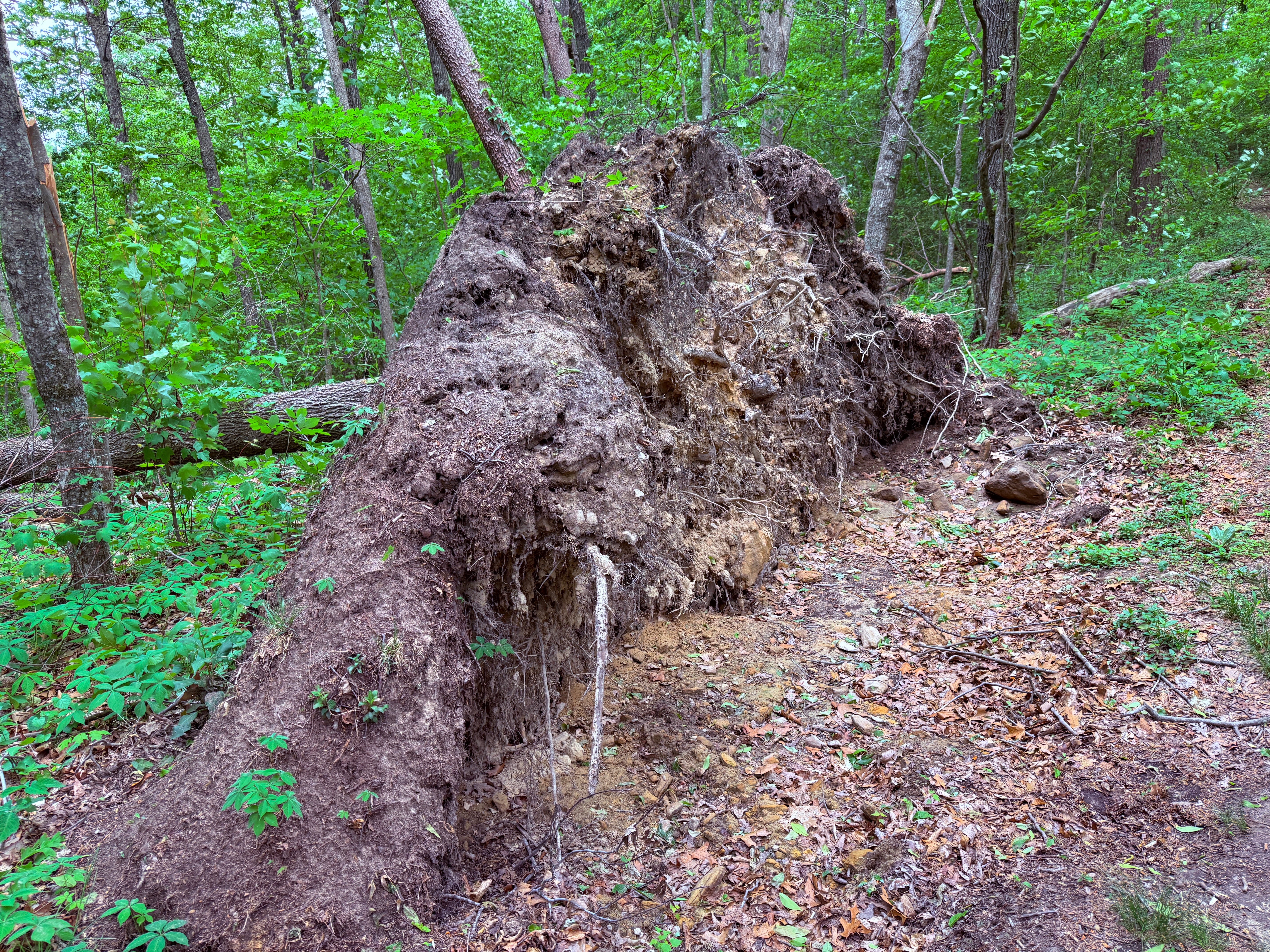
Mile 0.19: Notice the huge downed tree along the trail. The tree uprooted, taking a large piece of earth with it.
Mile 0.30: The drainage that is visible to the right is Koger Creek, which empties into the Big South Fork River just downstream from Buzzard Rock.
Mile 0.34: The trail begins a slight descent, dropping over small rock ledges.
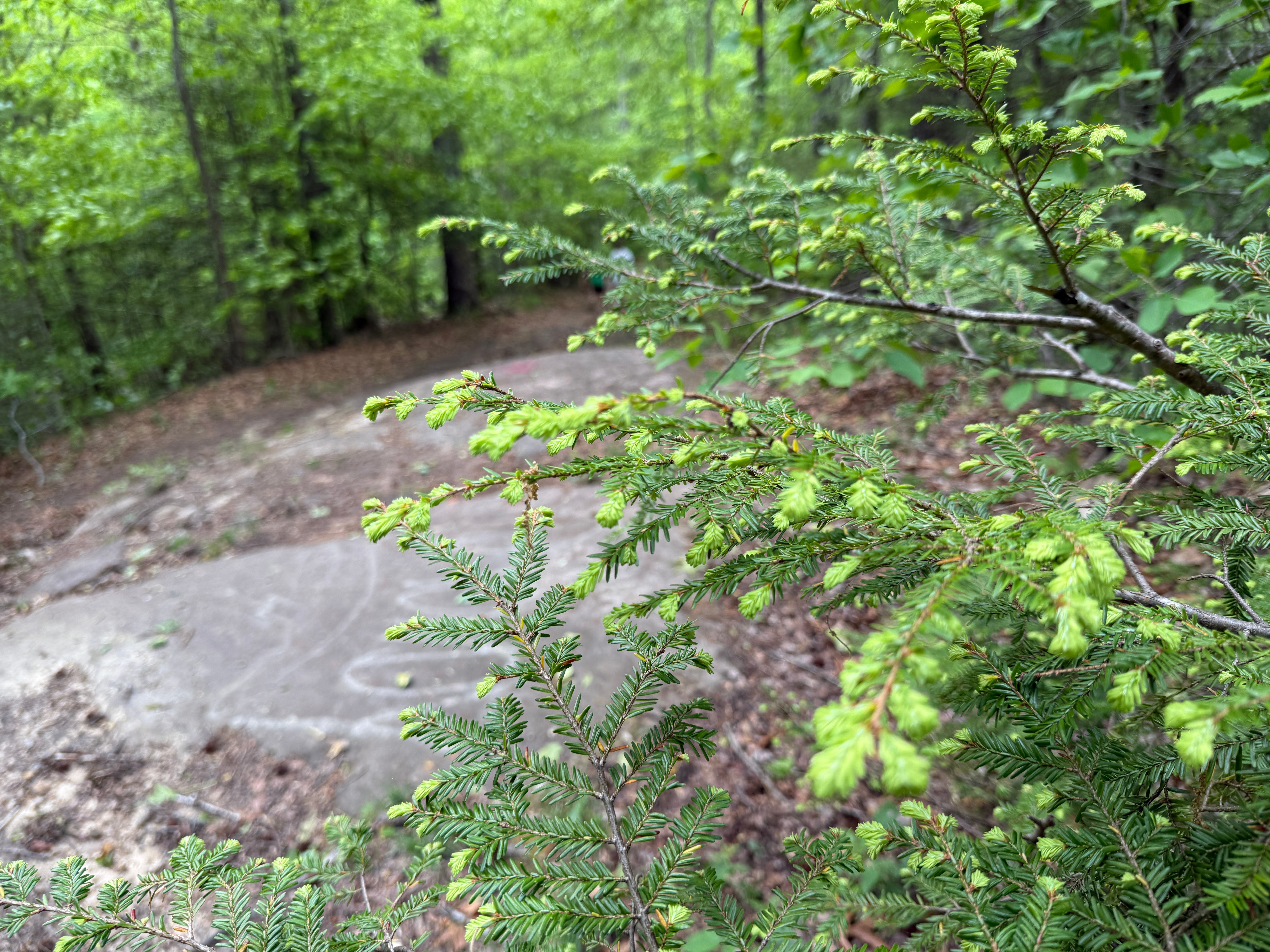
Mile 0.36: Notice the light-colored ends on the hemlock boughs. The lighter green is the new growth that emerges on the hemlocks during the middle of each spring. These lighter green tips will slowly become the same darker green as the rest of the hemlock’s foliage over the course of the summer.
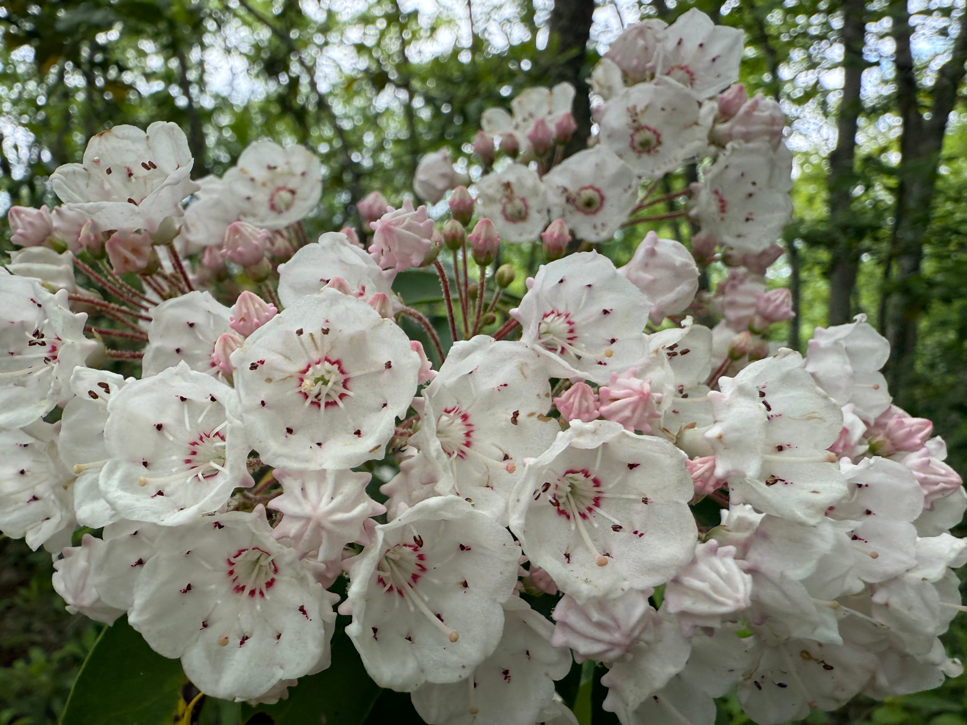
Mile 0.38: Mountain laurel is in full bloom now, and begins to show up along the trail. It will become quite prolific the rest of the way to the overlook.
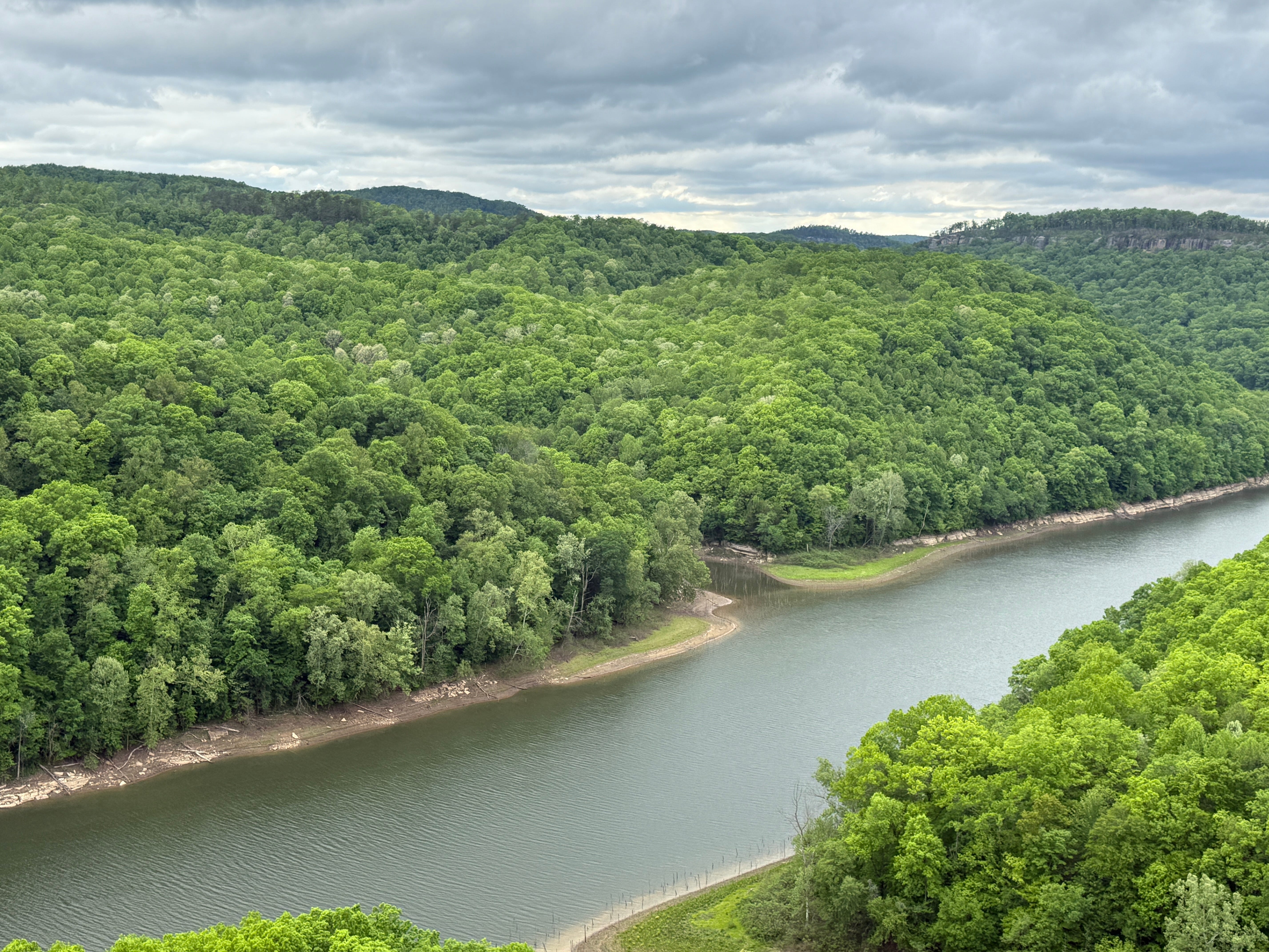
Mile 0.45: If you look through the trees, you’ll catch your first glimpse of the Big South Fork River. The first thing you’ll immediately notice is how calm and still the river is here, compared to Tennessee, where it’s fast-moving. That’s because the river this far north is constrained by the effects of the Wolf Creek Dam on the Cumberland River. The Big South Fork is part of the backwaters of Lake Cumberland at this point, calm and still the rest of the way to where it empties into the Cumberland River at Burnside, Ky.
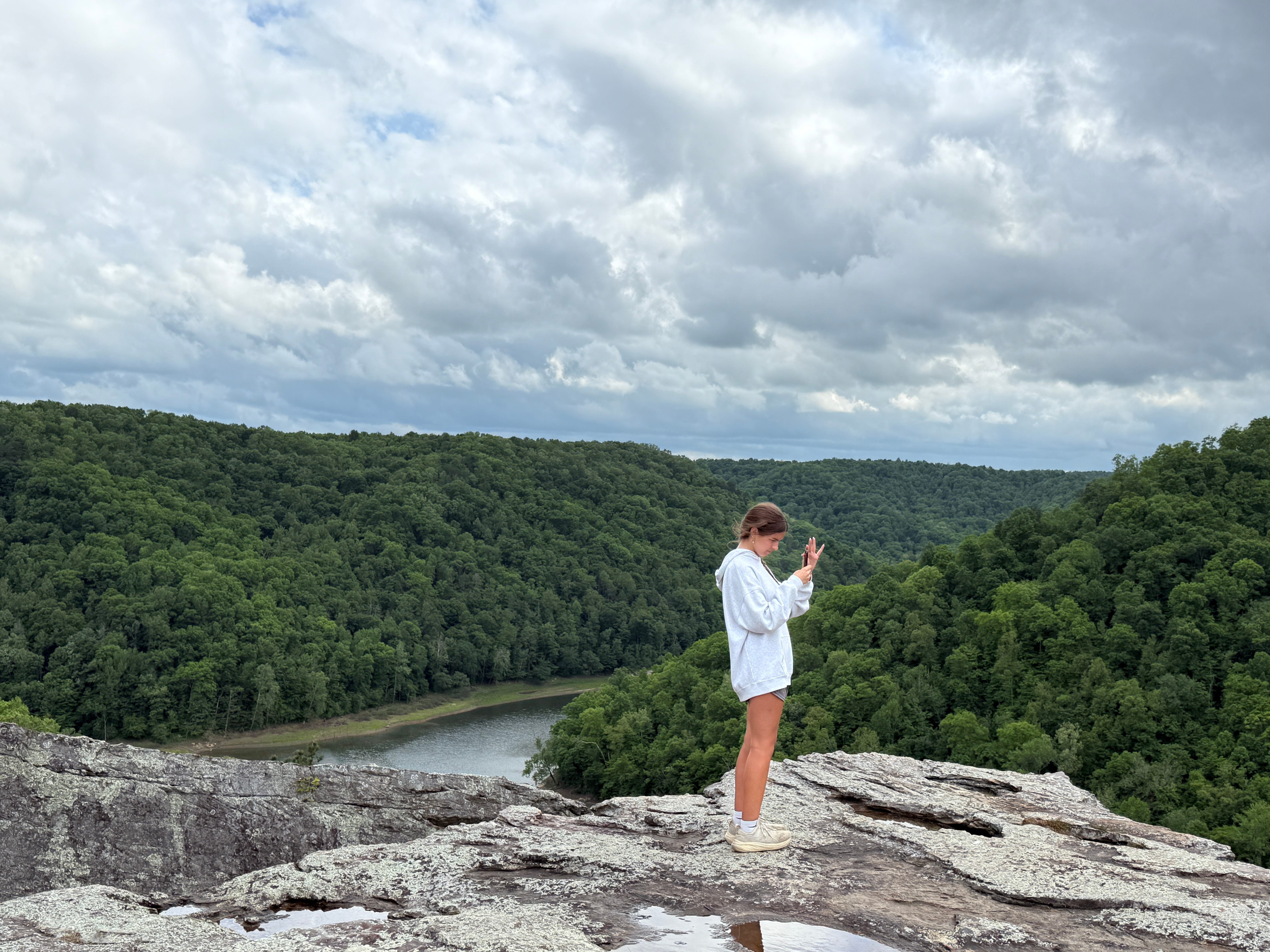
Mile 0.54: The trail turns downhill as it begins its final approach through the laurel to Buzzard Rock. A final step across a fissure in the earth and onto the large, flat surface of Buzzard Rock offers spectacular views of the Big South Fork valley. The stream to the right is Koger Creek. To the left, Big Creek empties in. Across the river is Cowhorn Creek. Downstream, you can see the rugged cliff lines along the edge of the ridge that separates the Big South Fork River from Straight Creek. You can’t see it from here, but just a short distance upstream, around an S-curve in the river, is Yahoo Falls Overlook, where we were just at a few weeks ago. Not visible but a short distance downstream is the mouth of the Little South Fork.
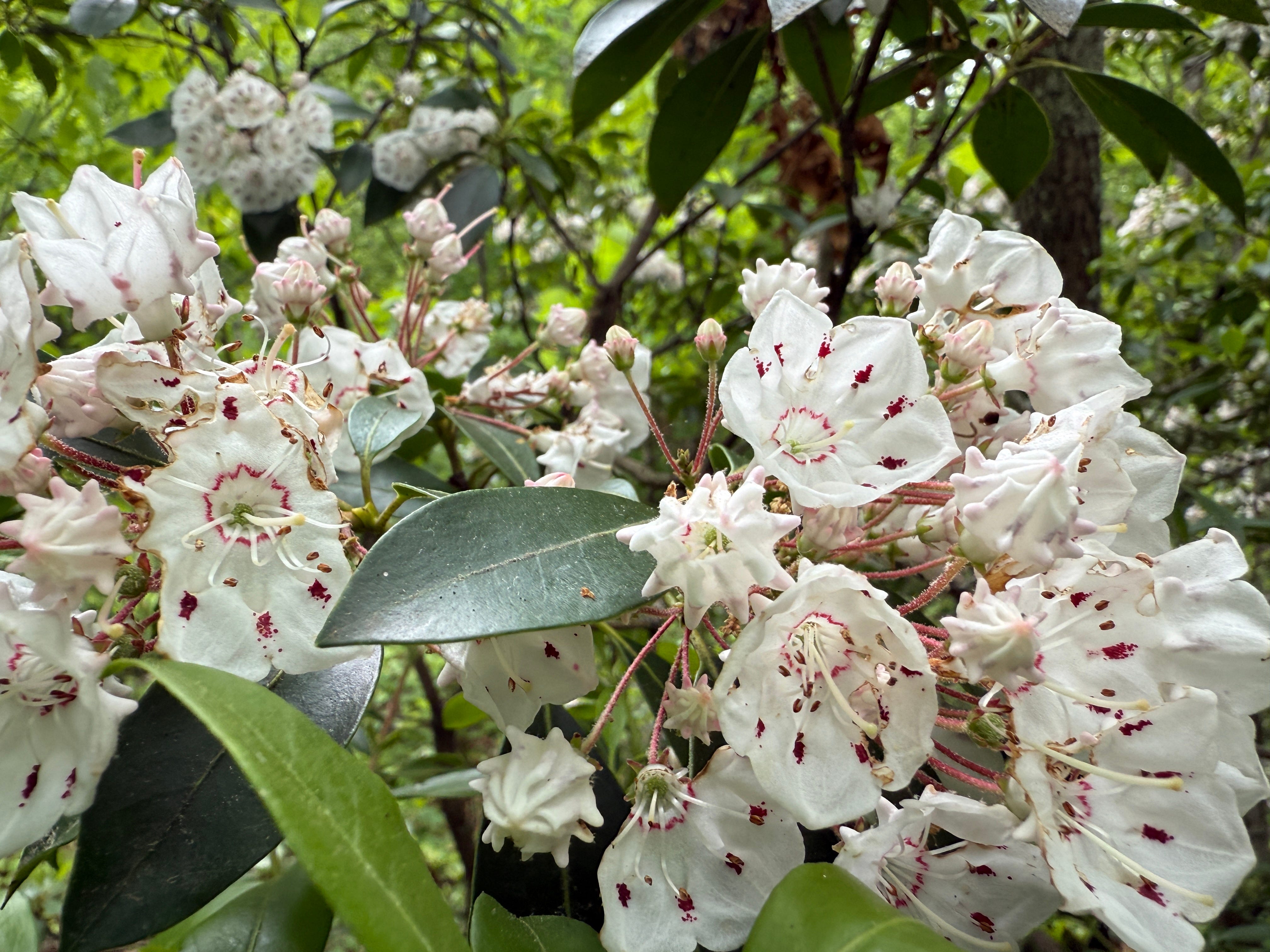
Scavenger Hunt: This week, we’re looking for mountain laurel … and you won’t have any trouble finding it, because it grows in abundance around Buzzard Rock and is in full bloom. It is truly one of the most spectacular flowers found in the Big South Fork region. Snap a photo and tag it with the #SpringHikingChallenge hashtag to be entered into this week’s drawing for a pair of Sunhauk sunglasses.
Historical Context: Although we drove through Daniel Boone National Forest to reach Yahoo Falls, this is the first time the Spring Hiking Challenge is actually setting foot in the national forest. It was established in 1937 as the Cumberland National Forest, and renamed in 1966 for the famous frontiersman who explored the area in 1769. It covers more than 700,000 acres of land in eastern Kentucky.
Make It Better: Just a short distance north from Buzzard Rock is the spectacular Natural Arch, also located in Daniel Boone National Forest. We aren’t coming back this far north simply out of respect to the drive time, but the hike to Buzzard Rock is so short you might wish to tack on the equally short hike to Natural Arch while you’re here. Natural Arch Scenic Area is located on Day Ridge Road. Back at U.S. 27 from Wiborg Loop, turn left toward Somerset and drive a few miles to Ky. Hwy. 927 (if you reach the turnoff to Cumberland Falls, you’ve gone too far). Watch for the signs to Natural Arch. After the turnoff, it’s 1.8 miles to the parking lot. The hiking trail is an easy, 1.5-mile loop.
Be Careful For: Buzzard Rock is unprotected. Use caution near the edges with pets and small children.
Please Remember: Hikers are encouraged to obey the “Leave No Trace” ethic. “Leave only footprints, take only memories.” Please do not litter! Also, remember that while all trails in the Big South Fork are dog-friendly, all dogs must be leashed and kept within six feet.
Document Your Hike: Record your participation on this week’s hike by taking a photo of you and your group and tagging it with the #SpringHikingChallenge hashtag on social media (make sure the post privacy is set to public!) or emailing newsroom@ihoneida.com.
Hike #1: Sunset Overlook
Hike #2: Angel Falls Rapid
Hike #3: Yahoo Falls
Hike #4: O&W Bridge
Hike #5: Northrup Falls
Hike #6: Burnt Mill
Great trail. But very short...