


Angel Falls Overlook
Trailhead: Grand Gap
Trail Type: Out-and-back
Payoff: Views
Difficulty: Easy/Moderate
Distance: 2.7 miles
Elevation Gain: 273 feet
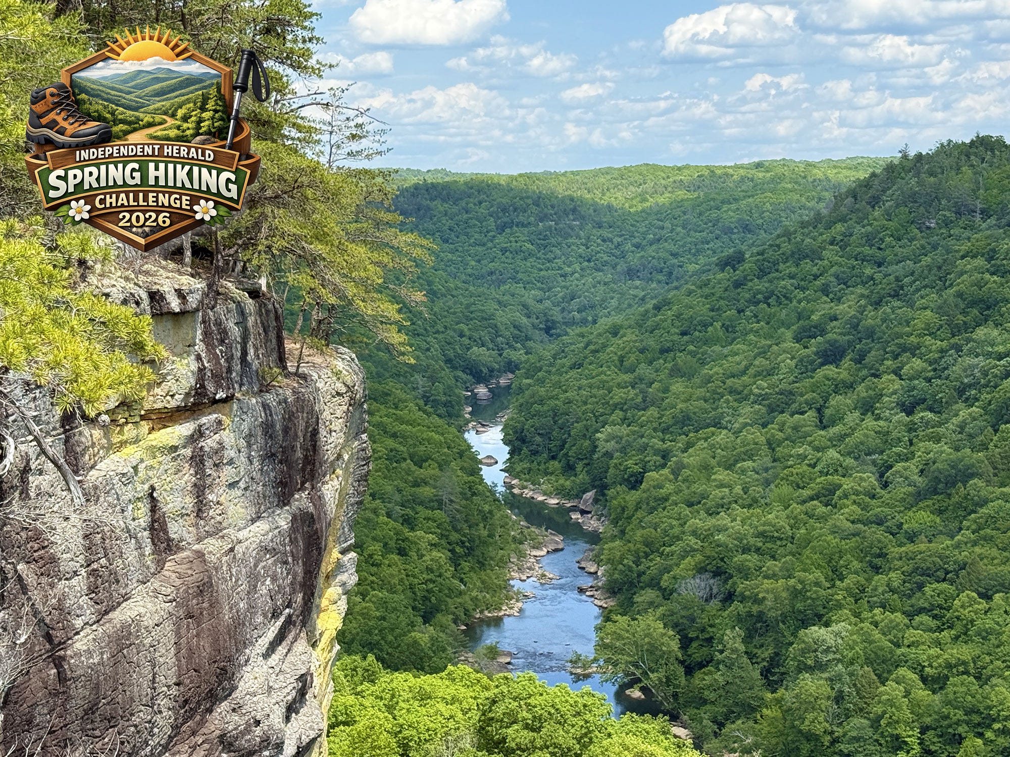
The Twin Arches and O&W Bridge might beg to differ, but there is arguably no scene in the Big South Fork National River & Recreation Area that is photographed any more than Angel Falls Overlook — specifically, the view north along the Big South Fork River, with the rock wall jutting out into the foreground. It is a stunning vista, and little wonder that it is considered the best overlook anywhere in the Big South Fork NRRA.
That’s our destination for Week #9 of the Spring Hiking Challenge. There are multiple ways to get to Angel Falls Overlook. In keeping with the theme of the challenge — family-friendly to encourage the participation of young and old alike — we’re choosing the easy route, with an option to take the longer route if you so choose. By doing so, we’ll turn this into an out-and-back hike of just 2.7 miles, beginning and ending at the Grand Gap Trailhead on Alford Smith Road.
Please note that parking is somewhat limited at Grand Gap Trailhead. That’s why we didn’t include this hike earlier in the challenge, waiting instead for the number of participants to diminish somewhat. Also note that Alford Smith Road is a one-lane, gravel road that may not be suitable for some sportier vehicles. SUVs, pickup trucks, and most cars are fine on this road, but sportier cars that sit very low to the ground might not be the best option. If either of these things are a concern, the hike in from Leatherwood Ford is much more scenic — just longer and more difficult. Don’t let them discourage you from attempting this hike; just know that if you drive a McLaren 750s, you probably don’t want to drive this road! Sedans like a Toyota Camry or Kia Optima, however, will be just fine.
With that in mind, let’s get started!
To get to Grand Gap Trailhead, drive to Bandy Creek, and turn right into Bandy Creek Campground. Just past the registration kiosk, turn left to drive to Bandy Creek Pool. Just beyond the pool, the pavement ends. Continue onto the gravel road. This is Duncan Hollow Road. After a mile or so, the road will fork at a power line right-of-way. Take the left fork to stay on Duncan Hollow Road. Continue on Duncan Hollow Road until you see the signs indicating a right turn for Grand Gap Loop. This is Alford Smith Road. Drive to the end of the road.
The Grand Gap Loop Trail crosses the road just before the parking area. A short distance north, John Muir Trail departs the Grand Gap Loop and heads toward Station Camp. A short distance south, Fall Branch Trail departs and leads back to the John Litton Farm Loop. At the parking area, there is an unsigned but well-worn trail that connects to the Grand Gap Loop. For the purposes of the mileages listed in this trail description, we’re taking this short cut and knocking off a couple of tenths of a mile from the start of the hike. Go left on Grand Gap Loop.
Note: Angel Falls Overlook is located southeast from the parking area. If you’re standing on Alfred Smith Road looking at the parking area, we’re going to head right, NOT left.
Mile .07: As we head east along Grand Gap Loop, notice the cleared area to your left. This was the site of the Alford Smith homeplace — the man for who the road to Grand Gap Loop is named for. He was the son of John “Hawk” Smith, a noted resident of the Big South Fork area. According to Alford’s grandson, Dave Smith, who lives in Muncie, Ind., the road once led through Alford’s barn at this location. The road trace is still there, although the current road ends at the Grand Gap Trailhead.


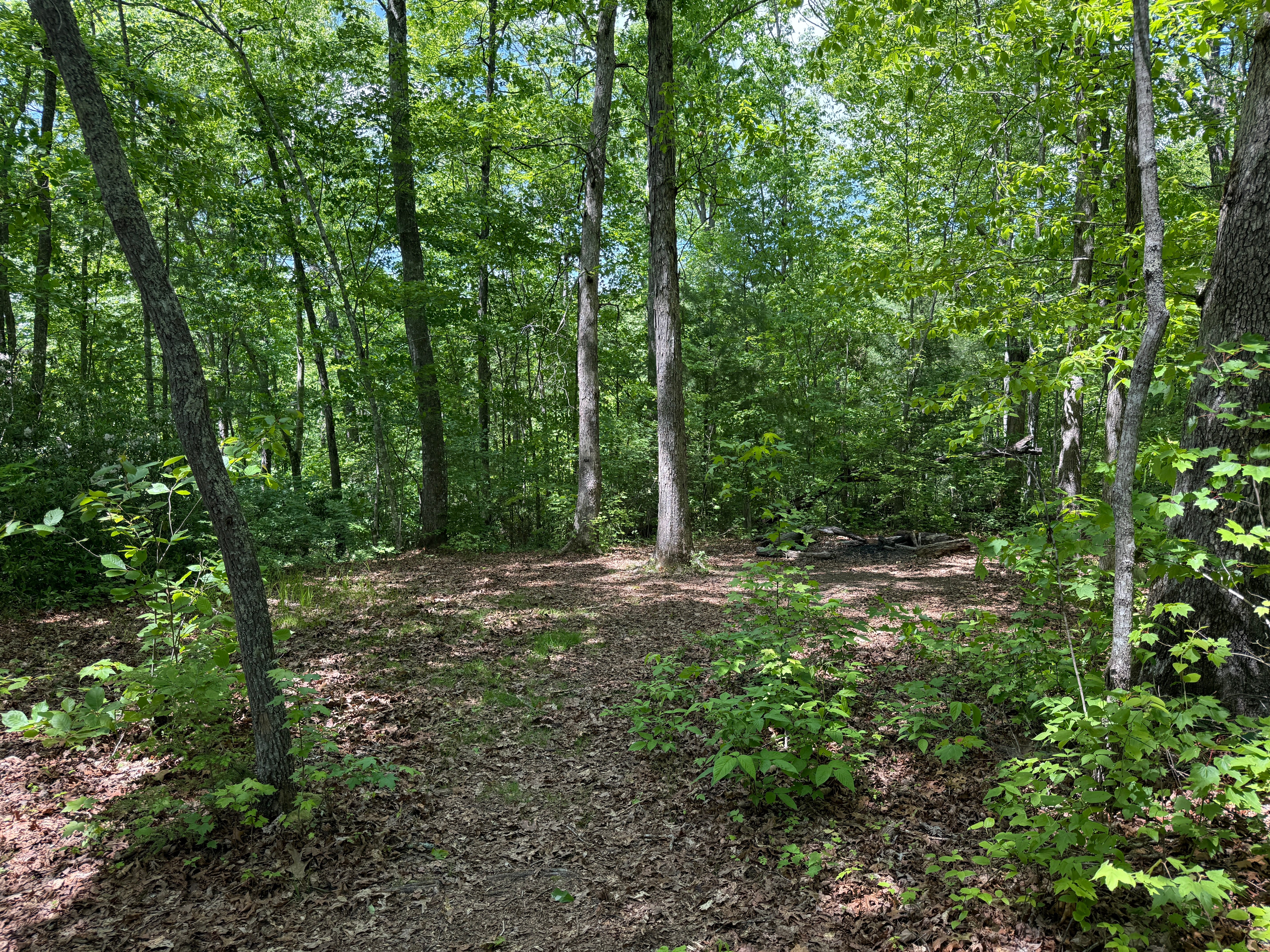
Mile .32: The forest along this stretch of trail is a mixed-oak forest typical of the Big South Fork’s upland areas. Here, several young bigleaf magnolia trees begin to mix in. The bigleaf magnolia is an understory tree that has the largest simple leaves and the largest flower of any tree indigenous to North America. In Tennessee, it isn’t often found outside the Cumberland Plateau. Its natural range is limited to the plateau and a large swath of Mississippi and Alabama, along with smaller pockets elsewhere in the Southeast.
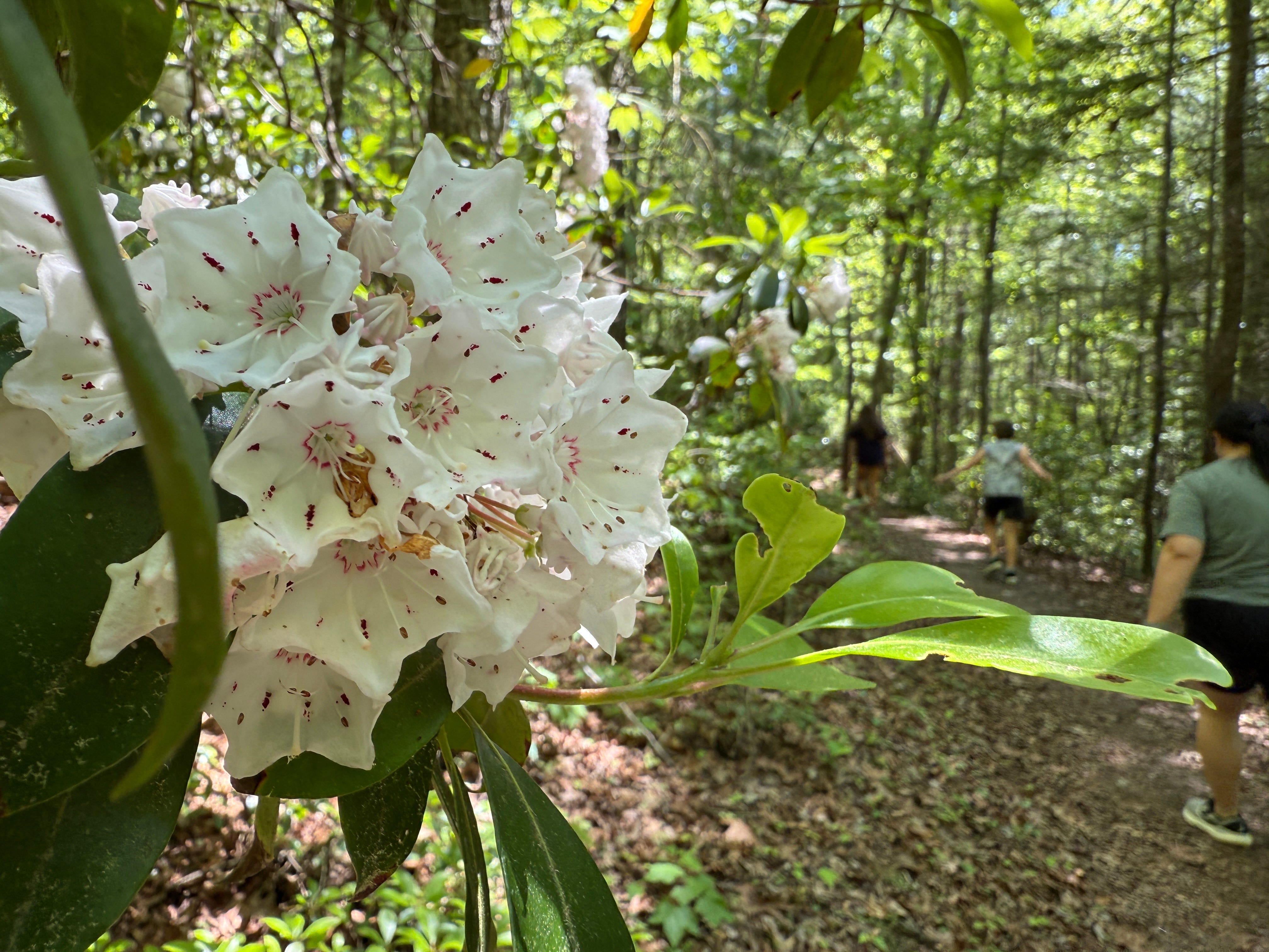
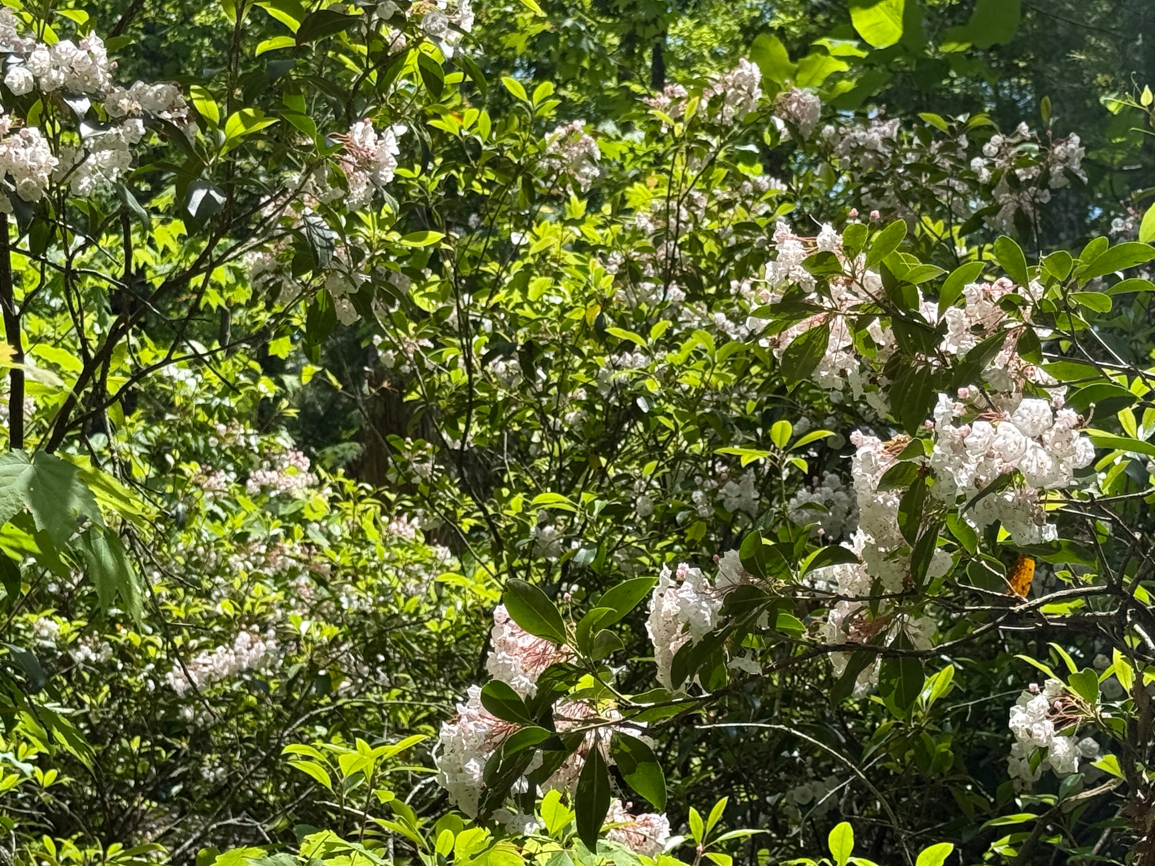
Mile .36: Mountain laurel begins to dominate the understory along this stretch of trail. The laurel is still blooming, though the blooming season is nearing its end. Here, the laurel grows in such density that it creates a nearly impenetrable thicket on either side of the trail.
Mile .41: The old Alford Smith road trace reappears along the left side of the trail. The road parallels the trail for the first half-mile or so. Just past here, the trail will start a slight ascent to the ridgetop.


Mile .56: On the left is the grave of Archie Smith. This is also called “The Baby Grave” by locals. Archie was born May 27, 1932, and died on Oct. 22, 1932. He was the son of Alford Smith and Elva Choate. His last surviving sibling, Milford Smith, died in 2022. Hikers sometimes leave small trinkets on Archie’s grave as a show of respect.
Mile .65: The trail begins a slight descent as it heads down the ridge towards the gorge rim.
Mile .82: A backcountry campsite is located on the right. This is a popular stopping point for backpackers on the John Muir Trail, which utilizes this section of the Grand Gap Loop as it makes its way from Pickett State Forest to Honey Creek.
Mile .99: Notice the sandy soils, the scrubby appearance of the forest canopy, and the thickness of the undergrowth. These are all signs that we’re approaching the rim of the gorge, where the shallow soils don’t support the massive oak and hickory trees that are found deeper in the forest.
Mile 1.04: The first overlook comes into view. This is not Angel Falls Overlook, although many hikers mistakenly assume that it is. This is Fall Branch Overlook. The drainage you’re looking at is Fall Branch, which heads up around the historic John Litton Farm and drains much of the Bandy Creek area. It empties into the Big South Fork River just above Angel Falls. If you step out onto the rock and look left, you’ll see the river in the distance.
Mile 1.17: The trail intersects with the John Muir Trail segment that connects Grand Gap to Leatherwood Ford. Hikers who make the trip in from Leatherwood emerge from a beautiful, miniature canyon at this spot that serves as a natural passageway through the cliff line. It’s interesting to observe the rapidly changing forest types here. On either side of this passageway are the sandy-soiled, unshaded edges of the gorge with their scrubby growth. However, this canyon provides an environment for deep, lush growth that includes hemlock, rhododendron and other species preferring relatively cool, moist environments, casting a deep shade that contrasts with the surrounding rim areas.


Mile 1.33: The trail reaches Angel Falls Overlook. As you step over a crack in the rock and onto the overlook, you might notice that Angel Falls Overlook is actually a freestanding rock butte, or chimney. It’s an incredible geological feature that also provides one of the most spectacular vantagepoints found anywhere in the Big South Fork NRRA. Just below the overlook, Fall Branch empties into the Big South Fork. If you look upstream, you can pinpoint the TVA transmission line that crosses the gorge just downstream from Leatherwood Ford. If you look downstream, you’ll see the incredible view that has appeared on magazine covers and brochures since the Big South Fork was created — the iconic scene of the river appearing as a blue ribbon snaking through the canyon as the rock wall juts out in the foreground.
You don’t actually see Angel Falls from here, although it’s called Angel Falls Overlook. The rapid is hidden by the forest canopy. However, you can certainly hear Angel Falls. The sound of the roaring whitewater easily reaches to the top of the gorge. This is a spectacular place to simply sit and take in the sights and sounds of Big South Fork Country.
One interesting temporary feature: if you look directly below the overlook, along the far side of the river, you’ll notice a scar from a huge blowdown caused by high winds during a late winter thunderstorm. You might remember that when we hiked to Angel Falls Rapid earlier in the challenge, we passed through a significant blowdown that had been cleared by National Park Service trail maintenance crews. This is a bird’s-eye view of what mother nature’s destruction looks like.
From the overlook, we retrace our steps back to the trailhead.
Scavenger Hunt: Along the route, there is a tree that has been uprooted by high winds, creating a huge rootball near the trail. That’s what we’re looking for this week. Snap a picture of this gigantic rootball and post it on social media with the hashtag #SpringHikingChallenge to be entered into our drawing for a pair of Sunhauk shades.
Historical Context: Alford Smith (sometimes mistakenly called Alfred Smith) was the man who called this area home. What remains of his farm — and there’s very little besides a “clearing” that is quickly being reforested by nature — is located just east of the Grand Gap Trailhead. Alford Smith (1891-1970) was the son of John J. “Hawk” Smith (1886-1949) and Polly Ann Blevins (1868-1942). Both his parents were descended from some of the Big South Fork’s first settlers, including Anderson Smith and Armstead Blevins. He married Nancy Burke, the great-granddaughter of Jonathan Burke, another of the BSF’s first settlers. However, she died in 1925. He then married Elva Choate of Jamestown. He had a total of 13 children, including Everett, Claude, Lonnie, Clay, Dallas, Ruth Marie, James, Herbert, Archie, Edna, Ralph, Milford and Mildred. Milford and Mildred were twins. Alford and his family left the Big South Fork region during World War II, when he moved to Oak Ridge to take a job there as the Manhattan Project flourished.


Make It Better: There are two ways to add mileage to this hike, if you wish. The first is to begin and end your hike at Leatherwood Ford. This is a spectacular hike that crosses the river on the S.R. 297 bridge, descends a staircase on the far side of the river, then follows the river to Fall Branch before climbing to the base of the cliffs, then traveling through a natural passageway through the cliffs to reach the Grand Gap Loop. This is a 6.0-mile route featuring 712 feet of elevation gain with a difficulty of hard. The second option is to keep hiking Grand Gap Loop once you’ve reached the overlook, turning it into a loop hike rather than an out-and-back. The total Grand Gap Loop is a 6.4-mile hike featuring 680 feet of elevation gain.
Be Careful For: Duncan Hollow Road is a multiuse trail that is shared by mountain bikers, hikers, and horseback riders. Alford Smith Road is a multiuse trail that is shared by mountain bikers. Please drive with caution on these roads. Fall Branch and Angel Falls overlooks are not protected. Use extreme caution with pets and small children.
Please Remember: Hikers are encouraged to obey the “Leave No Trace” ethic. “Leave only footprints, take only memories.” Please do not litter! Also, remember that while all trails in the Big South Fork are dog-friendly, all dogs must be leashed and kept within six feet.
Document Your Hike: Record your participation on this week’s hike by taking a photo of you and your group and tagging it with the #SpringHikingChallenge hashtag on social media (make sure the post privacy is set to public!) or emailing newsroom@ihoneida.com.
Hike #1: Sunset Overlook
Hike #2: Angel Falls Rapid
Hike #3: Yahoo Falls
Hike #4: O&W Bridge
Hike #5: Northrup Falls
Hike #6: Burnt Mill
Hike #7: Buzzard Rock
Hike #8: Cracks in the Rock