


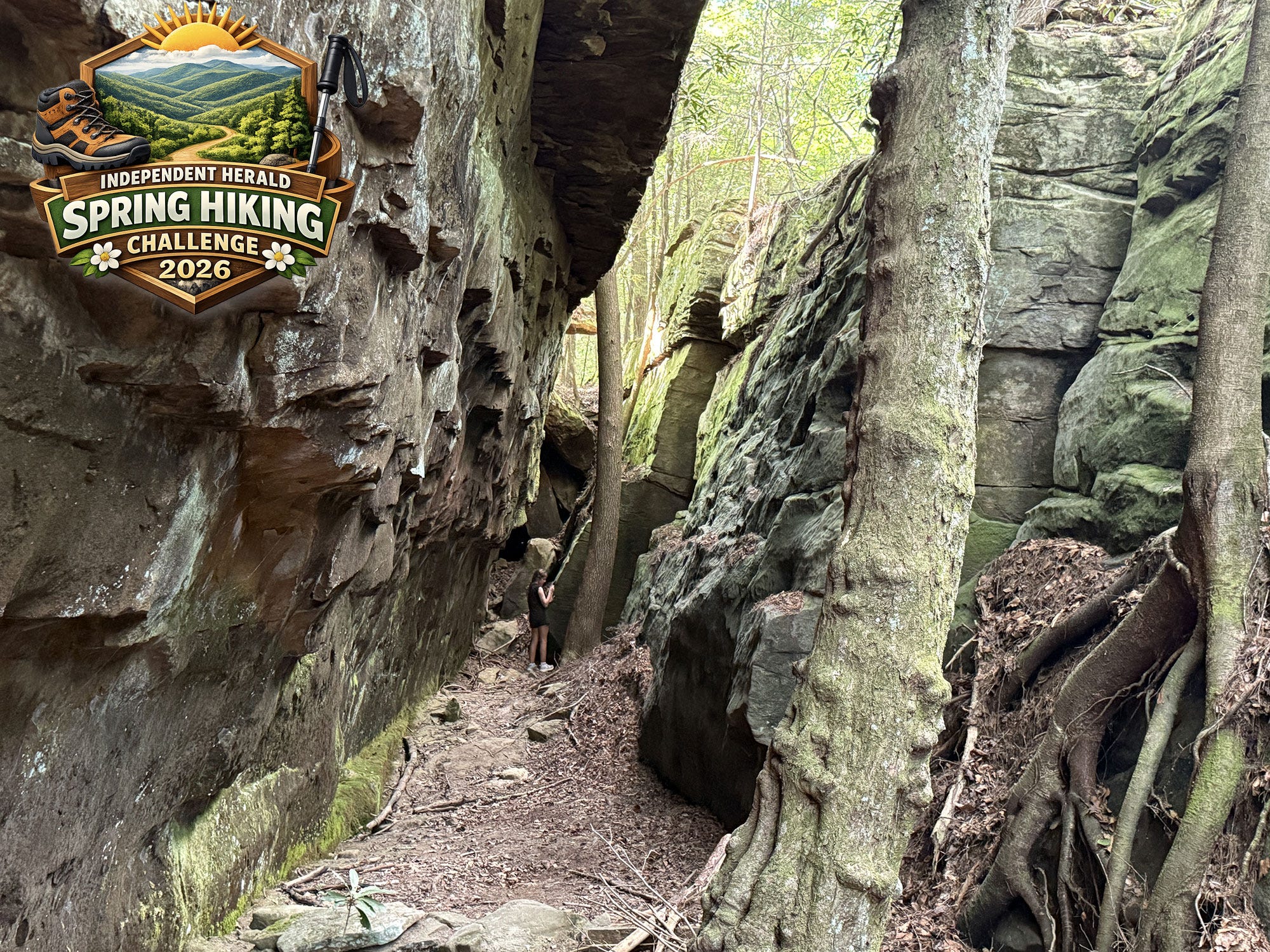
The Spring Hiking Challenge visits another of the northern Cumberland Plateau region’s lesser-known spectacular features this week, with a hike to Kellogg’s Crack in the Rugby State Natural Area, just outside the historic village of Rugby.
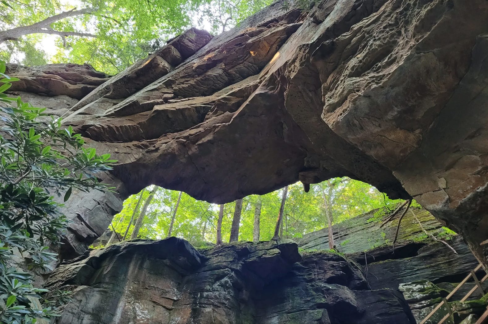
Located on White Oak Creek, which is one of the most scenic tributaries of the Big South Fork River system, Kellogg’s Crack is a stunning natural passageway between two rock walls that features a hidden exit through a cave that leads out of the crack and to the west bank of the creek.
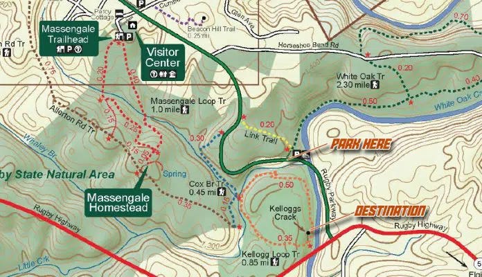
This hike utilizes parts of three different trails that make up the Rugby trail system: Link Trail, Cox Branch Loop, and Kellogg’s Loop. Together, they make up a short, two-mile hike that is a combination of out-and-back and a loop.
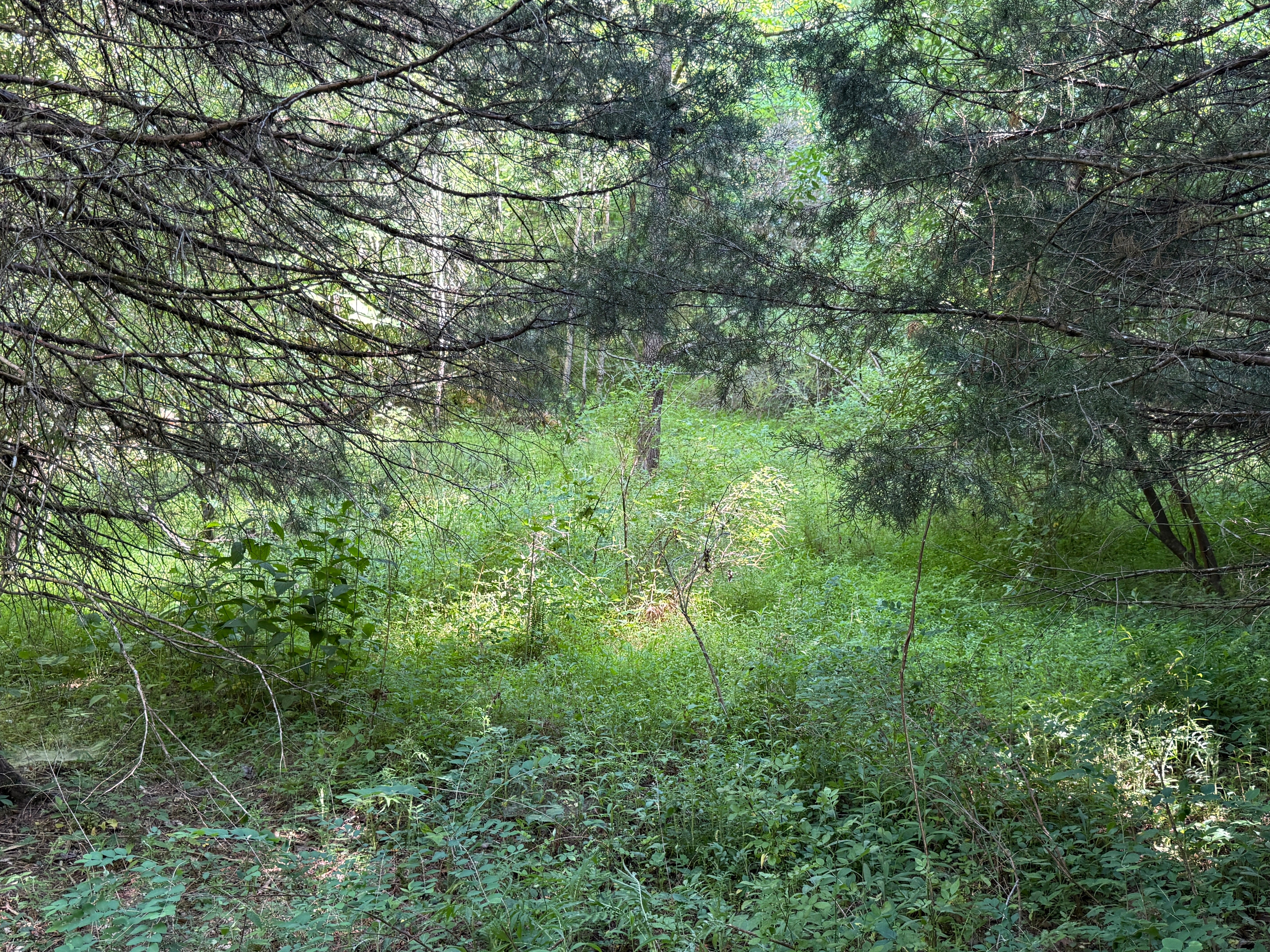
This week’s hike does come with a major caveat: the trails at Rugby are utilized very little and, unfortunately, the trails leading to Kellogg’s Crack are in dire need of maintenance. They’re a little overgrown in places. Additionally, a bridge over Little Creek was washed away by flood waters several years ago and has not been replaced. The stream bed was dry when we scouted the hike earlier this week, and it’s easy to cross without a bridge. However, thunderstorms are in the forecast this week and weekend. Depending on how much rain we receive, crossing Little Creek might require getting your feet wet.
With that in mind, we’re offering an alternative. We encourage you to hike to Kellogg’s Crack. This hike is one part hiking, one part spelunking, and 100% adventure. However, the goal is for each hike to be kid-friendly. While we believe this one still is, if you would rather seek out the alternative, we invite you to complete this week of the challenge by instead hiking to Split Bow Arch. More on the alternative below.
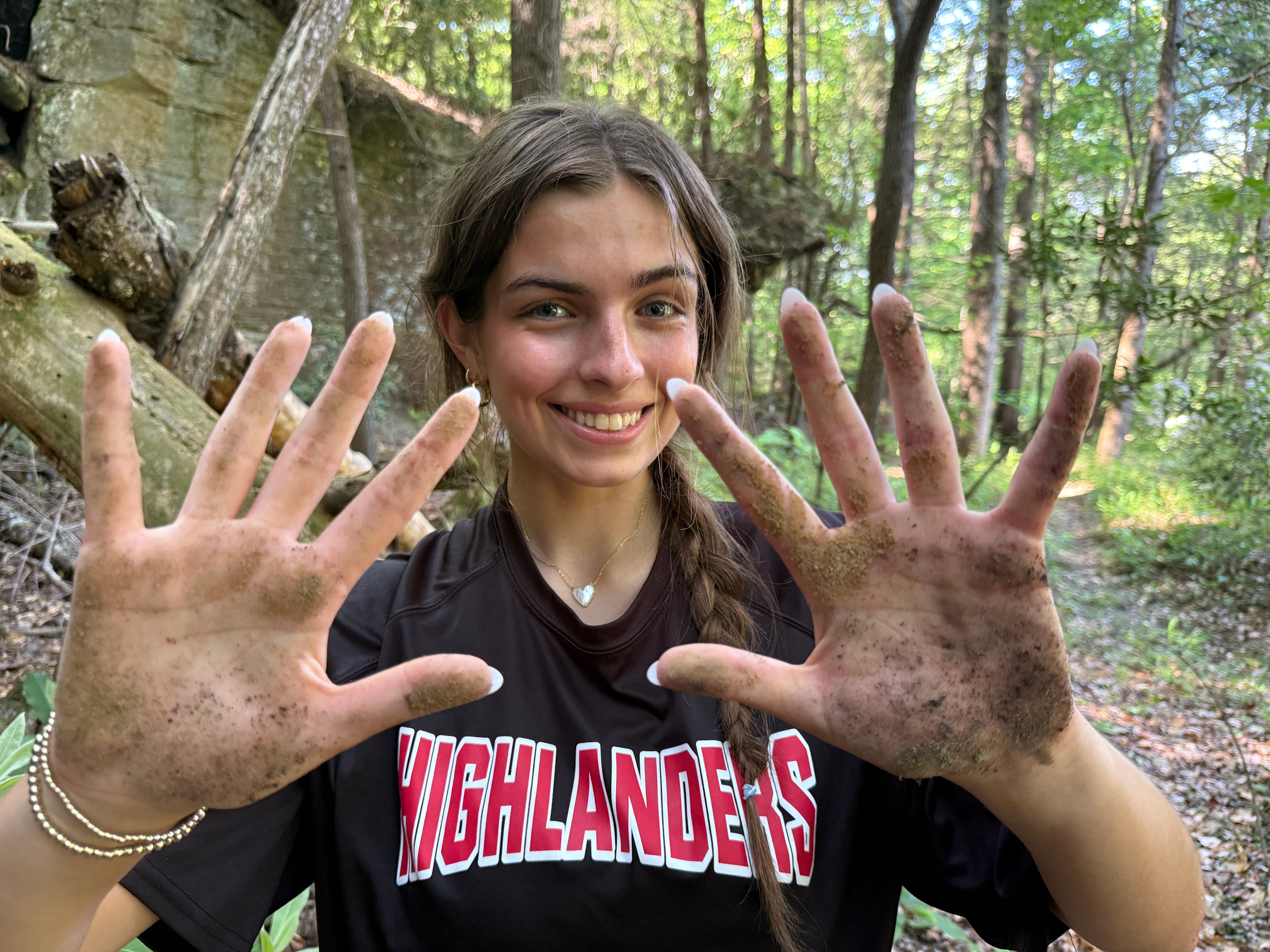
If you do hike Kellogg’s Crack, a few things to keep in mind: 1.) Insect repellent is absolutely recommended to ward off ticks. 2.) Wear shoes you don’t mind getting wet in case Little Creek is running high. 3.) Wear clothes you don’t mind getting a little dirty if you choose to exit Kellogg’s Crack through the cave. Doing so isn’t absolutely necessary, but it is by far the coolest part of the hike.
Let’s get started!
Kellogg’s Crack
Trailhead: White Oak Creek, Rugby
Trail Type: Out-and-back, loop
Payoff: Rock formations
Difficulty: Easy
Length: 2.0 miles
Elevation Gain: 237 feet
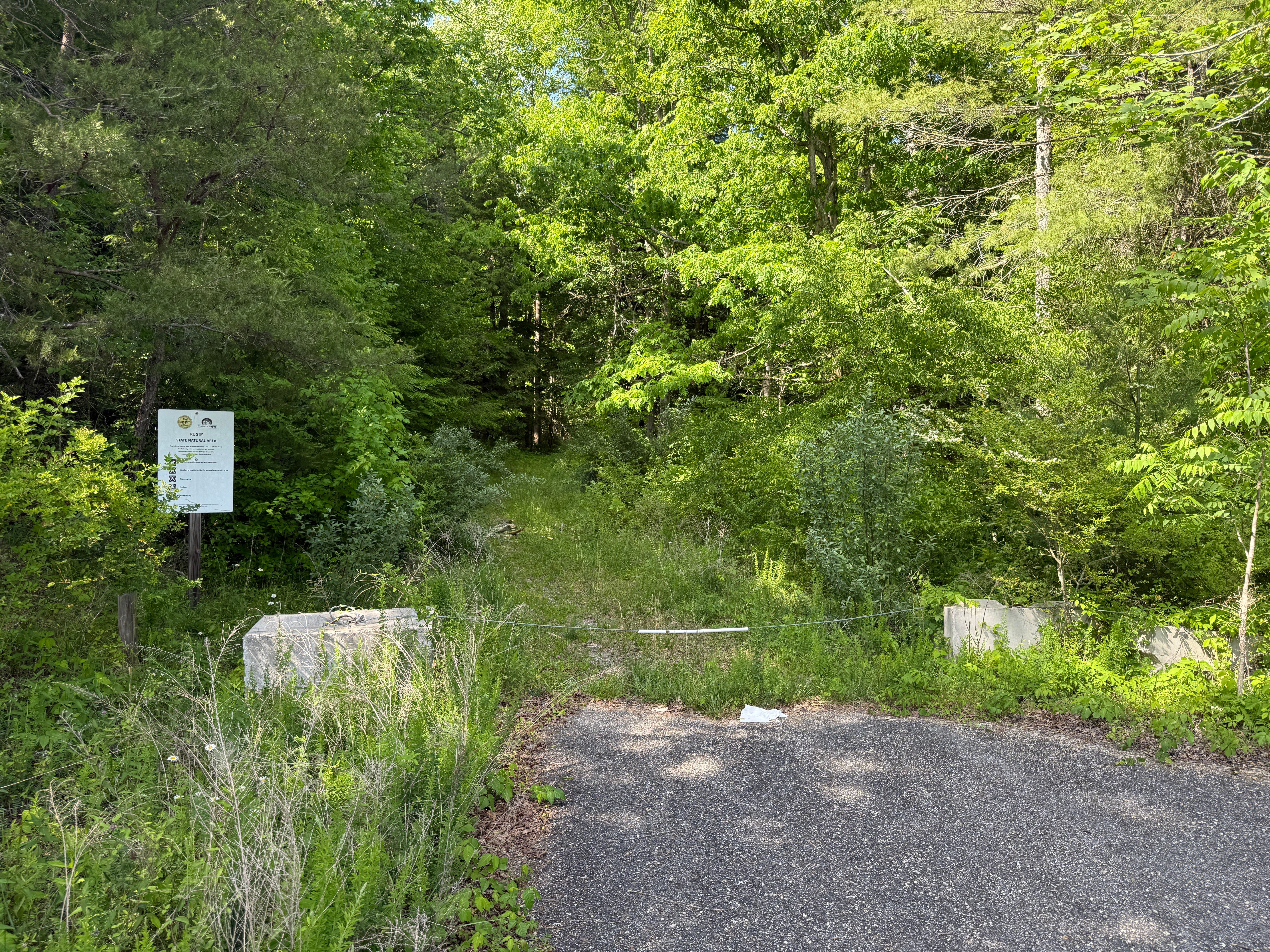
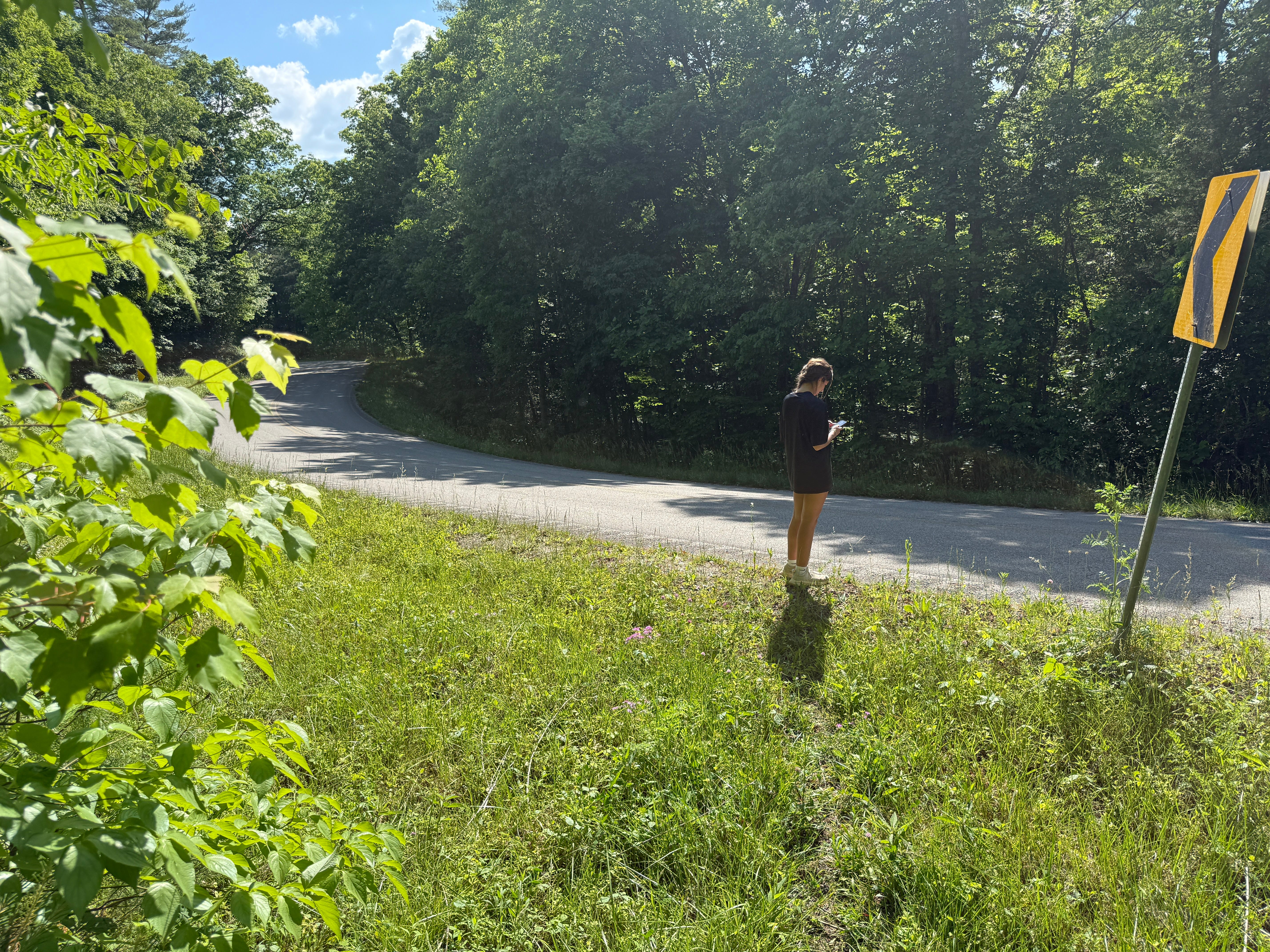
We’re starting our hike at the White Oak Creek parking area on Rugby Parkway. To get there, take U.S. Highway 27 south to Elgin, and turn onto S.R. 52. Continue west for 5.6 miles, then turn right onto Rugby Parkway (old Highway 52). In three-tenths of a mile, just after you’ve crossed the bridge over White Oak Creek, there’s a small parking area on the right. This is the starting point for the White Oak Trail, which is a 2.3-mile trail that loops through the Horseshoe Bend area northeast of Rugby. Note that this first leg of the hike, along the Link Trail, is the part that is especially overgrown. If you want to avoid it, you can hike up Rugby Parkway to Cox Branch Trail, which will be on the left side of the road.
Mile 0.00: Head north along White Oak Trail, past the old Highway 52 bridge, which dates back to the 1920s.
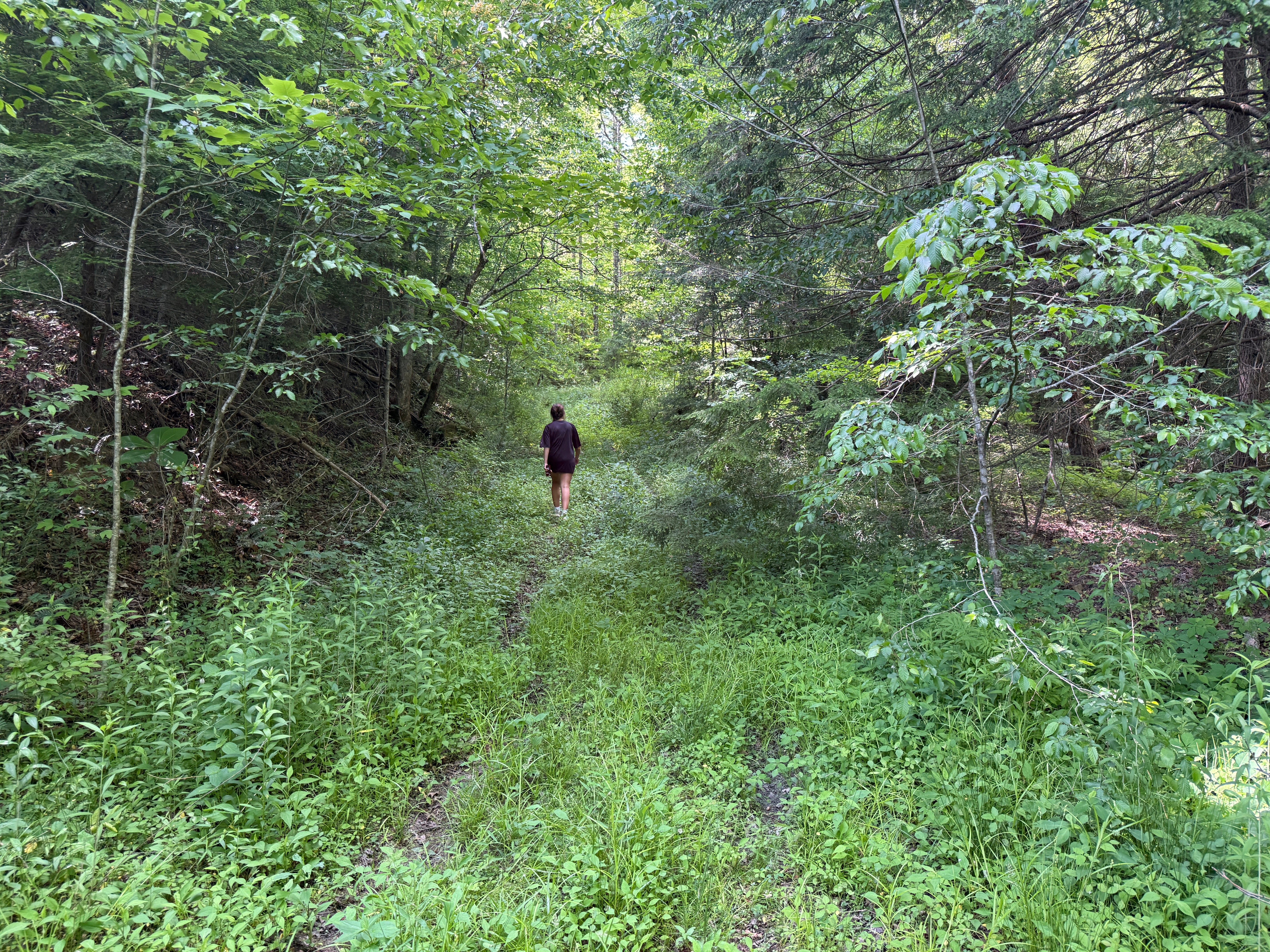
Mile 0.04: Turn left onto the Link Trail. This trail is not signed, but you’ll turn left and follow an old road trace up the hill. This trail follows the original road into Rugby. It was just a wagon road, of course, and was called “The Rugby Road.” It connected Rugby to Elgin (although Elgin was then called Sedgemoor), where folks disembarked from trains and headed west to Rugby during the colony’s earliest days of settlement. Because the trail isn’t frequently maintained, it is overgrown with weeds, making insect repellent a strong recommendation to avoid ticks!
Mile 0.10: There’s an old houseplace on the left that is slowly being reclaimed by nature. There’s nothing left of the home that once stood here, but you can pick out where the edges of the clearing used to be.
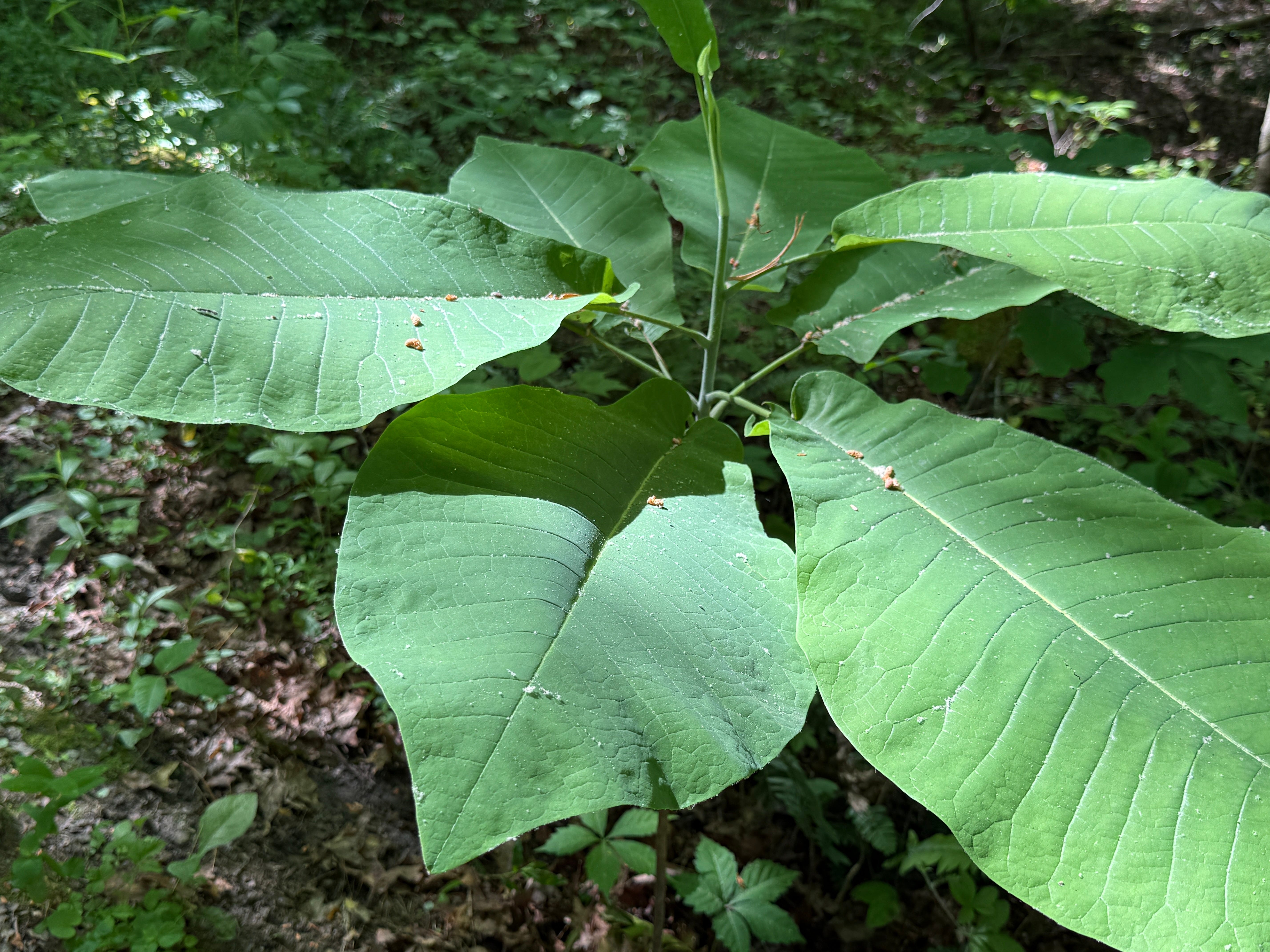
Mile 0.12: Several young bigleaf magnolia trees grow along the trail. As pointed out on recent hikes to Buzzard Rock and Angel Falls Overlook, the bigleaf magnolia has the largest leaf and the largest single flower of any tree indigenous to North America. The tree is native to parts of the Southeast, including the Cumberland Plateau region and parts of Mississippi and Alabama.
Mile 0.23: The trail arrives at Rugby Parkway. Turn left on the roadway and walk a short distance to the Cox Branch Trail.
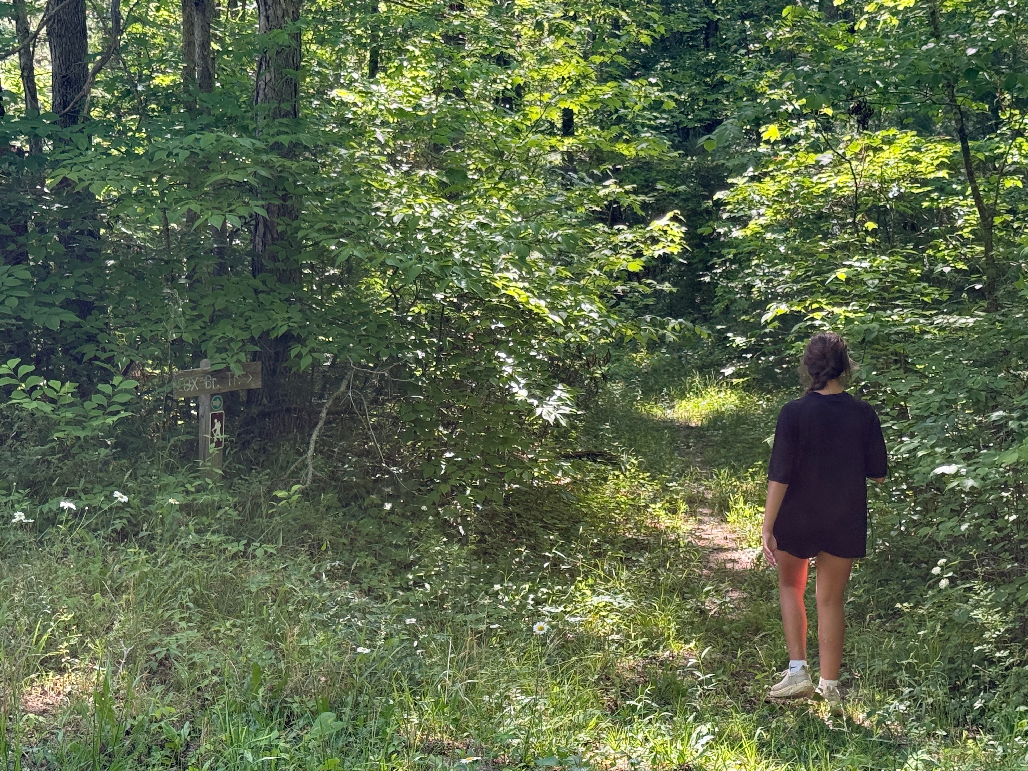
Mile 0.31: Cox Branch Trail leaves the roadway on the right. It follows another old road trace towards Little Creek.
Mile 0.43: The trail dips to Cox Branch, which will soon empty into Little Creek, which in turn empties into White Oak Creek near where we parked and began our hike.
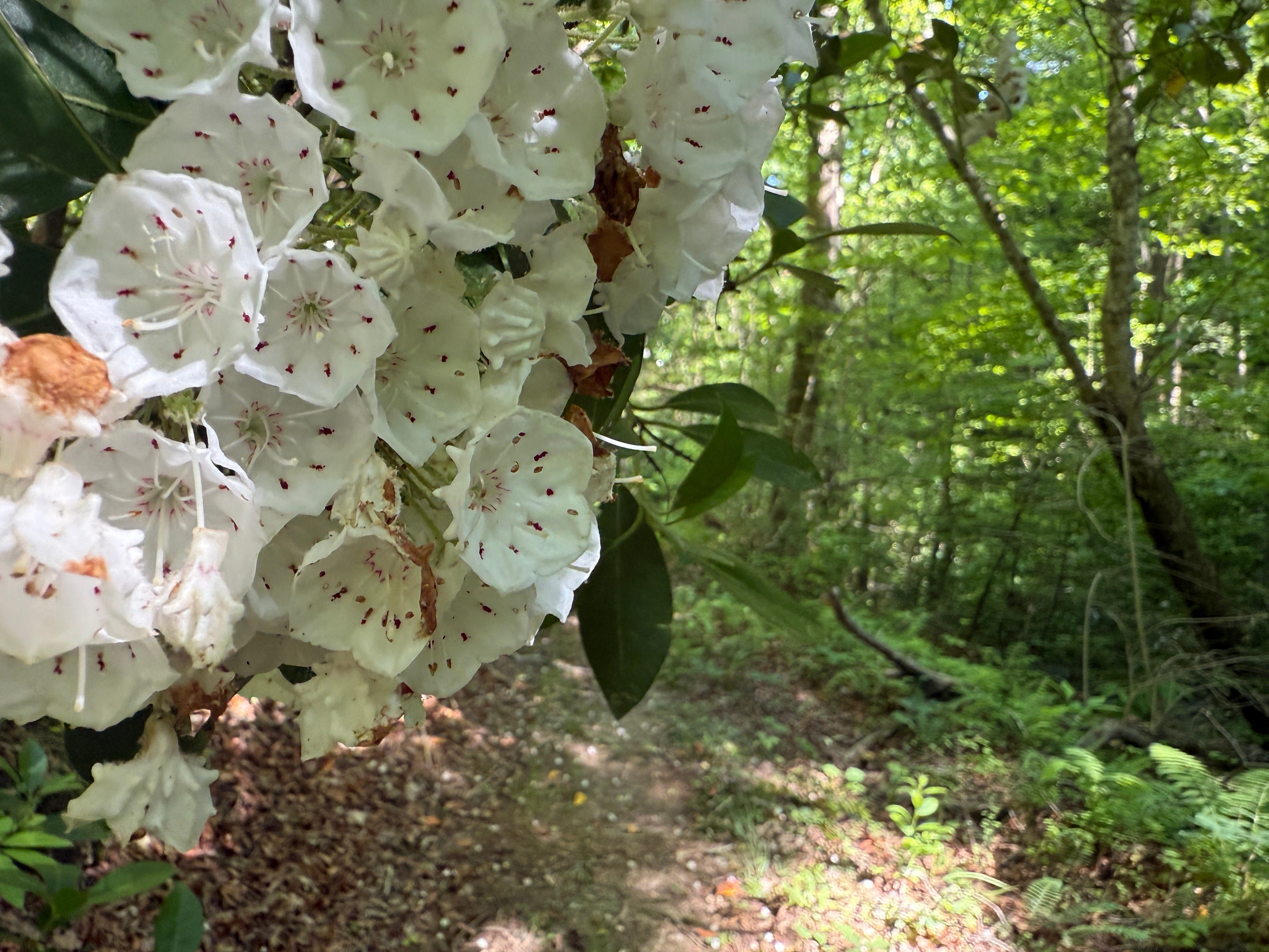
Mile 0.49: Thick stands of mountain laurel — still blooming — blanket both sides of the stream, creating a tunnel that the stream flows through.
Mile 0.58: The trail emerges on an old road trace and turns right.
Mile 0.61: At the trail intersection, turn left onto Kellogg’s Loop. If you cross the new wooden foot bridge, you’ve gone too far.
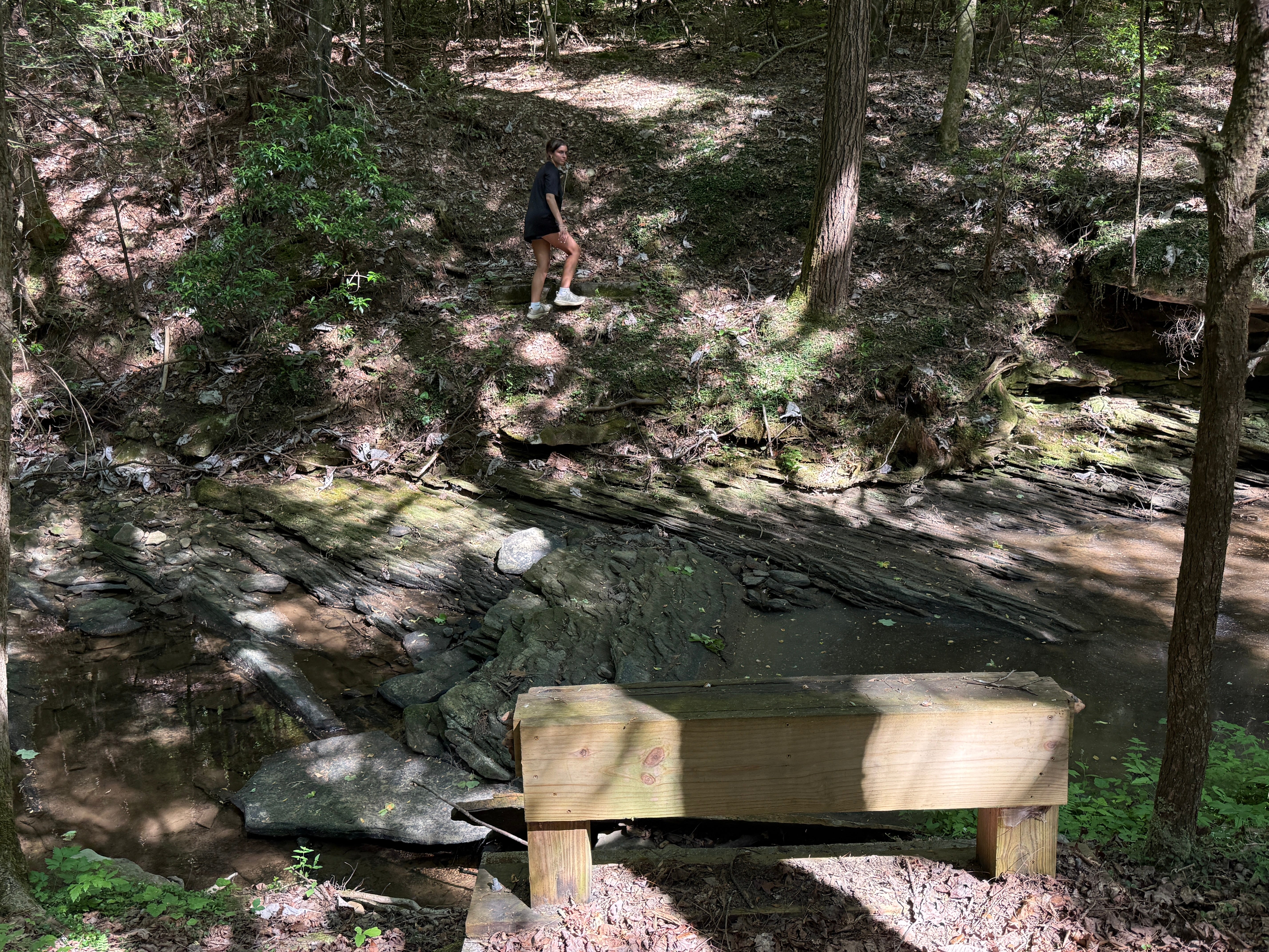
Mile 0.63: Kellogg’s Loop crosses the creek. The bridge that was once here is gone, washed away four years ago by heavy flood waters. Only the wooden foundation remains. The creek bed is solid rock, allowing you to easily walk across as long as the water isn’t too high (it almost never is this time of year, and with any luck, it’ll be low enough that you won’t get your feet wet). Scramble up the bank on the other side to reach the loop part of the trail.
We are going to go right, and hike the loop portion of the trail in a counter-clockwise direction. This section of trail is not often utilized by hikers and is faint. However, it is blazed with orange flagging tape, so you won’t lose your way.
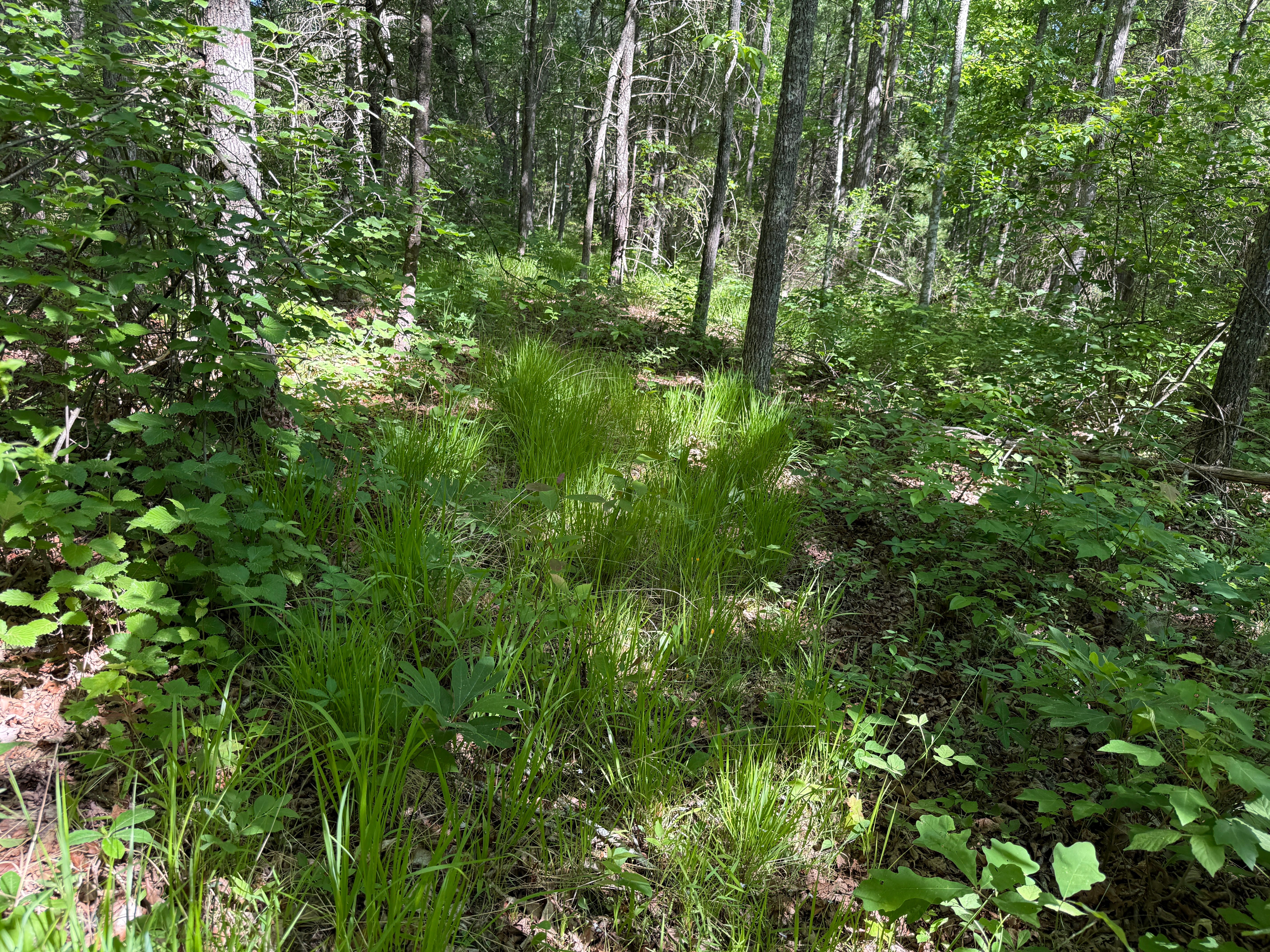
Mile 0.80: The trail passes through a lush stand of native warm-season grasses. This entire hike is an excellent example of changing forest types in and around the Rugby State Natural Area. Although you’re never far enough away from the highway to escape the traffic noise, you are never close enough to a home to feel like you’re actually in Rugby. The trail travels through forests that much look much like they did when English settlers first arrived here in the early 1880s.
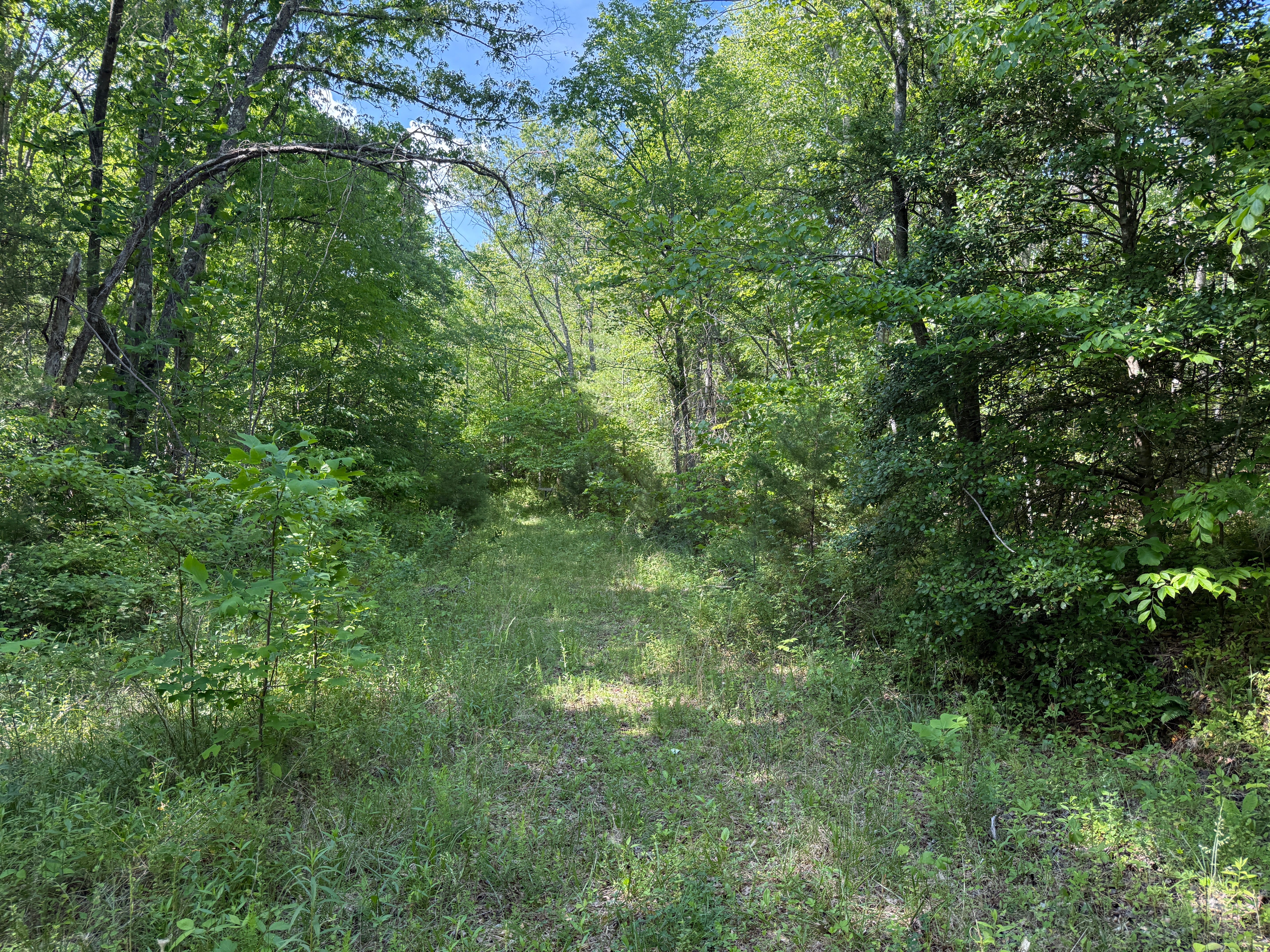
Mile 0.88: The trail crosses an old road trace. On the opposite side of the old road, it is much more worn and easy to follow.
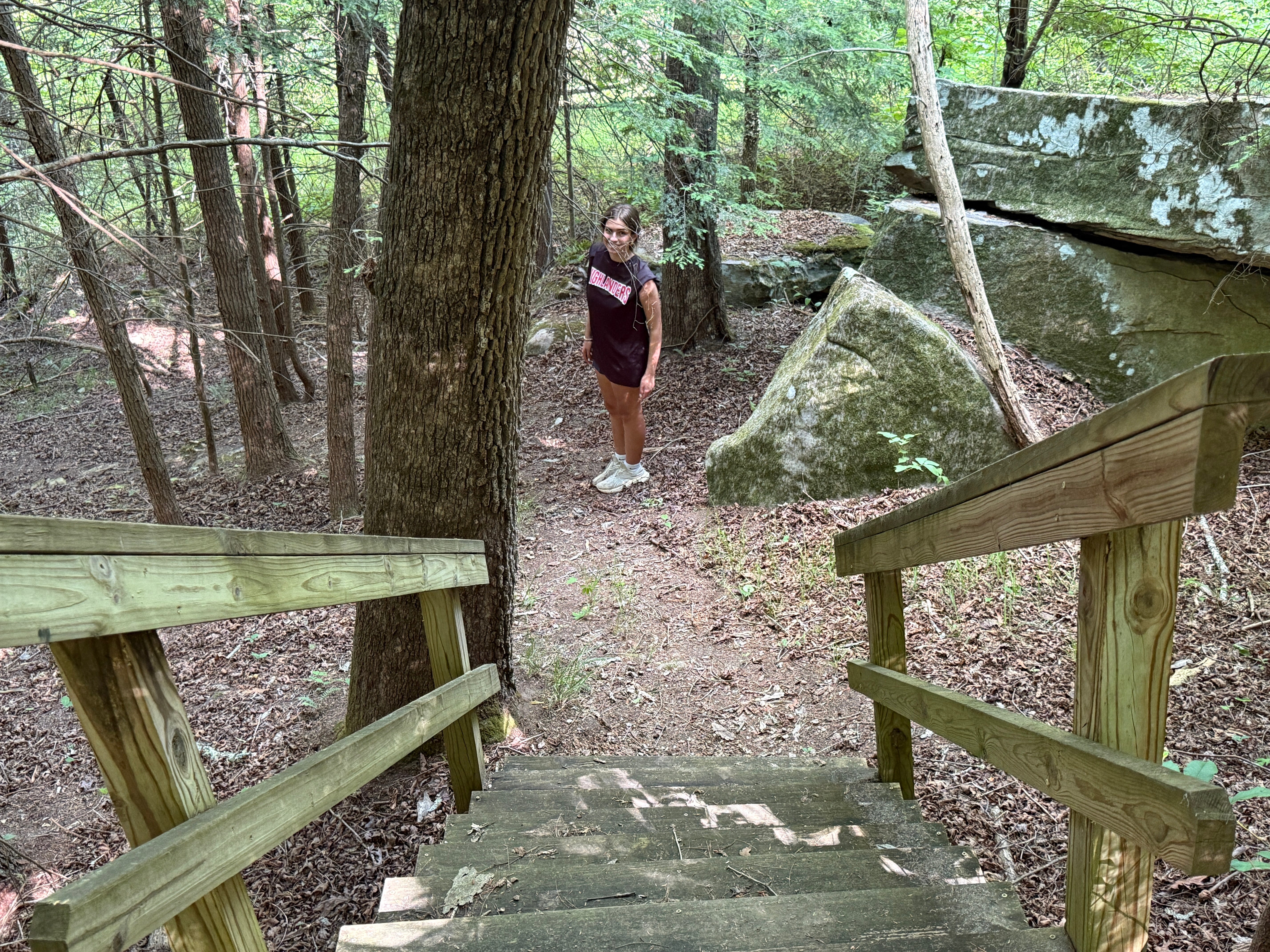
Mile 1.07: The trail reaches a set of wooden steps just above White Oak Creek. We’re nearing Kellogg’s Crack.
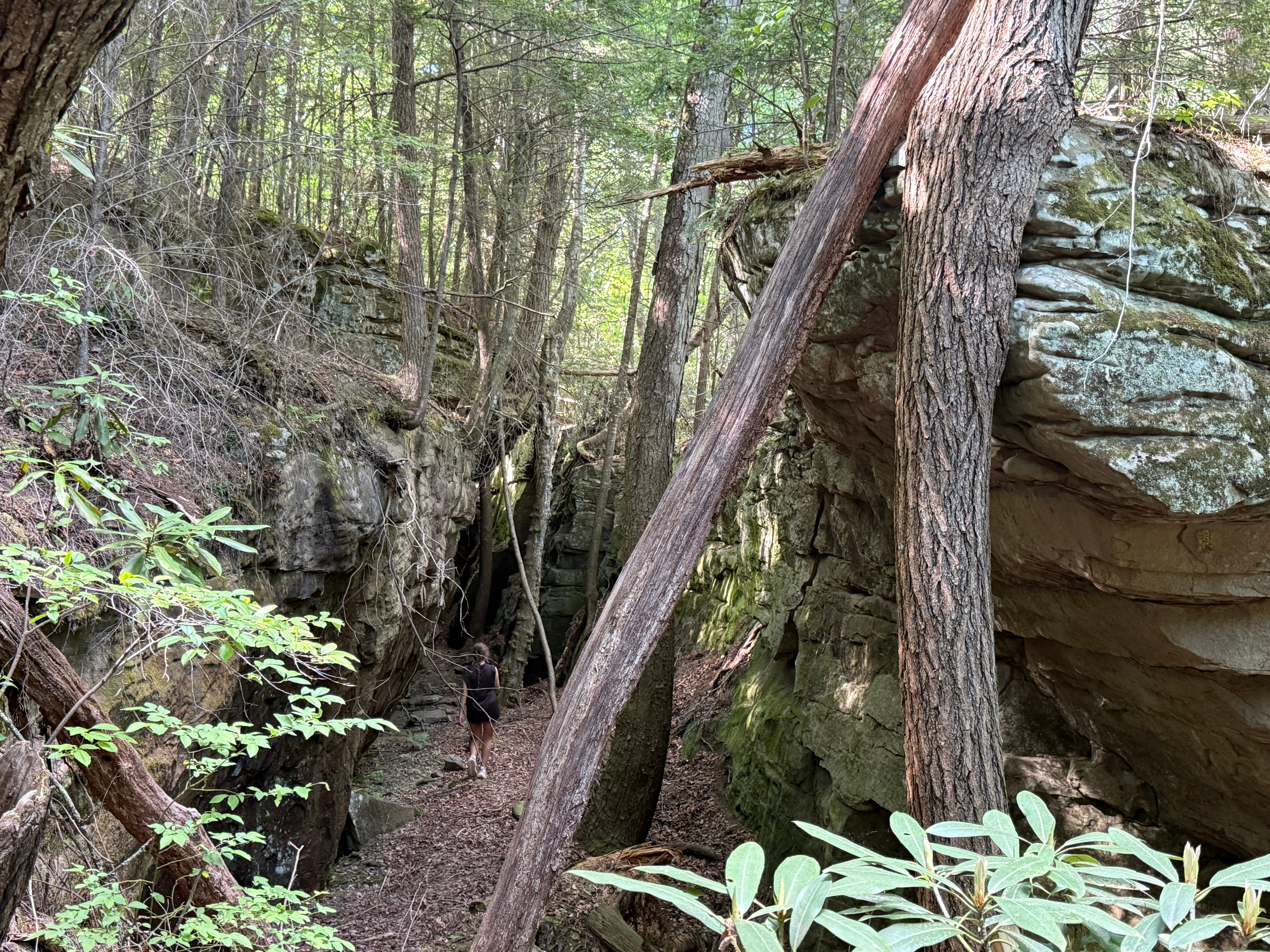
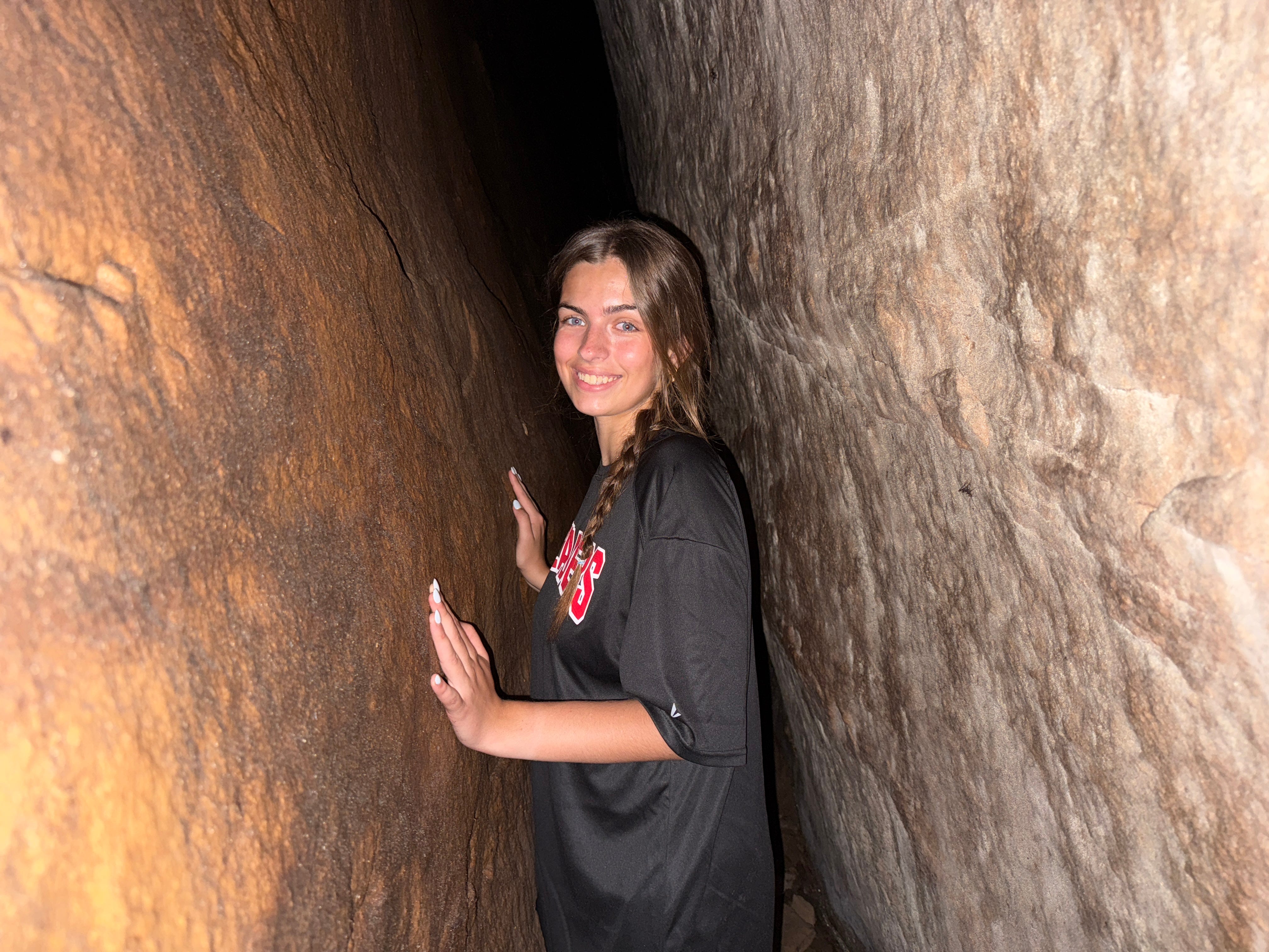
Mile 1.08: The gap in the rocks to the left is Kellogg’s Crack. It is not signed, and the hiking trail actually bypasses it. It’s possible to stay on the trail and walk around the crack, but you’re missing the best part of the hike if you do. Go left to walk down the crack.
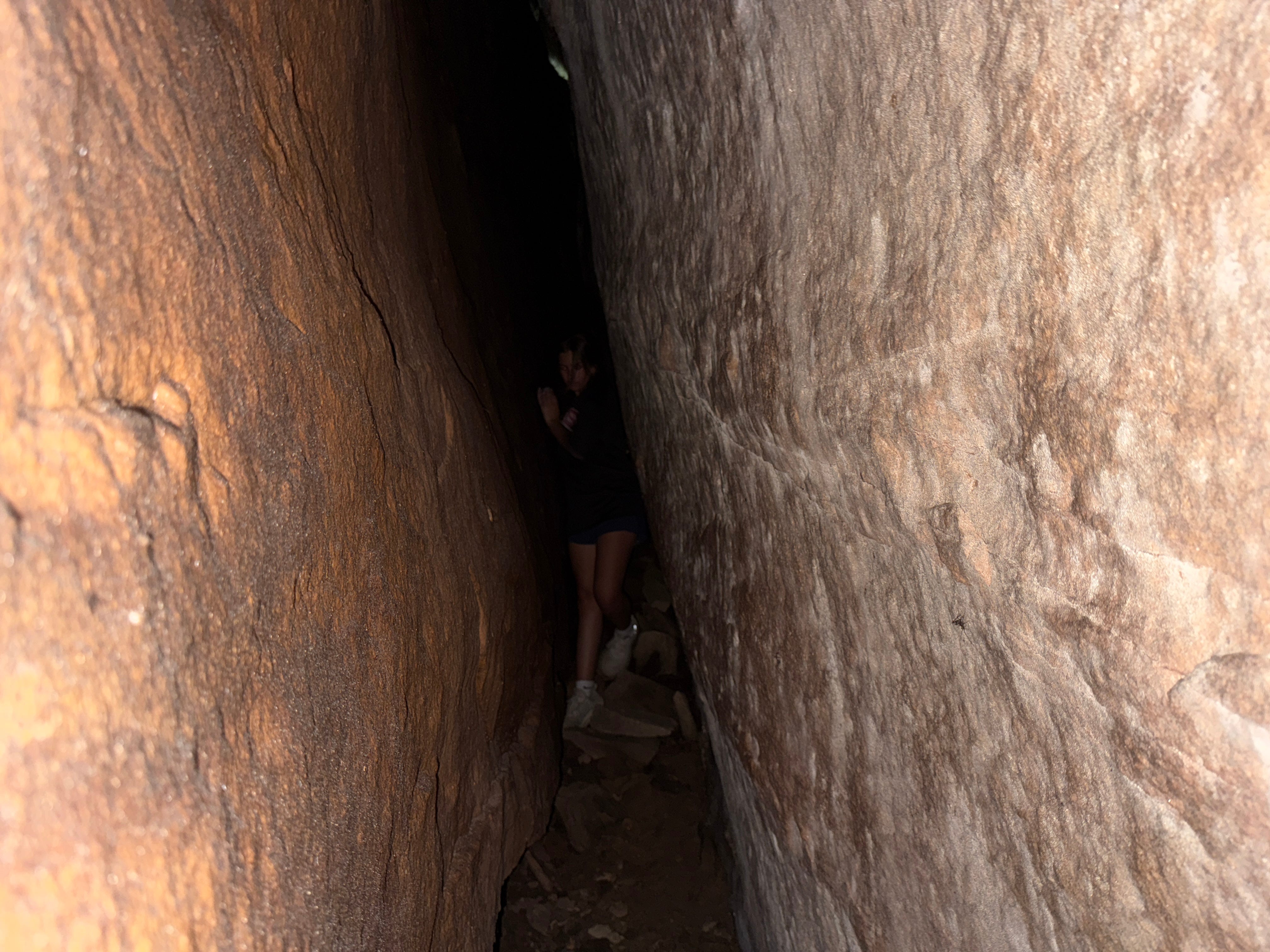
Mile 1.12: At the back of the crack, you’ll find a narrow passageway (cave) on your right. It might look like it’s too tight to squeeze through, but it isn’t. A couple of notes about this adventurous way out of Kellogg’s Crack: You will brush the sides of the rocks, which are always slightly damp, even during dry weather. At the cave’s exit, you’ll have to stoop down and basically crawl out, which will result in your hands and knees getting a little dirty. A flashlight isn’t completely necessary for this adventure, but if you happen to have one handy, it sure helps.
If you’re claustrophobic or simply afraid of getting a little dirt on your hands and knees, you can turn around and retrace your steps to the entrance of Kellogg’s Crack, and follow the path around it. However, you’ll be missing out on the best part of the adventure!
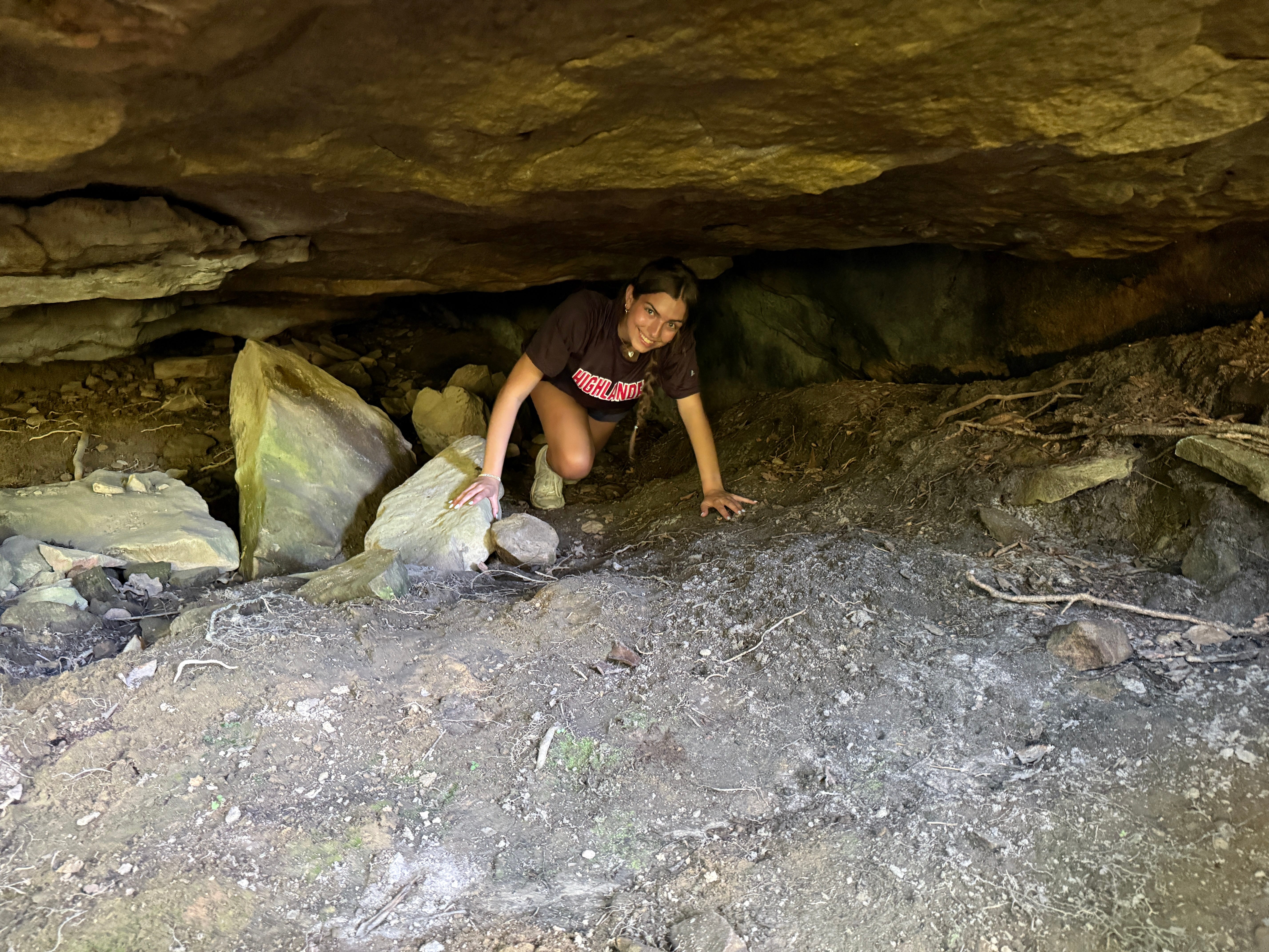
Mile 1.19: The trail emerges from the small cave. When you stand up, you’ll be looking directly at White Oak Creek. From here, we turn left and continue following Kellogg’s Loop in a counter-clockwise direction through a hemlock forest. Note the hundreds of young bigleaf magnolia trees growing along the left side of the trail along this section of the route.
Once the trail reaches Little Creek, it turns along the creek and follows it back to where the bridge is out. At this point, cross the creek and retrace your steps back to the trailhead. If you chose to walk the Link Trail coming in, you might choose to walk along Rugby Parkway on your way out so that you don’t have to pass through the overgrown segment of the trail again!
Scavenger Hunt: This week, we’re simply looking for a picture from inside the small cave that serves as an exit from Kellogg’s Crack. Post it on social media and tag it with the #SpringHikingChallenge hashtag to be entered into this week’s random prize drawing!
Historical Context: Kellogg’s Crack (and Kellogg’s Loop) are named for Nelson Kellogg (1850-1925). Originally from Pennsylvania, he migrated here and owned Rugby’s Newbury House, which remains in operation today. Nelson and his wife, Ida May Clark (1856-1945), are buried at Laurel Dale Cemetery just outside Rugby. The Newbury House was Rugby’s first boarding house. Today, it is one of several lodging options in Rugby, featuring five bedrooms and a suite that can accommodate up to 14 guests. It is complete with authentic Victorian-era furnishings.
Make It Better: No trip to Rugby is complete without exploring the historic village that was established by famed British author Thomas Hughes. There are no events scheduled for this weekend (Irish Road Bowling will be featured next weekend), but you can still tour the town, including the South’s first free public library. There’s also a 22-minute screening of the award-winning historical film, “The Power of a Dream,” that can be seen at the theater inside the Rugby Visitor Center (free admission). You’ll also tour the Kingstone Lisle, which was Hughes’ home, built in 1884; the Christ Church Episcopal, built in 1887; the schoolhouse, built in 1907; and the Rugby Printing Works. Tours of the print shop are offered every Friday, Saturday, and Sunday.
Be Careful For: There are no real hazards on this hike (except the ticks!), but you’ll want to be careful for the scramble back up the bank when crossing Little Creek.
The Alternative: Split Bow Arch is a magnificent natural sandstone arch in the Kentucky portion of the Big South Fork National River & Recreation Area. It is accessible via an easy, 0.6-mile loop featuring less than 200 feet of elevation gain. To add a little additional length to the hike, you can check out Bear Creek Overlook from the same trailhead. To access the trailhead: head north on U.S. Highway 27 from Oneida and across the TN-KY line. At Strunk, Ky., turn left onto Ky. Hwy. 1470 (Mt. Pleasant Road), following the signs towards Bear Creek Horse Camp. After 5.5 miles, take a sharp left onto Bear Creek Road, and follow it to the trailhead in another 1.5 miles.
Please Remember: Hikers are encouraged to obey the “Leave No Trace” ethic. “Leave only footprints, take only memories.” Please do not litter! Also, remember that while all trails in the Big South Fork are dog-friendly, all dogs must be leashed and kept within six feet.
Document Your Hike: Record your participation on this week’s hike by taking a photo of you and your group and tagging it with the #SpringHikingChallenge hashtag on social media (make sure the post privacy is set to public!) or emailing newsroom@ihoneida.com.
Hike #1: Sunset Overlook
Hike #2: Angel Falls Rapid
Hike #3: Yahoo Falls
Hike #4: O&W Bridge
Hike #5: Northrup Falls
Hike #6: Burnt Mill
Hike #7: Buzzard Rock
Hike #8: Cracks in the Rock
Hike #9: Angel Falls Overlook