


John Litton Farm
Trailhead: Litton Farm
Trail Type: Loop
Payoff: Scenic landscapes
Trail length: 1.7 miles
Elevation Gain: 210 feet
Difficulty: Easy/Moderate
Each week of the Spring Hiking Challenge has highlighted the history of that week’s hike. But there are few hiking trails in the Big South Fork National River & Recreation Area with as much history as the Litton Farm Loop. Week 12 of the 14-week hiking challenge takes us to the John Litton Farm — one of only two preserved homesteads in the national park that are remotely located in the backcountry, away from vehicular access (the other is Charit Creek Lodge).
We aren’t hiking the entire, six-mile Litton Farm Loop. Instead, we’re making a short and relatively easy hike along an inner loop of sorts, combining the administrative access road with a portion of the hiking trail. This is a delightful 1.7-mile hike that combines the human history of the BSF with an all-encompassing tour of the park’s natural features.
We’re going to begin our hike near the end of the public access portion of John Litton Road. To get there: Enter Bandy Creek Campground, just like we did when hiking to Angel Falls Overlook a few weeks ago. Just past the registration kiosk, turn left toward Bandy Creek Pool. Continue onto the gravel road at the pool, which is Duncan Hollow Road. When the road splits at the TVA transmission line, turn right onto John Litton Road. In a few hundred yards, the road splits again. Stay straight to enter the field. At the far side of the field, where the road re-enters the forest, there’s a small parking area on the left. Park here. We’ll begin our hike by continuing on foot along John Litton Road.
Mile 0.01: Notice the hiking trail on the right. This is where the Litton Farm Loop Trail joins John Litton Road on its way back to Bandy Creek Campground. We’ll be completing our hike here. For now, though, we’re going to continue on the gravel road to hike this loop in a clockwise direction.
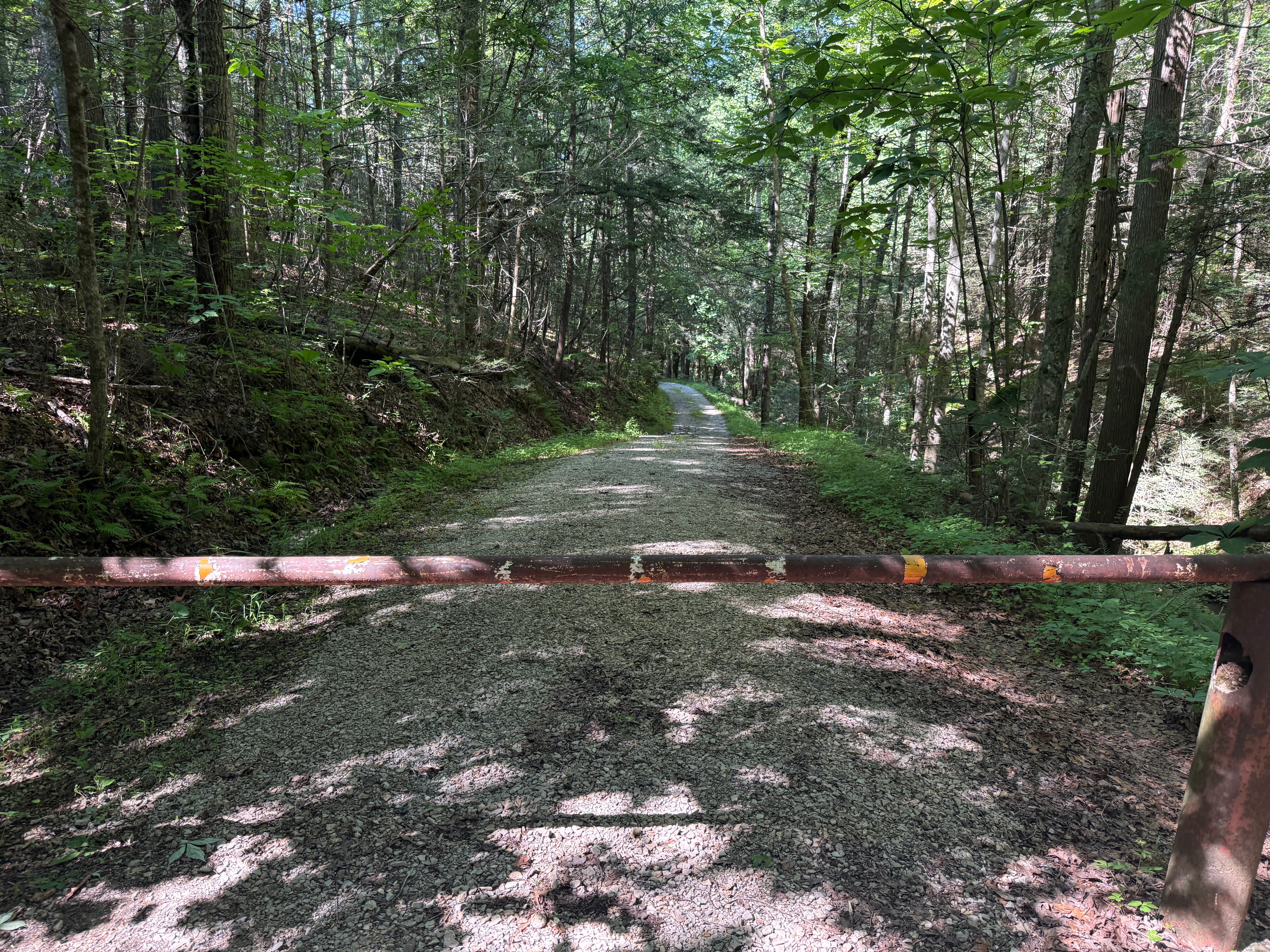
Mile 0.12: A gate blocks vehicular traffic. There’s another small parking area by the gate. The remainder of the road is used for administrative access to the Litton Farm. The small stream that begins to form on the right side of the road is the headwaters of the North Fork of Fall Branch. Fall Branch drains the Bandy Creek area along the east side of Bandy Creek Road.


Mile 0.19: The stream drops over a small waterfall and the character of the forest immediately begins to change as the drainage quickly widens. Rhododendron, hemlock, holly, and magnolia crowd the forest, and a rock bluff wall begins to emerge on the left side of the road.
Mile 0.27: The road reaches the bottom of the hill. The North Fork of Fall Branch crosses under the road via a culvert, and another small stream empties into it from the left.
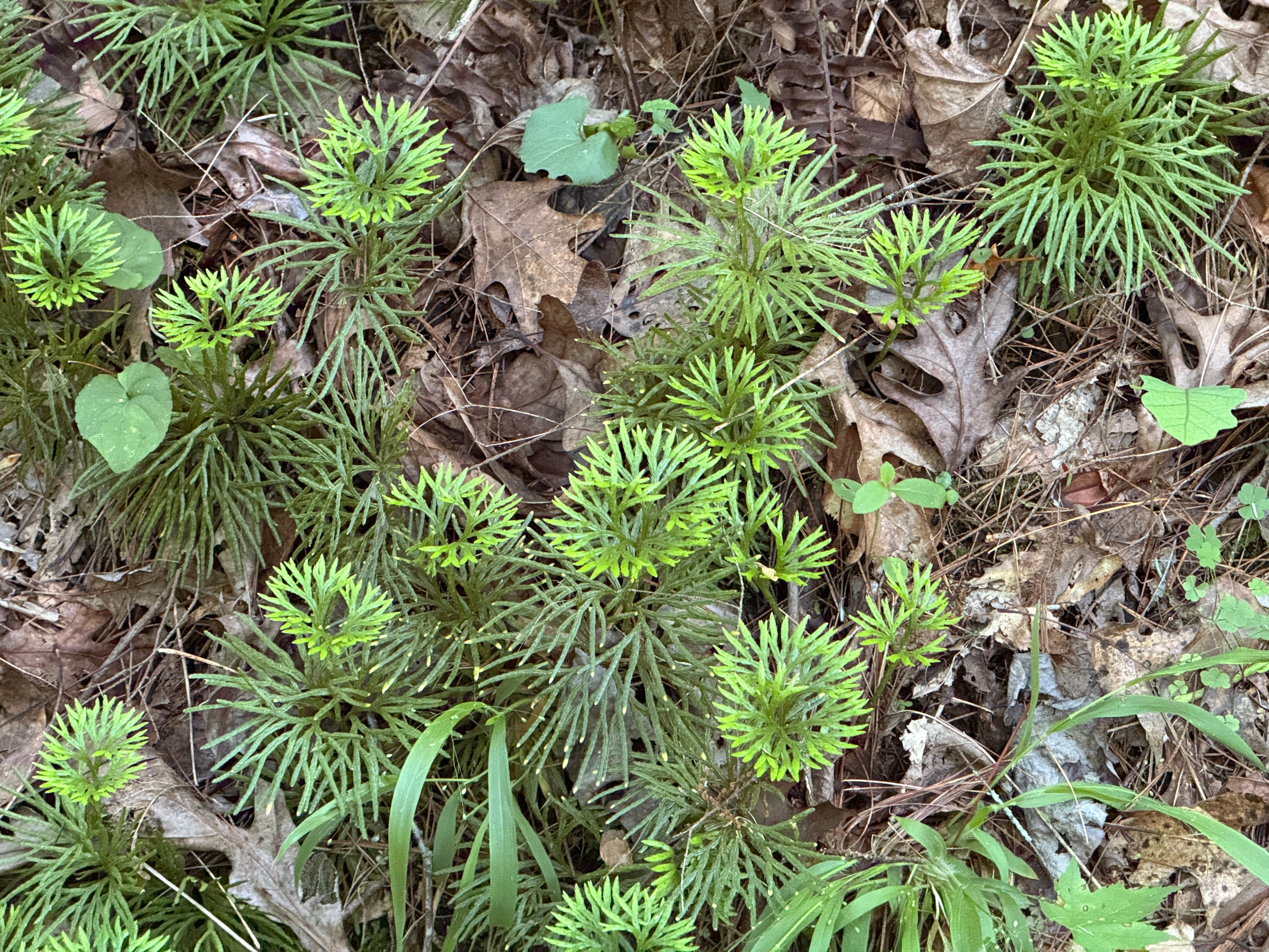
Mile 0.32: Check out the large, dense colony of fan clubmoss on the right side of the road. Also known as “groundcedar” or “crowsfoot,” clubmoss isn’t really moss; rather, it’s a primitive vascular plant that relies on undisturbed, acidic soil conditions to provide a delicate groundcover in shaded understory areas of the forest.
Mile 0.36: The North Fork of Fall Branch passes under the road again. Look closely and you’ll likely see a large school of creek minnows in the small pool of water at the end of the culvert. The first of the old fields at the Litton Farm is visible here.
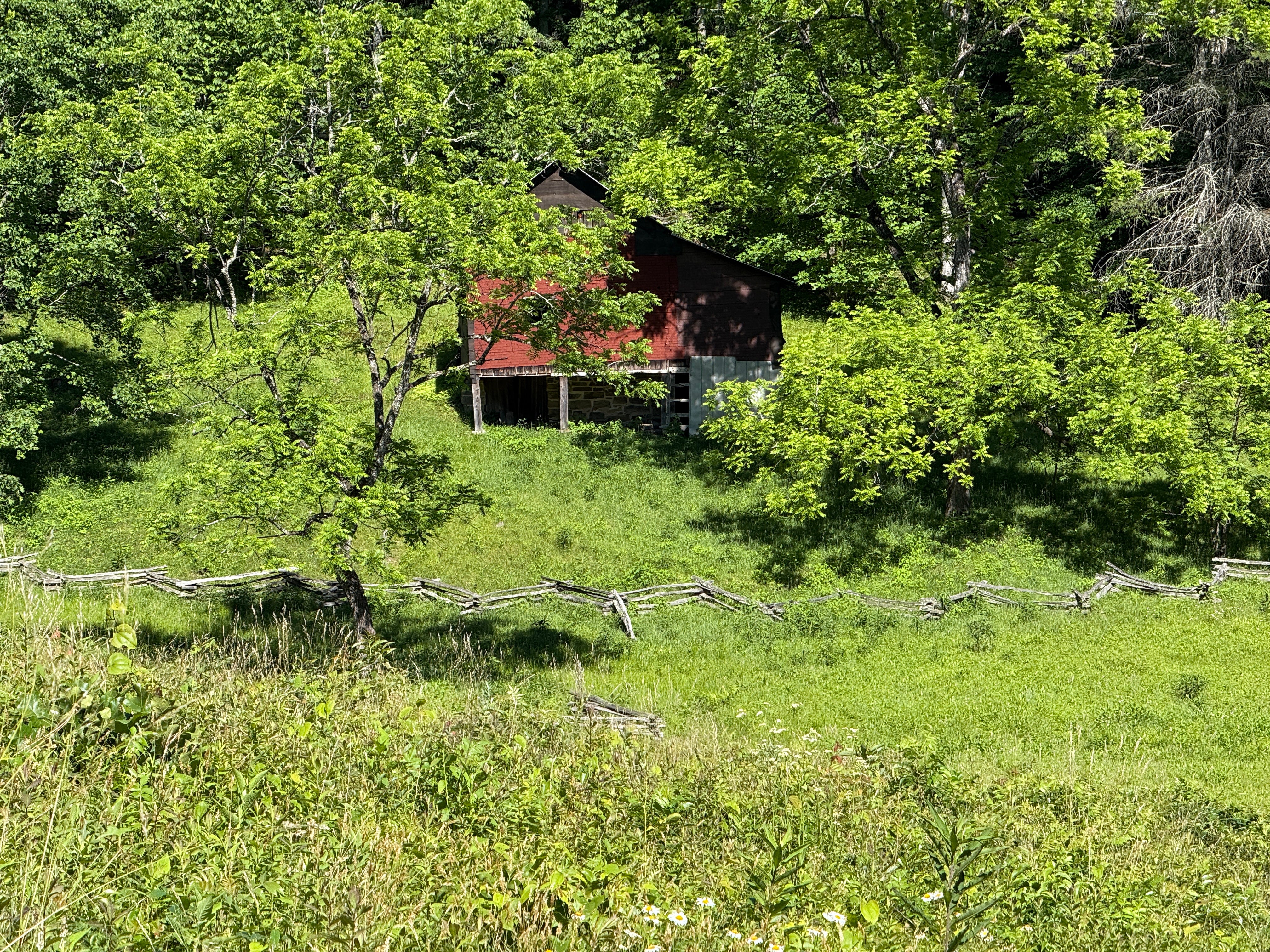
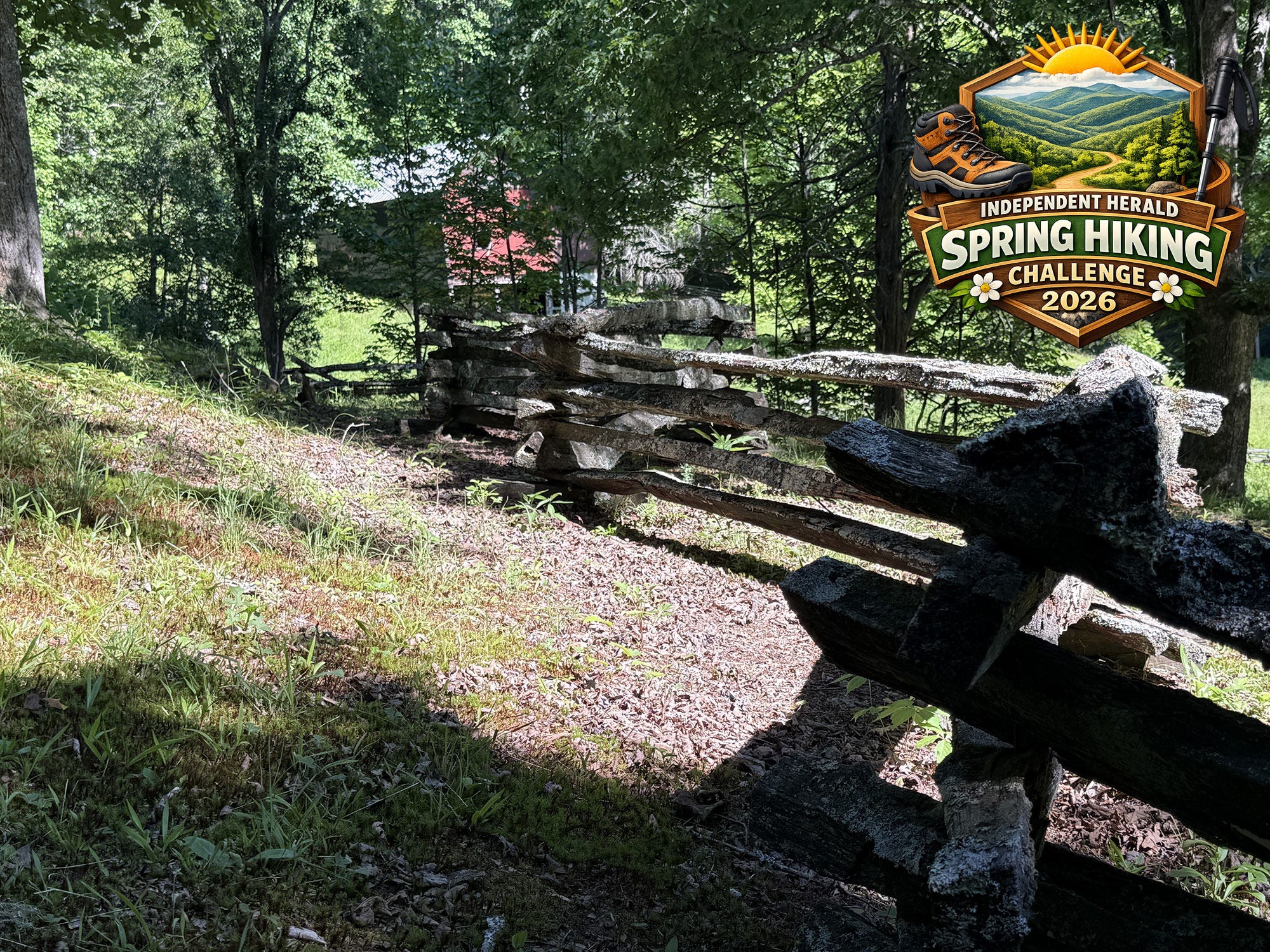
Mile 0.43: The old house that John Litton built comes into view, along with the original split rail fences. Walnut trees stand in front of the home.
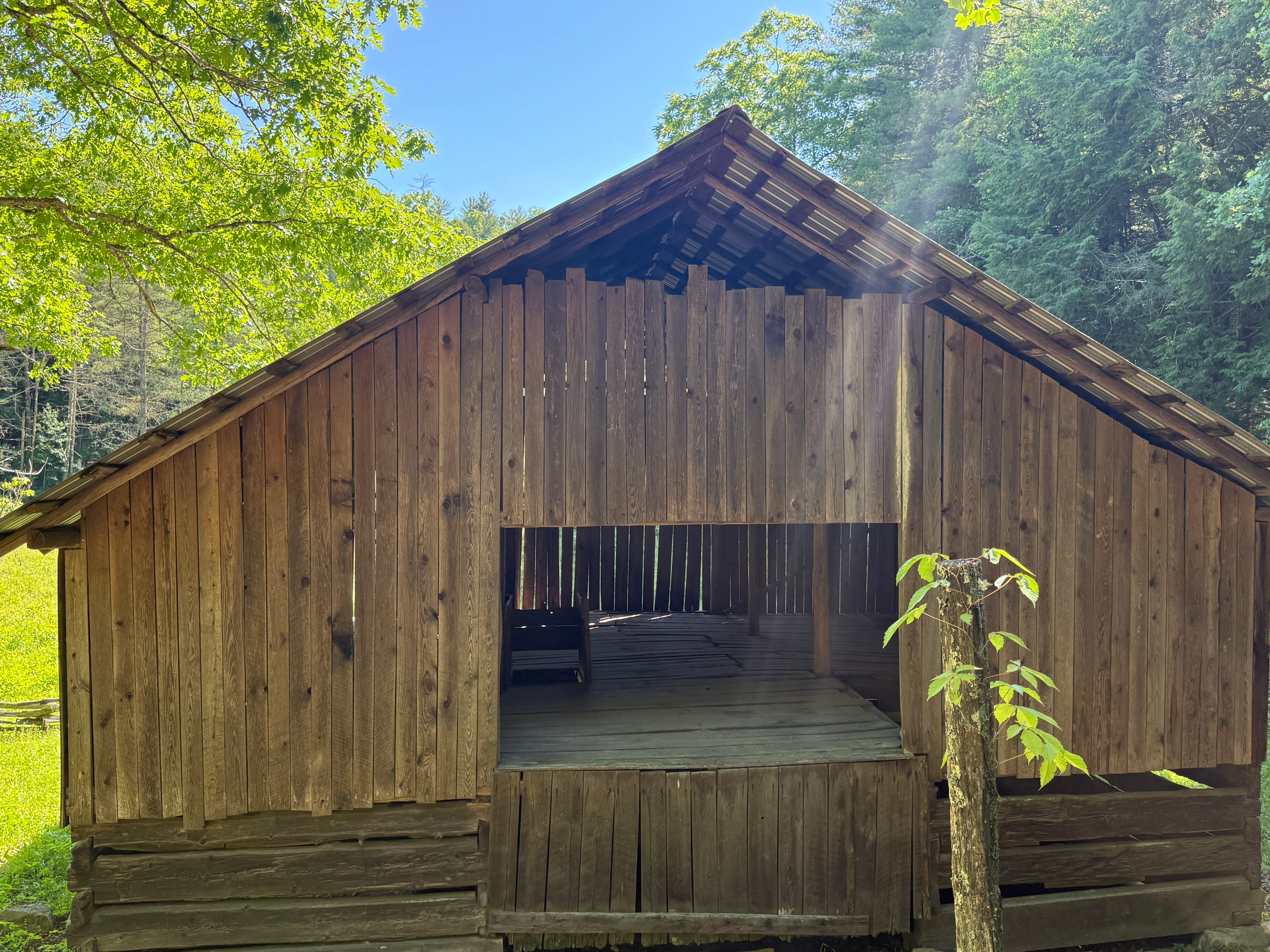
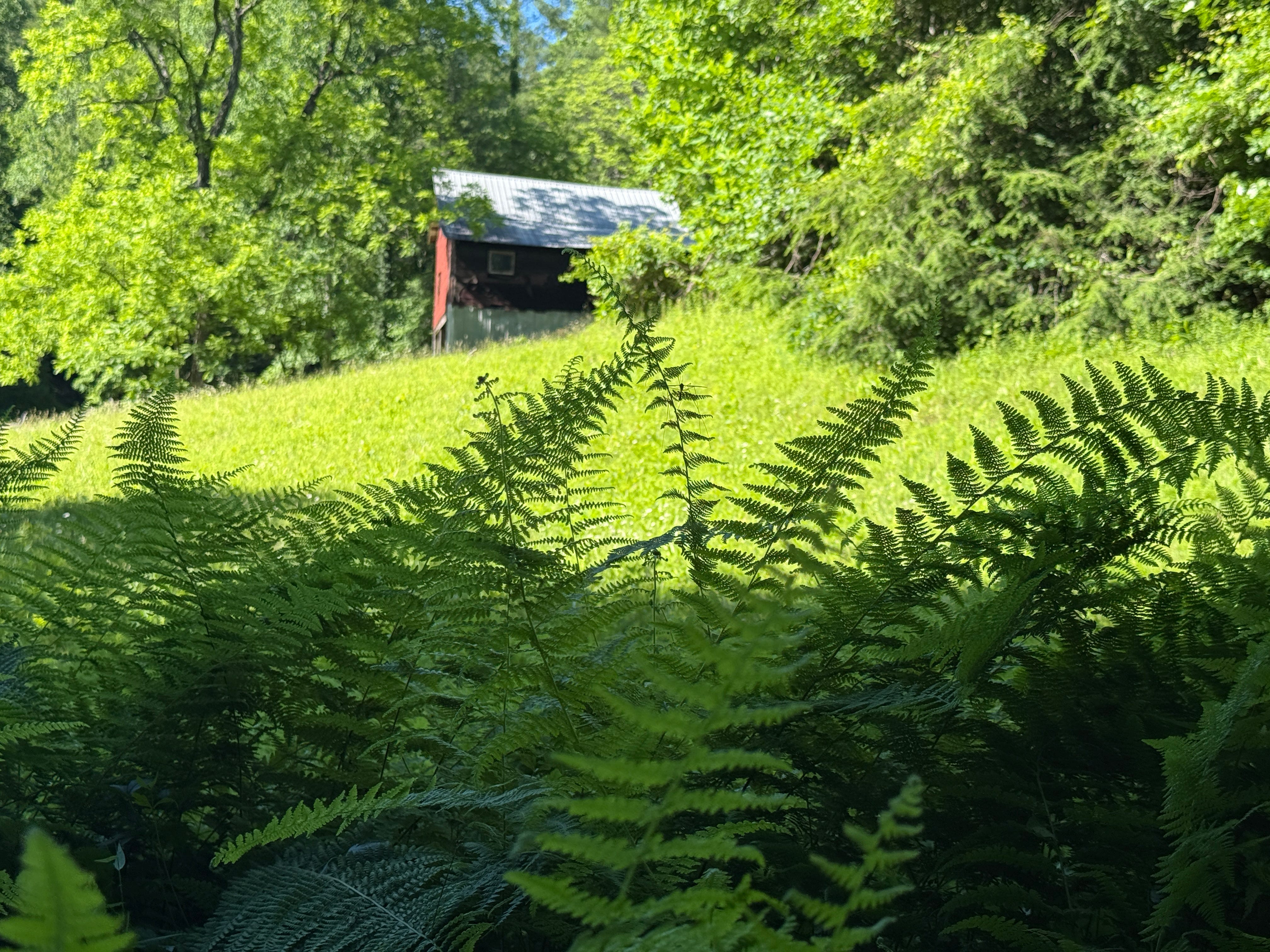
Mile 0.47: The large, English-style barn comes into view. Like the home, the barn was built by John Litton sometime around 1900.


Mile 0.49: The hiking trail turns right. We’ll be coming back to this. Off the trail, just up the hill to the left and out of sight, are the old hog pens where General Slaven — who lived here after the Littons — kept his pigs beneath the bluffs.
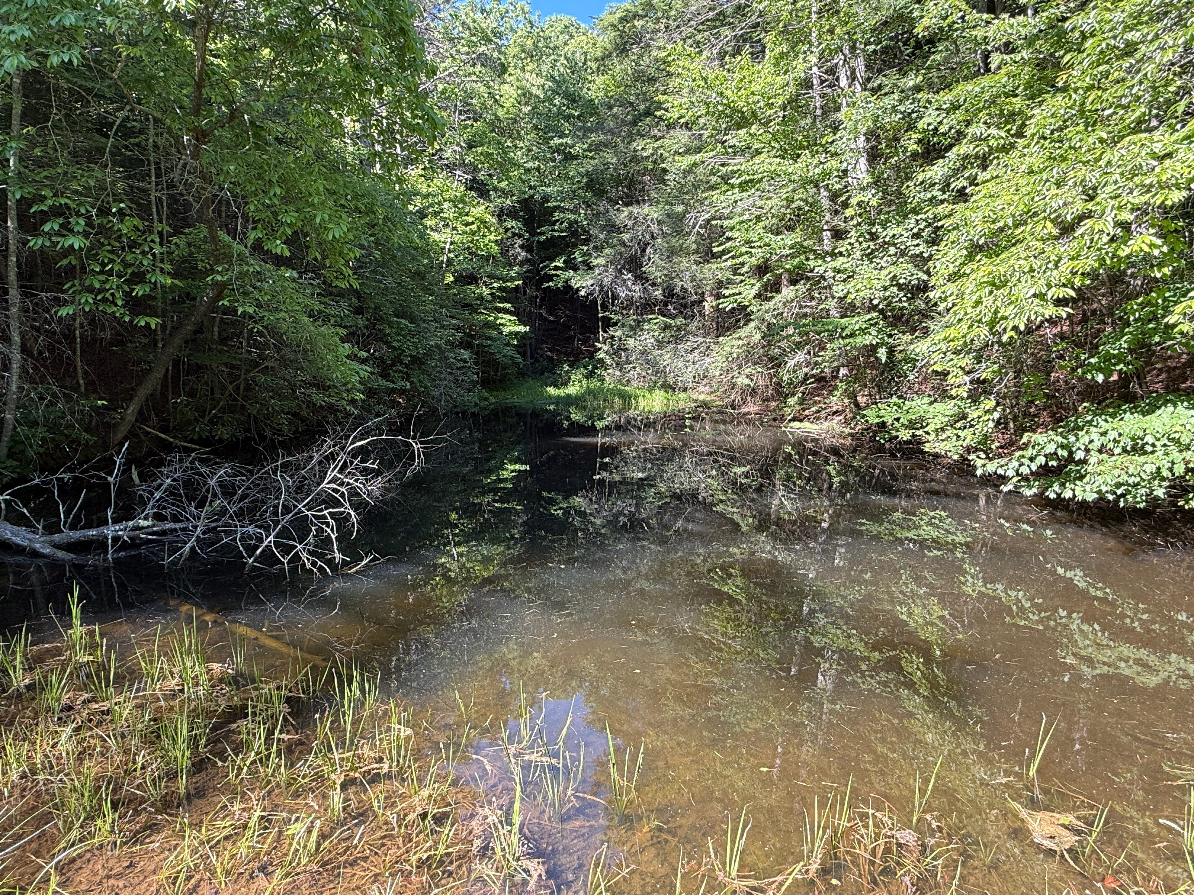
Mile 0.54: A manmade earthen dam creates a small pond. The pond has mostly filled with silt and sediment over the years, but the water that remains is unusually clear, and it is home to a large number of aquatic and amphibian life, including small fish, bullfrogs, salamanders, and more.
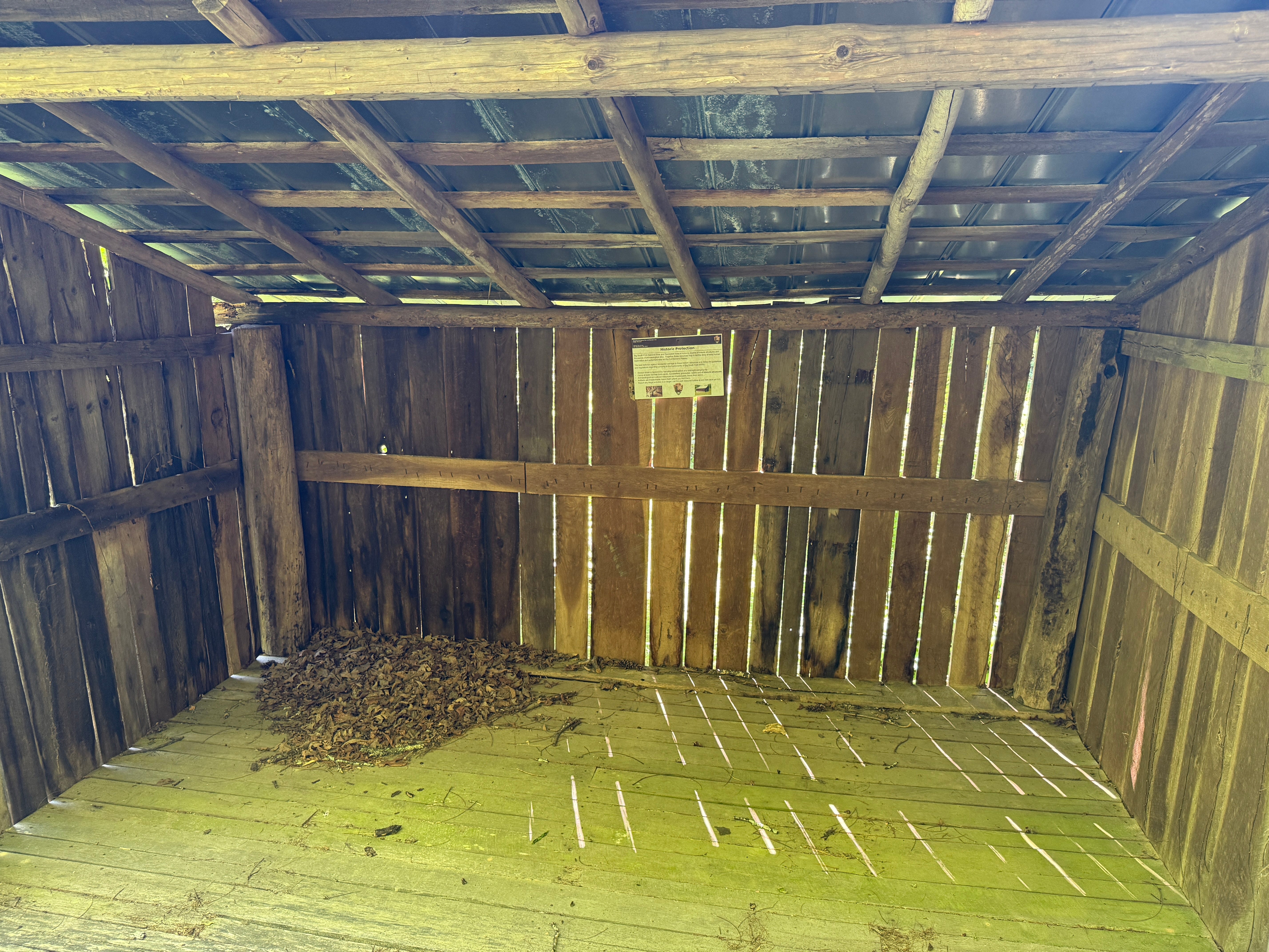
Mile 0.57: This woodshed was built by General Slaven during the latter years of settlement on this farm.


Mile 0.58: We’ve reached the Litton home. Unlike the nearby Oscar Blevins and Lora Blevins homes, this one is open and can be entered. However, visitors should use extreme care to respect the fragile nature of this historic structure. Unfortunately, it is in a state of serious disrepair and will eventually be lost to the passage of time without a major restoration project. The siding is nearly completely gone, and the underlying felt that covered the walls is deteriorating, as well. Several of the glass windows are missing. Not too many years ago, you could still read the old newspapers that were used to paper the walls, but they’re just about completely gone now. Check out the torn linoleum that can still be found in the kitchen of the home.
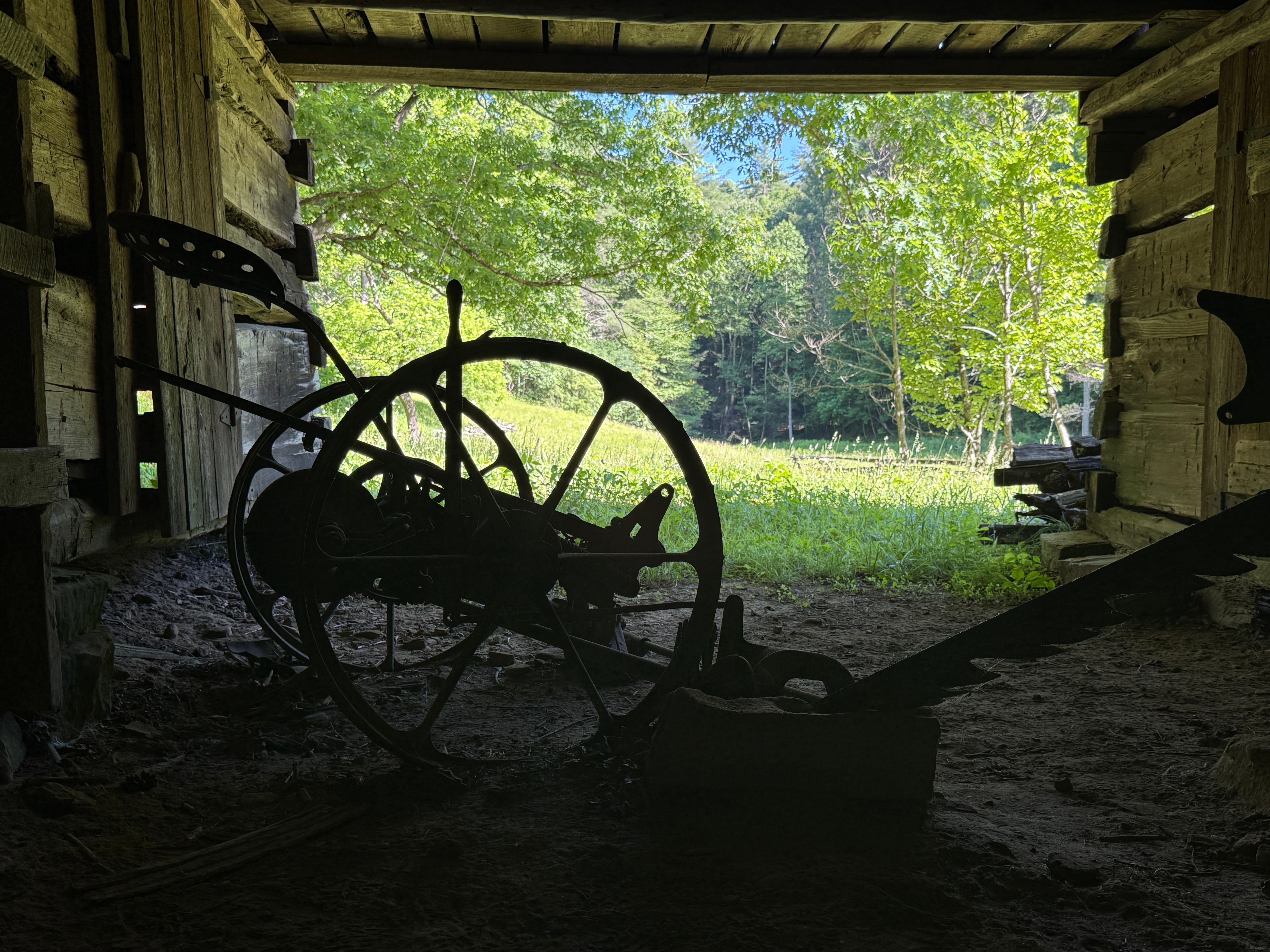
Back outside the home, we’ll backtrack past the woodshed, the pond, and the barn to the hiking trail intersection. Notice the implements and other equipment in the barn, including the antique, horse-drawn mower!
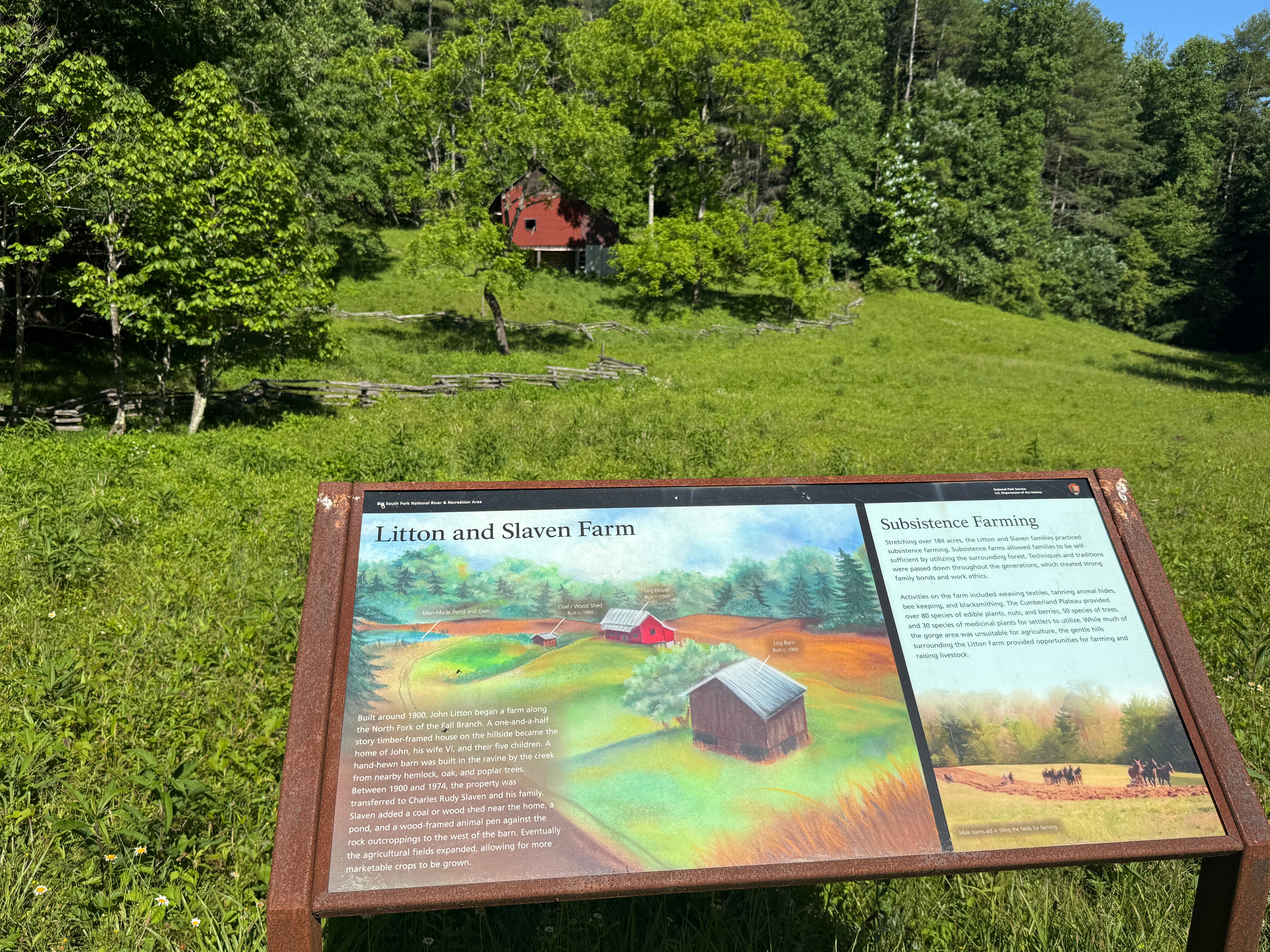
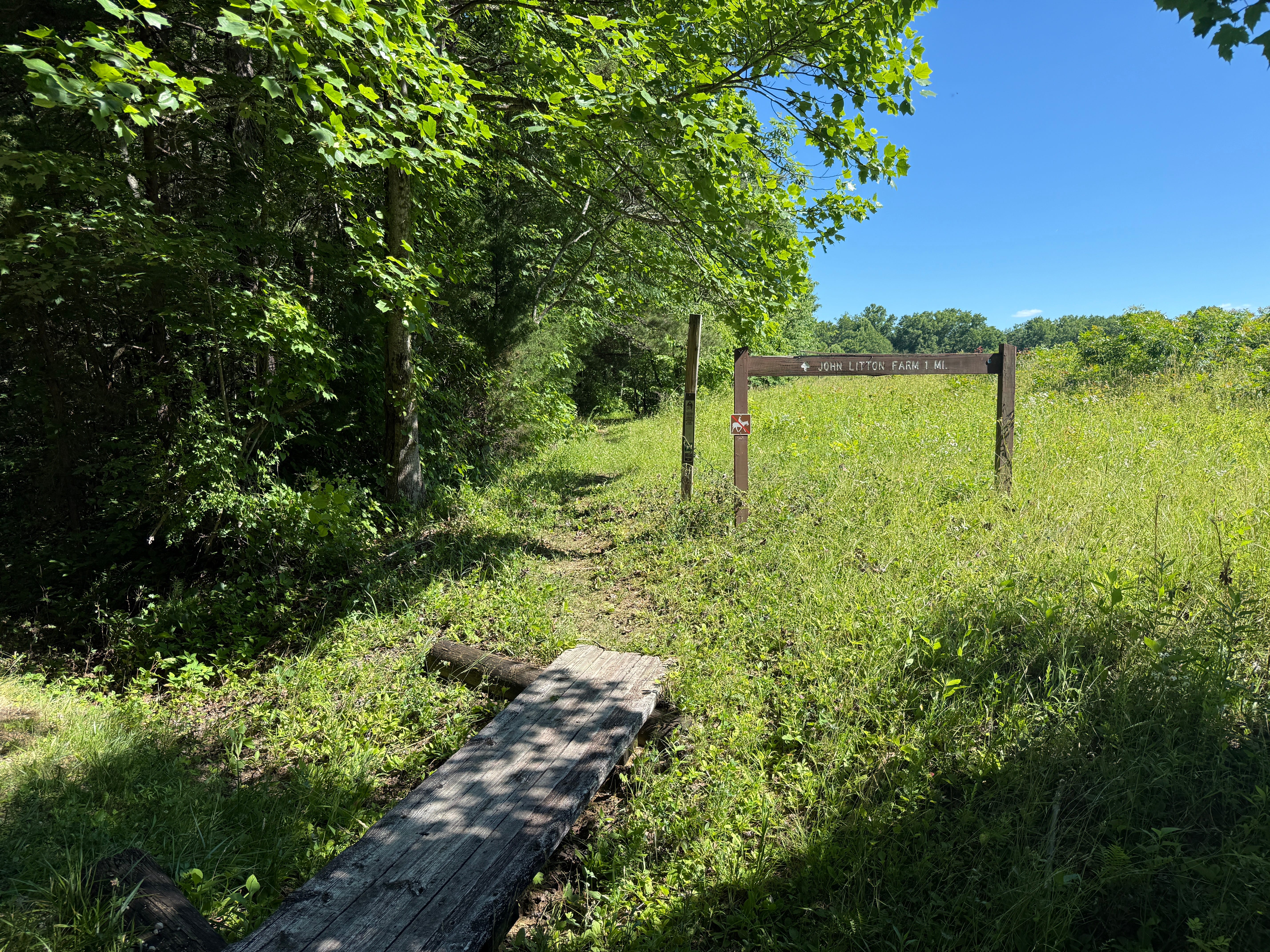
Mile 0.88: The hiking trail cuts left through John Litton’s field. After a few feet, there’s a signboard that tells the history of the Litton Farm.
Mile 0.94: The trail crosses the North Fork of Fall Branch on a wooden footbridge. You may see more minnows in the stream.
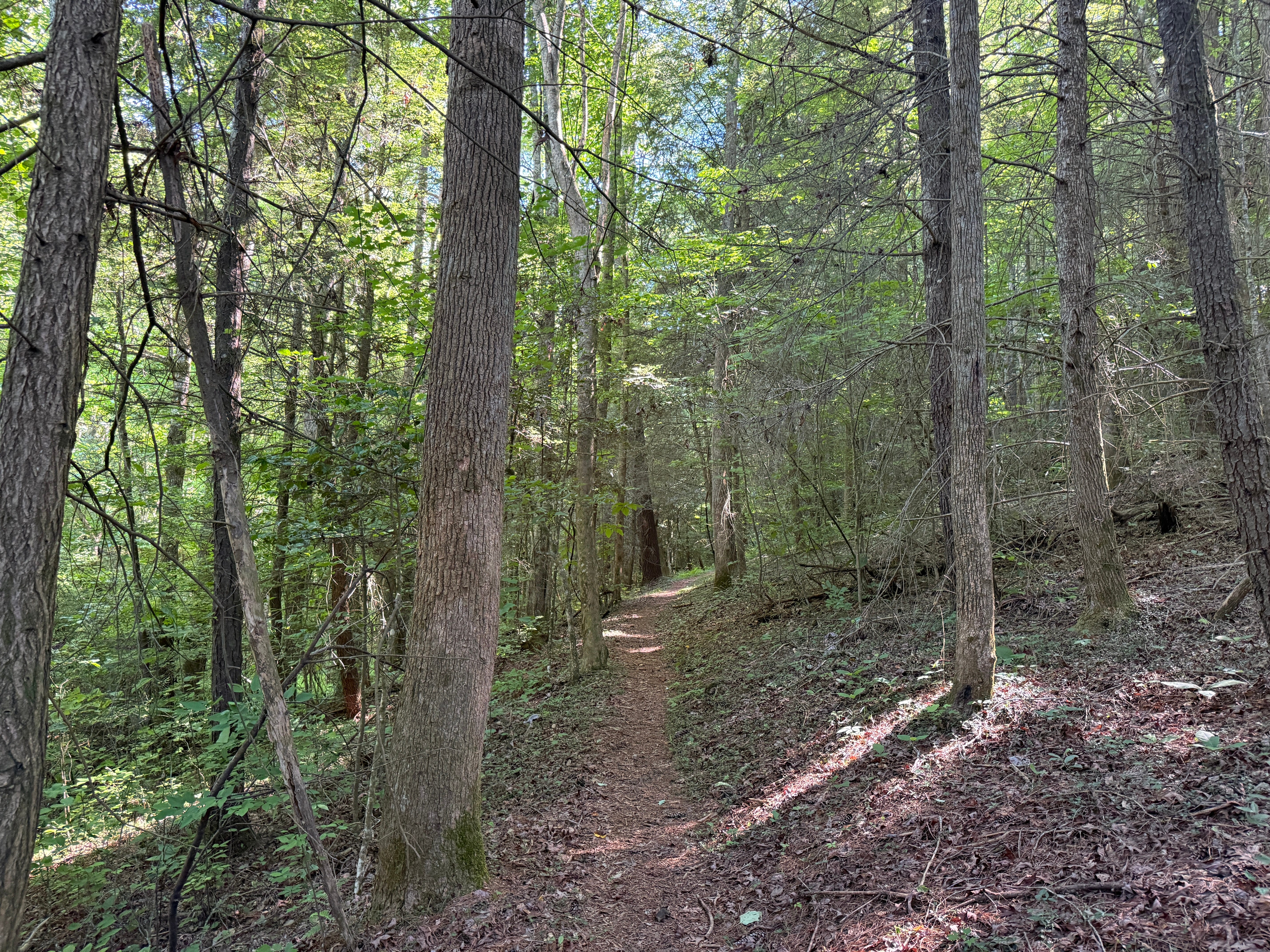
Mile 1.01: The trail enters the forest and begins climbing the hill. This is a dark forest dominated by evergreens, mostly hemlocks and white pines.
Mile 1.14: At a switchback, the trail offers one last look at the Litton Farm. During the warm-weather months, the fields and tin roofs are barely visible through the foliage. Just ahead is a miniature staircase, which signals the end of the trail’s steep part.
Mile 1.19: The trail passes through a dense stand of rhododendron and mountain laurel that crowd the pathway from either side.
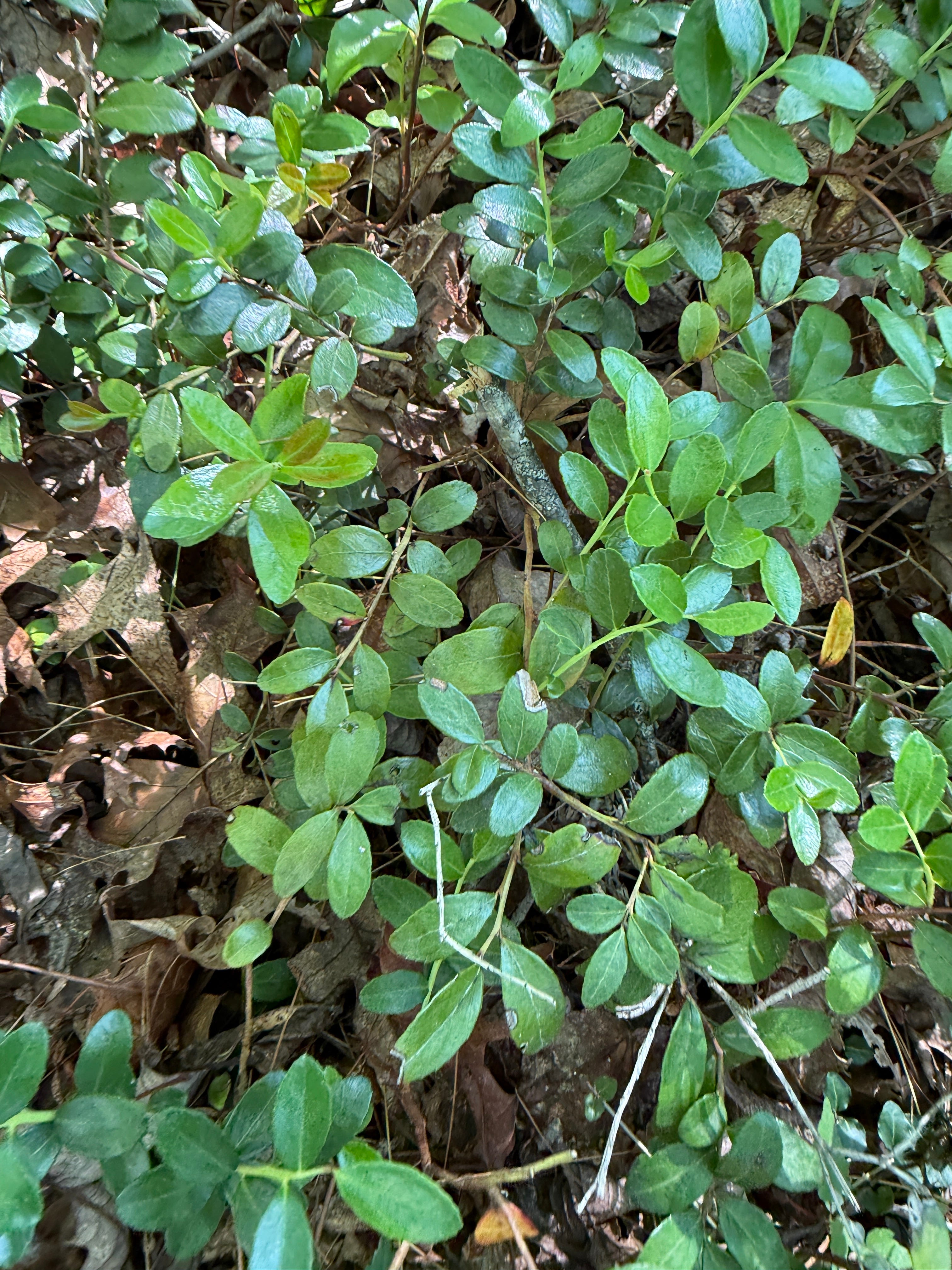
Mile 1.29: The trail re-emerges in the open forest. Check out the huge colonies of squaw vine growing here — or partridge berry.
Mile 1.43: The trail enters an old field that has been allowed to return to a state of reforestation. Notice how the forest type drastically changes, and how you can easily pick out the old field margins by the size of the trees growing here.
Mile 1.54: The trail reaches the edge of the newer field that is still kept clear by the National Park Service and Tennessee Division of Forestry.
Mile 1.72: The trail emerges at the gravel road where we parked.
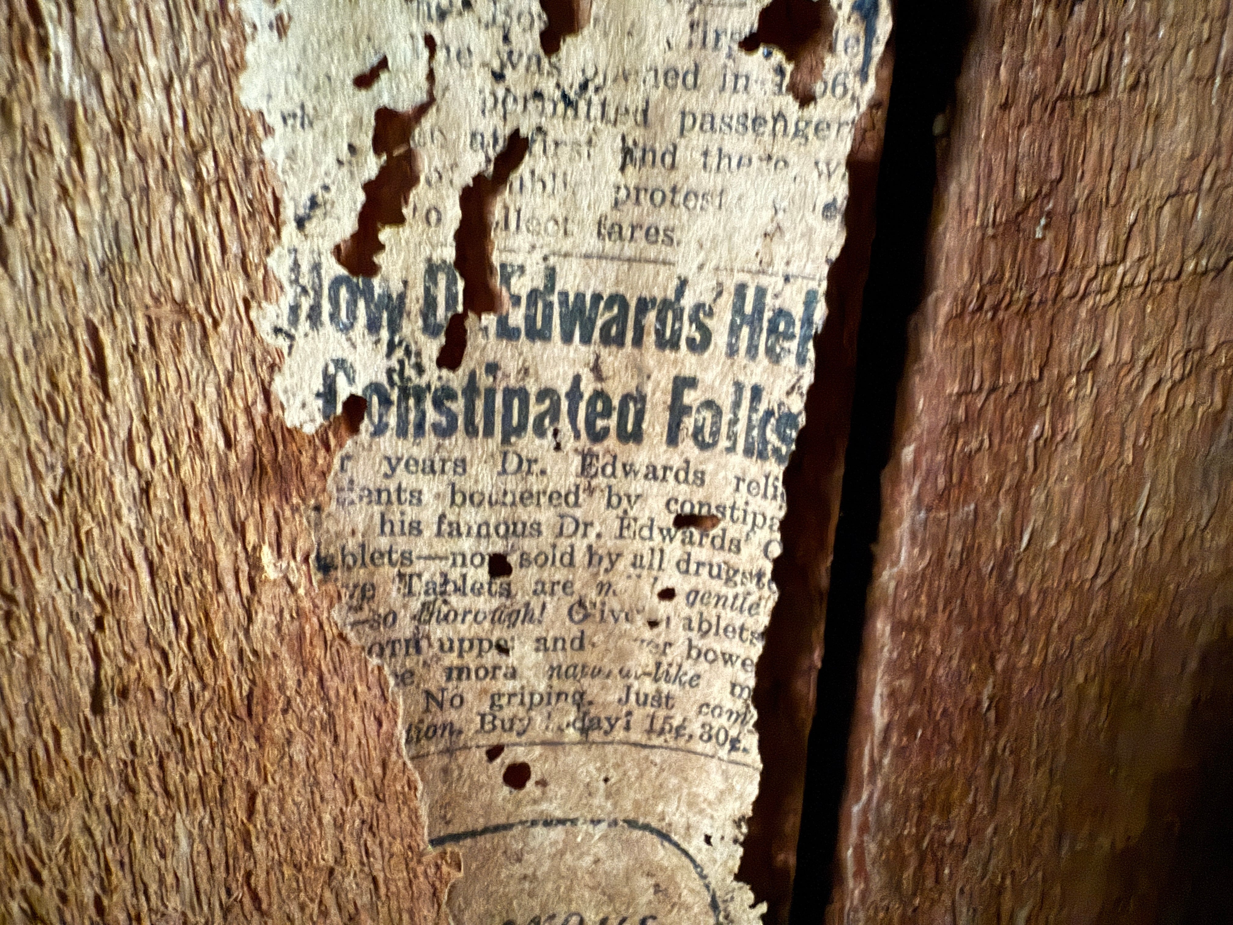
Scavenger Hunt: This week we’re looking for a tiny scrap of newspaper that includes a partial headline about how a doctor helped “constipated folks.” Snap a picture and post it on social media with the hashtag #SpringHikingChallenge to be entered into this week’s random prize drawing!
Make It Better: If you’re looking for more than just a 1.7-mile hike, you can begin and end your hike at the Bandy Creek Swimming Pool, and hike the entire John Litton Farm Loop. This 5.7-mile loop features 465 feet of elevation gain and has a difficulty rating of moderate. An added bonus is Fall Branch Falls. From the parking lot at the swimming pool, the trail begins on the opposite side of the road. It follows Duncan Hollow Road for a short distance before turning and paralleling Fall Branch for a couple of miles. At the point where Fall Branch and the North Fork of Fall Branch intersect, the trail turns left to the Litton Farm. From the Litton Farm, it climbs the hill to the ridgetop, and then follows the gravel roads (John Litton Road and Duncan Hollow Road) back to Bandy Creek.
Historical Context: The John Litton Farm dates back to about 1900, when John Litton built a single pen 1.5-story timber-framed house with a stone foundation on a hillside overlooking the North Fork of Fall Branch. He also built a 2-story, English-style milk barn in 1900 that measures 32 ft. by 32 ft. Both structures remain intact. Later, General Slaven purchased the farm and built a 14 ft. by 7 ft. woodshed and an earthen dam for a pond. Both of those remain intact, as well. Slaven also built a hog lot with wood fencing at the base of a rock bluff in the forest outside the cleared area, which is also intact. A wrap-around porch was added to the home by Slaven, but has since been removed. Slaven also added a wood-frame addition to the home. Once modified, the home measured 29 ft. by 26 ft. Beneath it is a root cellar walled with hand-hewn sandstone. The entire farm encompasses 184 acres. John Litton was a grandson of James Taylor Litton, a justice of the peace who helped found Scott County in 1849. He married Elvira “Vi” Dawes and they had five children. John died in 1935 and Elvira died in 1945. Both are buried at the Katie Blevins Cemetery near Bandy Creek. Around the time that John died, General Slaven and his wife, Mary “Did” Miller, purchased the farm. General was a great-grandson of Richard Harve Slaven, the first settler of No Business, and Did was a granddaughter of Jonathan Blevins. They had three children. The Slavens lived at the farm until after 1974, when the federal government purchased the land for the Big South Fork and they were forced to leave. It is written that no one went hungry when they visited the Litton Farm, because Did always had plenty to eat.
Be Careful For: There are no notable hazards on this hike.
Please Remember: Hikers are encouraged to obey the “Leave No Trace” ethic. “Leave only footprints, take only memories.” Please do not litter! Also, remember that while all trails in the Big South Fork are dog-friendly, all dogs must be leashed and kept within six feet.
Document Your Hike: Record your participation on this week’s hike by taking a photo of you and your group and tagging it with the #SpringHikingChallenge hashtag on social media (make sure the post privacy is set to public!) or emailing newsroom@ihoneida.com.
Hike #1: Sunset Overlook
Hike #2: Angel Falls Rapid
Hike #3: Yahoo Falls
Hike #4: O&W Bridge
Hike #5: Northrup Falls
Hike #6: Burnt Mill
Hike #7: Buzzard Rock
Hike #8: Cracks in the Rock
Hike #9: Angel Falls Overlook
Hike #10: Kellogg’s Crack
Hike #11: Slave Falls